-
Jack Drake wrote a new post, 6 YEARS LATER: Anniversary of the May 15th 2018 Severe Outbreak 2 months, 1 week ago
A warm and humid May afternoon in 2018 with temperatures rising close to 90 degrees in parts of Connecticut set the stage for one of the worst severe weather outbreaks in the area’s recent history.
Shortly a […]

-
Jack Drake wrote a new post, Temperature Forecasts and Wind Direction in the Spring 2 months, 3 weeks ago
The cold waters of the Atlantic Ocean and connected Long Island Sound can influence temperatures at the shoreline year round. In April and May, however, the temperature gradient that sets up between the shoreline […]

-
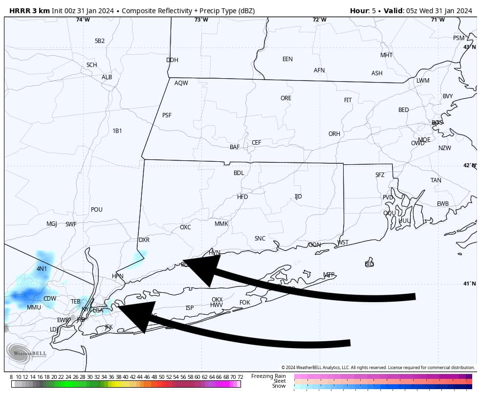
Jack Drake wrote a new post, Ocean Effect Snow in Connecticut?? 5 months, 3 weeks ago
Any flurries that occurred last night or this morning are essentially Long Island Sound or Atlantic Ocean effect as we have a SE wind off the water. This combined with some mid level energy is the trigger for the […]
-
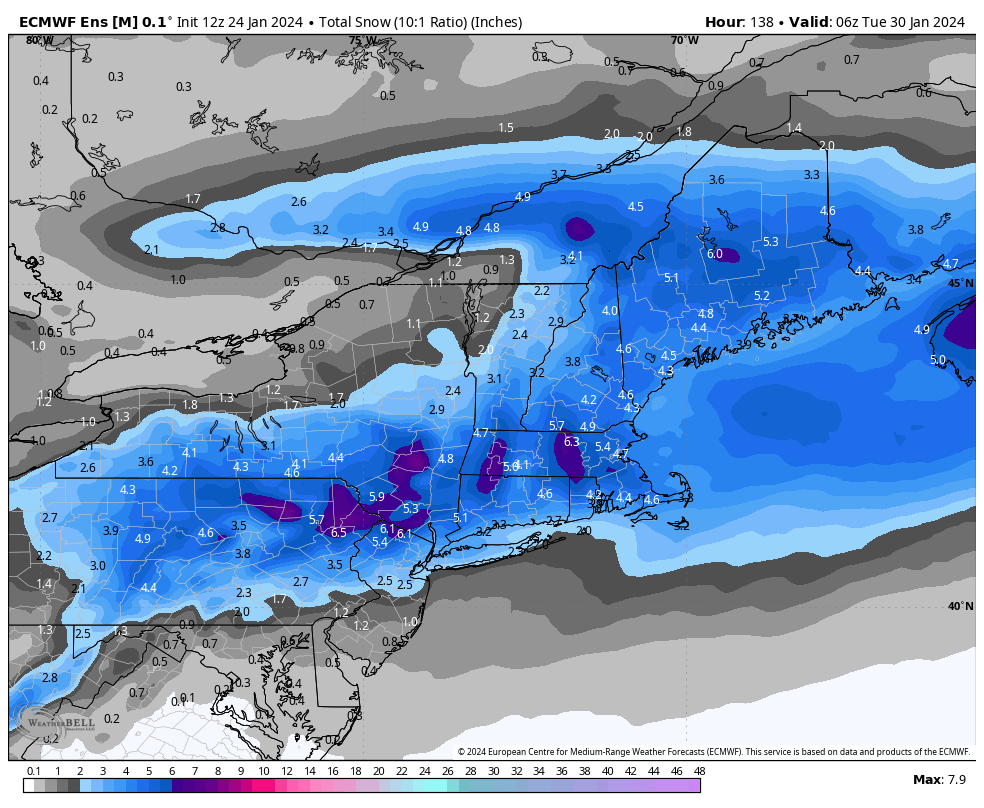
Jack Drake wrote a new post, Breaking: Snow Potential Sunday into Monday 1-28-24 6 months ago
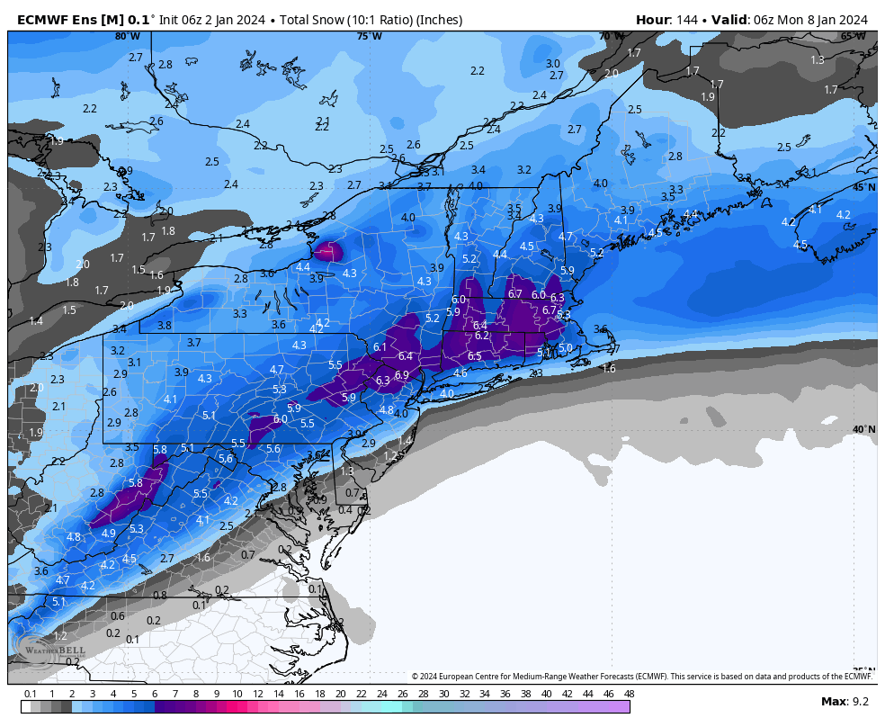
Models have trended colder and snowier for the late weekend forecast, with the Euro ensembles beginning to indicate a stronger signal for plowable snow across the region. With a slower track, more cold air is […]
-
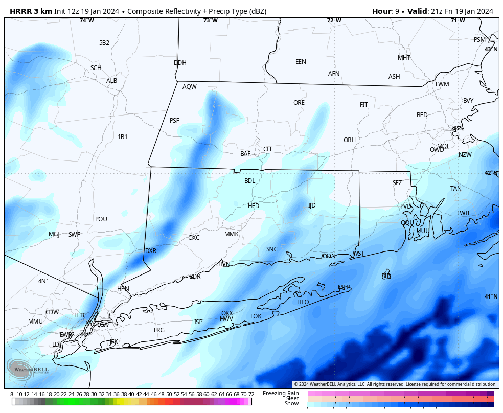
Jack Drake wrote a new post, Light Snow 1-19-24: THE LATEST 6 months, 1 week ago
Good morning! Forecast is generally on track for Friday, with light snow falling through much of the day. Expect the steadiest snow to fall late this morning through 3PM or 4PM, although light snow showers may […]
-
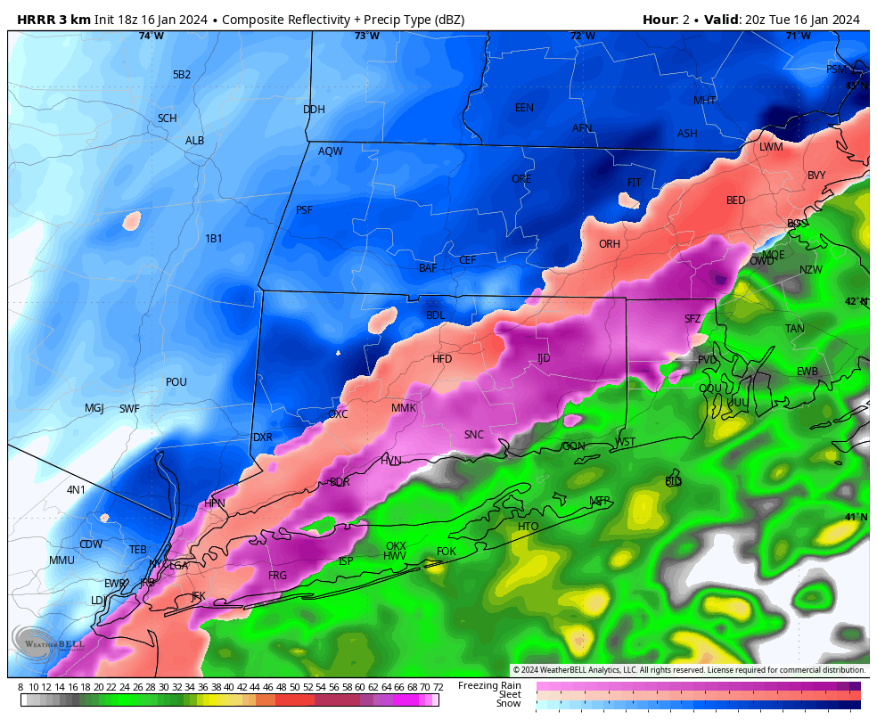
Jack Drake wrote a new post, Hazardous Travel Tuesday Afternoon and Evening 6 months, 1 week ago
Travel will be very slick this afternoon with temps in the mid to upper 20s along with sleet and freezing rain. We are getting widespread reports of freezing rain throughout CT and very hazardous travel. Precip […]
-
Jack Drake wrote a new post, SNOW SQUALLS SUNDAY 1-14-24 6 months, 2 weeks ago
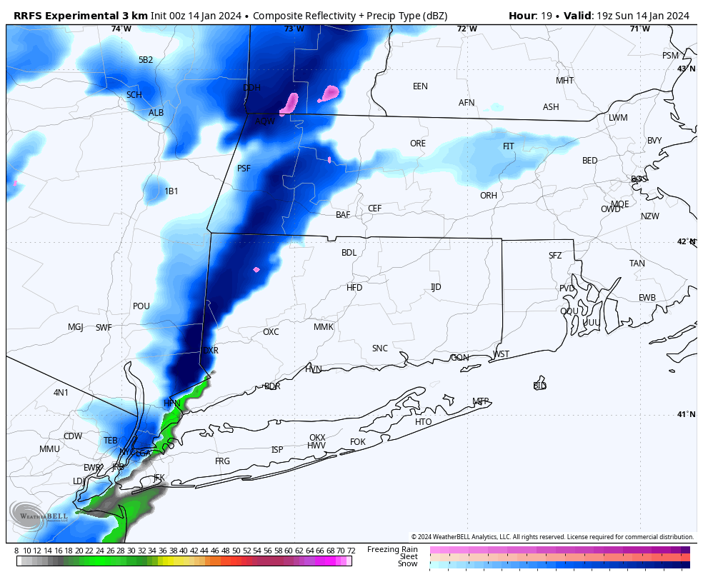
Models are continuing to be bullish on snow squall potential tomorrow. It appears these squalls will be traversing the area between 12PM and 4PM along an arctic front. Temperatures in the mid to upper 30s around […]
-
Jack Drake wrote a new post, THE LATEST: VERY ROBUST STORM SYSTEM FOR TUESDAY AFTERNOON INTO WEDNESDAY 6 months, 2 weeks ago
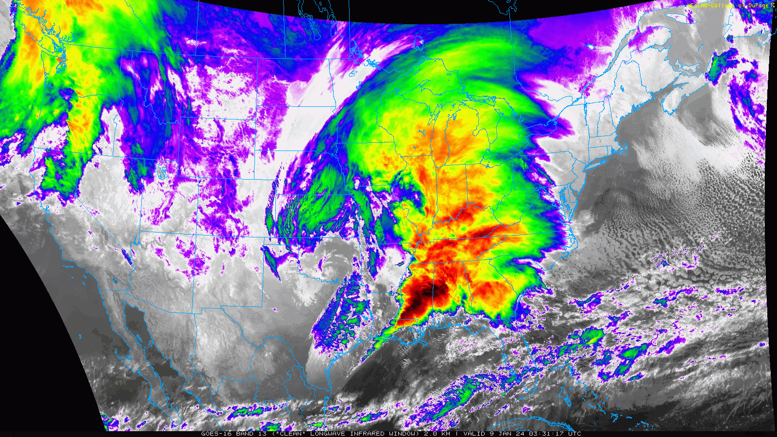
Data coming into the CT Weather Center continues to look alarming regarding a wind and rain event shaping up for Tuesday afternoon through Wednesday. We are leaning high on forecast wording and the potential for […]
-
Jack Drake wrote a new post, WINTER STORM RECAP: Snow Totals and General Forecast Thoughts 6 months, 3 weeks ago
Here’s a look a COCORAHS snow totals for our winter storm. Notice the sharp gradient between Southern CT and Northern CT. The “two part” nature of the storm also added the totals in many Northern areas where […]
-
Jack Drake wrote a new post, WINTER STORM UPDATE: Snow Expected for CT Saturday Night thru Sunday 6 months, 3 weeks ago
After extensive analysis, we decided on a new snow map this afternoon. Totals were bumped up a bit from previous forecasts, especially for interior locations. The main reason for this was a better mid-level […]
-
Jack Drake wrote a new post, INCOMING WEEKEND SNOWSTORM: Preliminary Look at the Setup and Potential Accumulation 6 months, 3 weeks ago
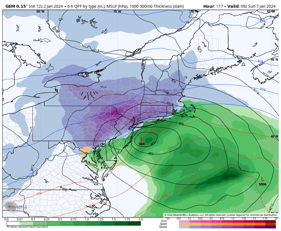
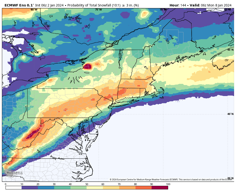
The largest snowstorm we’ve seen in a couple of years (not saying much but still) is possible Saturday night into Sunday. While we’re still a ways away from the event, there is strong model support for this […]
-
Jack Drake wrote a new post, Recap: Storm Overperforms Thursday Morning 12-28-23 Leading to More Rain and Wind than Forecast 7 months ago
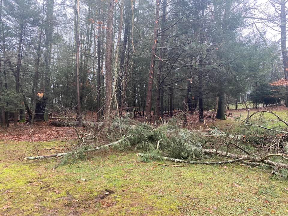
One of the best parts about increasing our public presence is the feedback that we get for our forecasts whether positive or negative. Last night and early this morning, the storm system slated to deliver around […]
-
Jack Drake wrote a new post, Heavy Rain into Thursday AM Commute 7 months ago
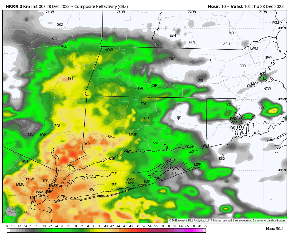
Looks like a very wet night ahead with short range modeling trending higher with rainfall totals. Rain looks particularly heavy for the early AM commute before tapering off to lighter isolated showers by mid […]
-
Jack Drake wrote a new post, Caution: Icy Spots Possible This Week 7 months, 1 week ago
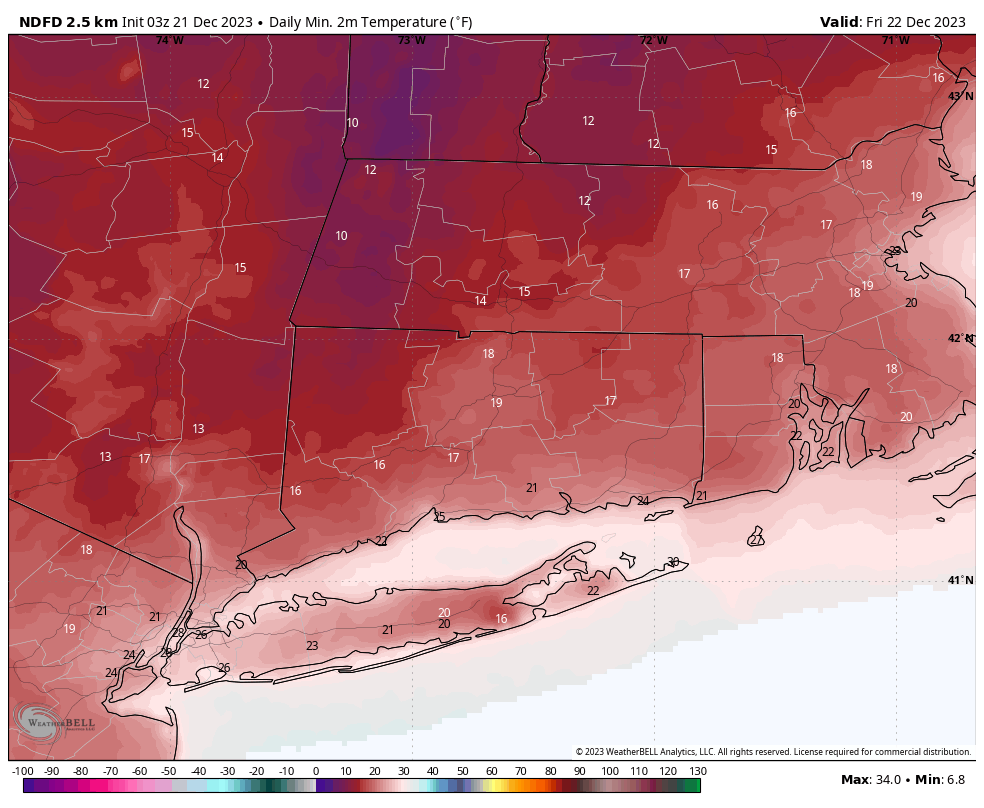
The forecast team wanted to note that several reports were received over the last few days of icy spots in the morning due to freezing of runoff from the excessive rainfall experience on Monday. Icing in the same […]
-
Paul Slaski wrote a new post, STORM UPDATE: PREPARE FOR HIGH WINDS AND HEAVY RAIN 7 months, 1 week ago
Forecast is on track for a big ticket “Southeaster” to impact the area tonight and tomorrow. This storm has already produced widespread rain and wind impacts in the Southeast and the Carolinas today, and will com […]

-
Jack Drake wrote a new post, Another Sunday Night Soaker: Rain and Wind Expected Sunday Night into Monday 7 months, 2 weeks ago
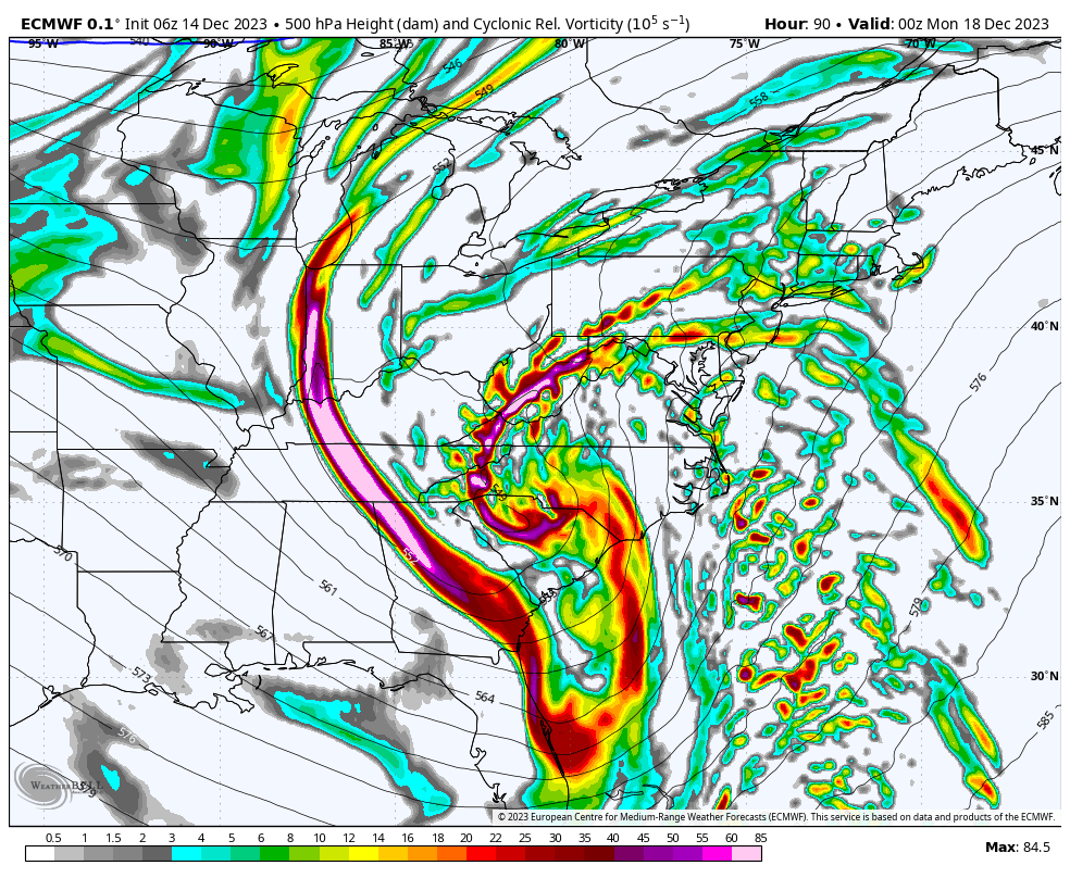
It feels like déjà vu! Another large storm is on the way late Sunday into Monday – and it will not be snow. Despite another rain event, this is an interesting setup from a meteorological perspective, with a t […]
-
Paul Slaski wrote a new post, UPDATE: Latest Briefing on the Multi-Hazard Storm Set for Sunday Into Monday 7 months, 2 weeks ago
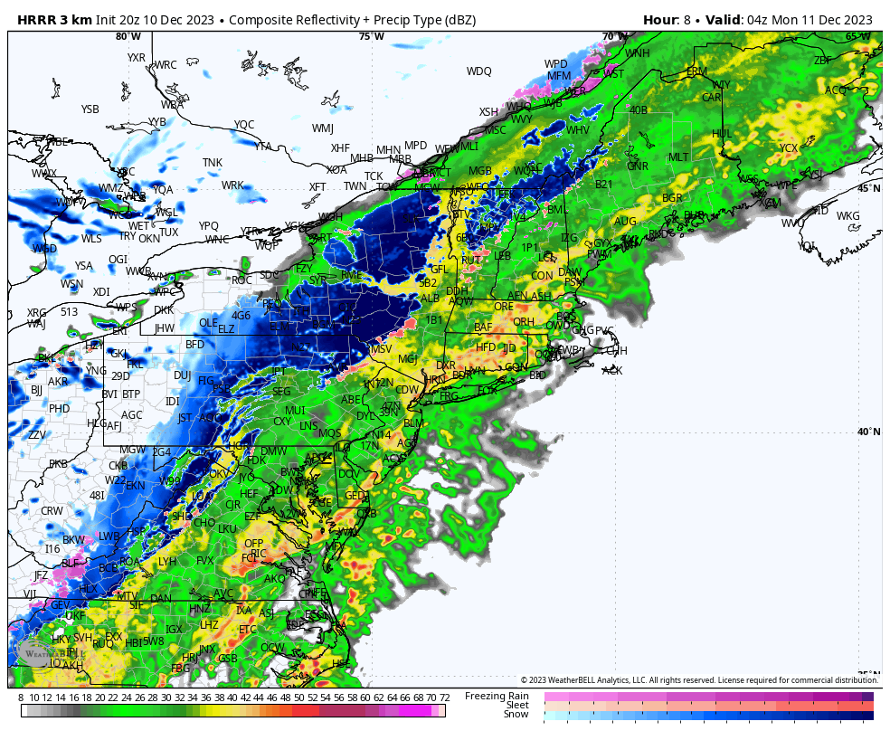
We have just briefed our clients and local Emergency Managers on the storm system impacting the region tonight through Monday.
As of now, no changes to the thinking. The forecast is on track. The damaging wind […]
-
Paul Slaski wrote a new post, STORM UPDATE: Multiple Hazards Coming for the Forecast Region 7 months, 2 weeks ago
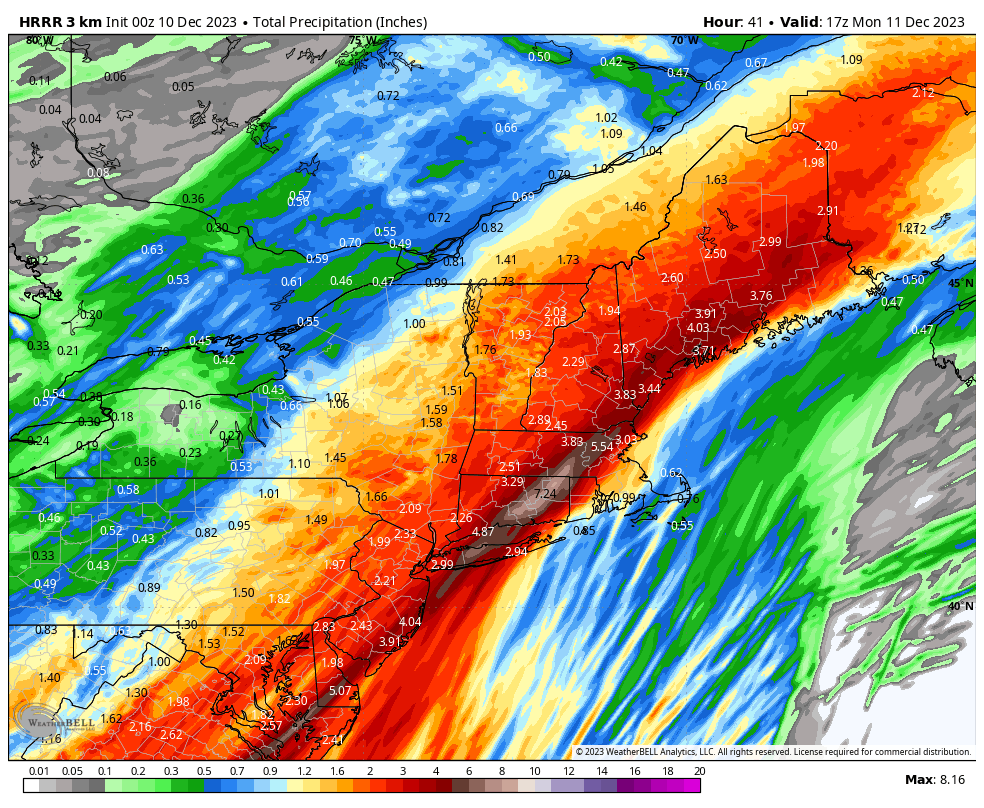
1. WINDS: Based on current forecast, peak wind gusts 35 mph to 45 mph in the Hudson Valley, Western CT and Central CT; 45 mph to 55 mph in Eastern CT, and 50 mph to 65 mph in coastal New London County and Rhode […]
- Load More
- Reach us by phone, fax or email.
- Phone: (203) 730-2899
- Fax: (203) 730--2839
- weatherlab@ctweather.com
