

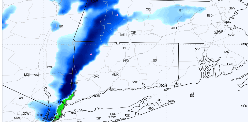
Models are continuing to be bullish on snow squall potential tomorrow. It appears these squalls will be traversing the area between 12PM and 4PM along an arctic front. Temperatures in the mid to upper 30s around noon will drop quickly to the upper 20s or low 30s as the snow showers and snow squalls arrive. Low visibilities and a quick coating to an inch are possible in the heaviest squalls. While the window for activity is 12PM to 4PM, it should be noted that a strong snow squall is only likely to last 15 to 30 minutes but can produce strong wind gusts and near white-out conditions. Snow squalls can be hazardous when driving, so please monitor the forecast and look out for any EAS Snow Squall Warnings that are issued.
We would also like to remind you the most significant danger from a snow squall is NOT accumulation totals (don’t ignore the warning because there may be only an inch of snow); the main hazard is near zero visibility from intense, wind-driven snow which can form in seconds.