

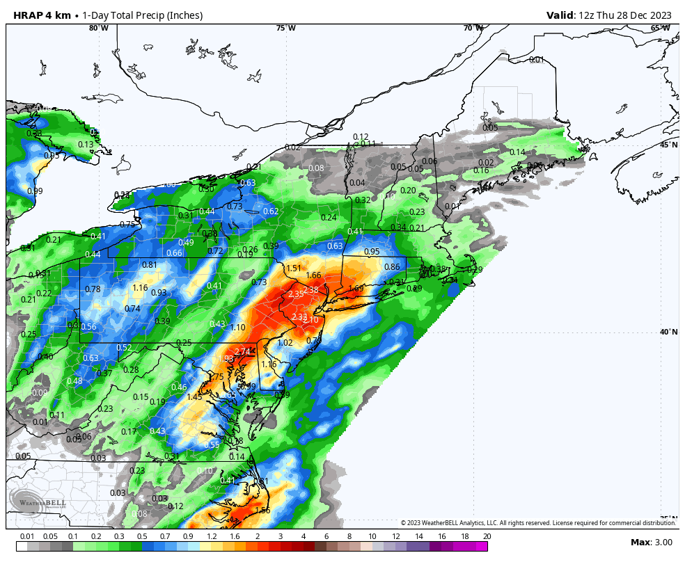
One of the best parts about increasing our public presence is the feedback that we get for our forecasts whether positive or negative. Last night and early this morning, the storm system slated to deliver around 1.0 inches of rain to the forecast region produced a swath of 2.00 to 2.75 inch rainfall totals from the Hudson Valley to Central Connecticut. Here are a few of the higher totals from around the area per the NWS and CoCoRaHS data. Imagine the backlash if this was a snowstorm forecast!
Waterbury                    2.60 in   0930 AM 12/28   COCORAHS
Shelton                      2.59 in   0857 AM 12/28   CWOP
Newtown                      2.36 in   0855 AM 12/28   CWOP
Norwalk                      2.34 in   0845 AM 12/28   CWOP
Sandy Hook                   2.26 in   0800 AM 12/28   COCORAHS
Danbury                      2.25 in   0900 AM 12/28   CWOP
Ridgefield                   2.19 in   0700 AM 12/28   COCORAHS
Redding                      2.18 in   0855 AM 12/28   AWS
Brookfield                   2.17 in   0700 AM 12/28   COCORAHS
New Canaan                   2.17 in   0800 AM 12/28   COCORAHS
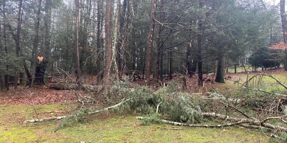
While the rain significantly outperformed the forecast with Flood Advisories and Flood Warnings issued, the wind was also a surprise. Danbury Airport briefly gusted to 36 mph during the most intense part of the storm, and there was isolated tree and power outage problems throughout Connecticut.
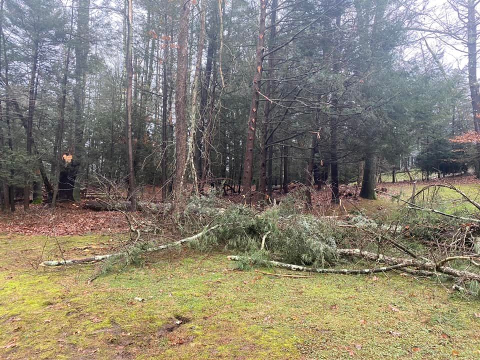
While these impacts were relatively minor in the grand scheme of things (and nothing compared to the storm 10 days ago) we still like to analyze these overperforming systems to see what can be adjusted for future forecasts.
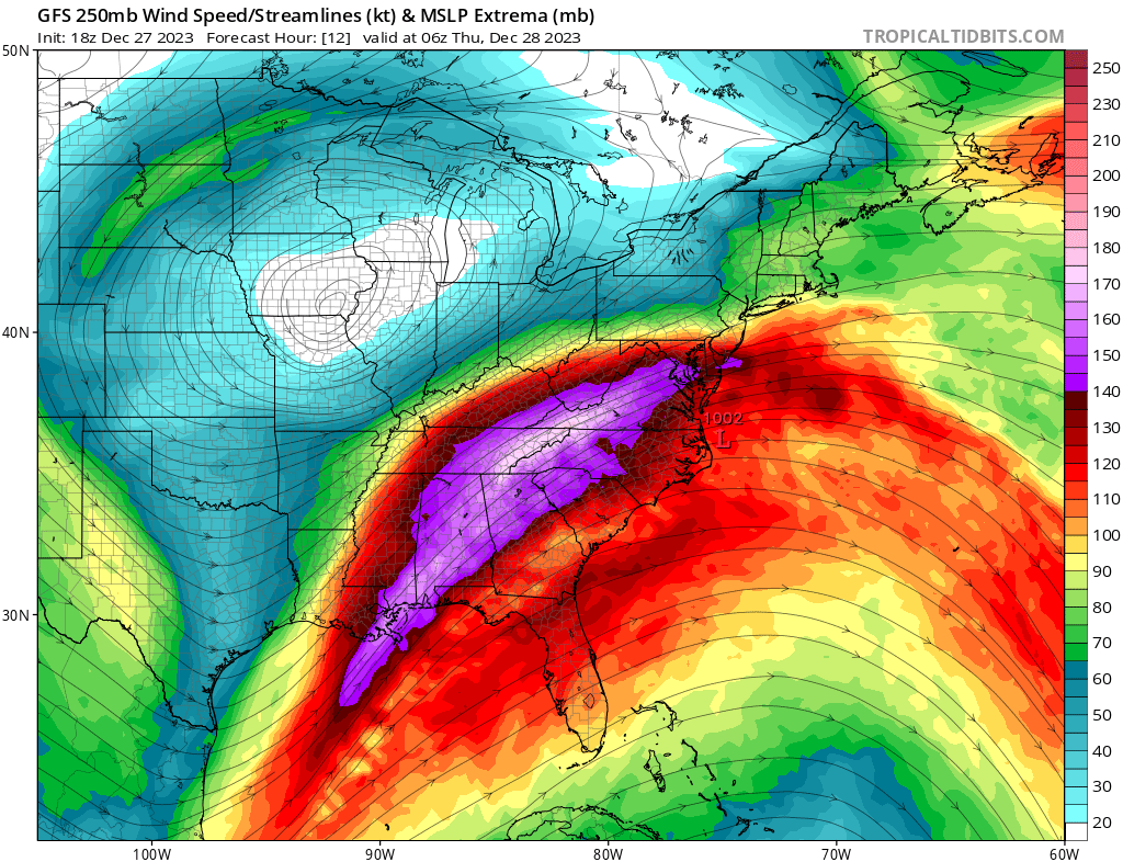
In this case, we had a strengthening low pressure system move up the coast, with favorable upper level dynamics. As you can see in the below map, the Mid Atlantic to New England was positioned favorably on the “Left Front Quadrant” of a strong 250mb jet streak. This aided in widespread rising motion, and allowed for heavier rain rates to verify. Short range guidance did a good job in picking up on this as we headed through Wednesday, and we targeted the Hudson Valley and Southern CT as the likely areas to receive more rain.
All in all, if I had to do it again, would probably have hit the wording harder, especially as the short range models began to spit out 2″+ of rainfall Wednesday night. As forecasters, we always try to balance the wording when putting out warnings with societal impacts, as over-warning can be just as damaging in the long term as under-warning is in the short term. Here’s to hoping we don’t have to forecast as many heavy rain events as we head into 2024.
Thanks for following along!