

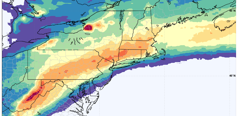
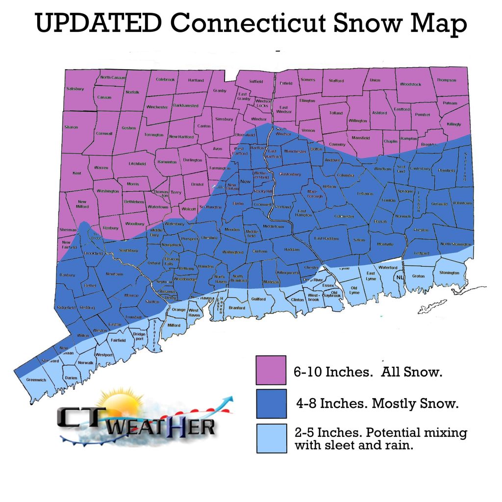
After extensive analysis, we decided on a new snow map this afternoon. Totals were bumped up a bit from previous forecasts, especially for interior locations. The main reason for this was a better mid-level evolution on guidance – most notably the GFS and the Euro. This allowed for a stronger low pressure system, and more snowfall. As with most winter storms in CT, we do have to worry about mixing issues as the shoreline towns will be near or just above freezing.
Bottom Line: A plowable event is on the way to CT – just don’t get carried away with double digit numbers just yet.
New update out tomorrow!