

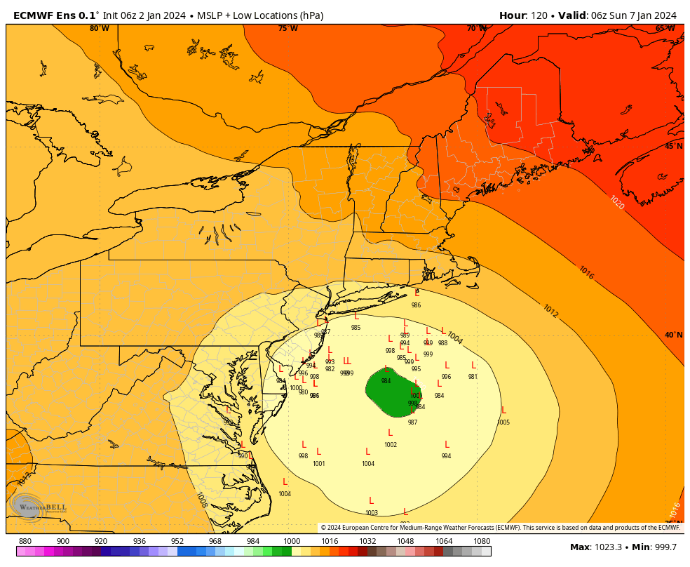
The largest snowstorm we’ve seen in a couple of years (not saying much but still) is possible Saturday night into Sunday. While we’re still a ways away from the event, there is strong model support for this system for low pressure system moving South of New England by Saturday night, allowing for enough cold air for snow. The latest Euro Ensembles illustrate this well, with a solid cluster of members in a good position for CT snowfall.
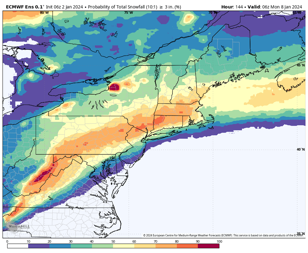
From a probabilistic standpoint, both GFS and Euro indicate a greater than a 60% chance of 3 inches or more of snow and a 40% chance of 6 inches or more of snow. At this range that is really strong consensus for a plowable snow event.
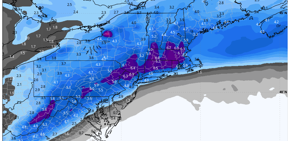
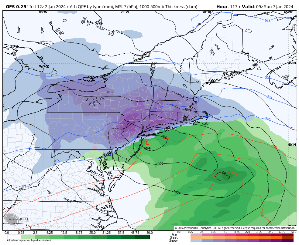
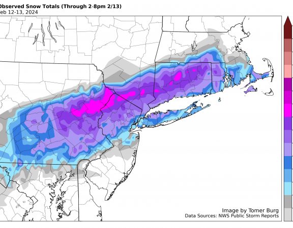
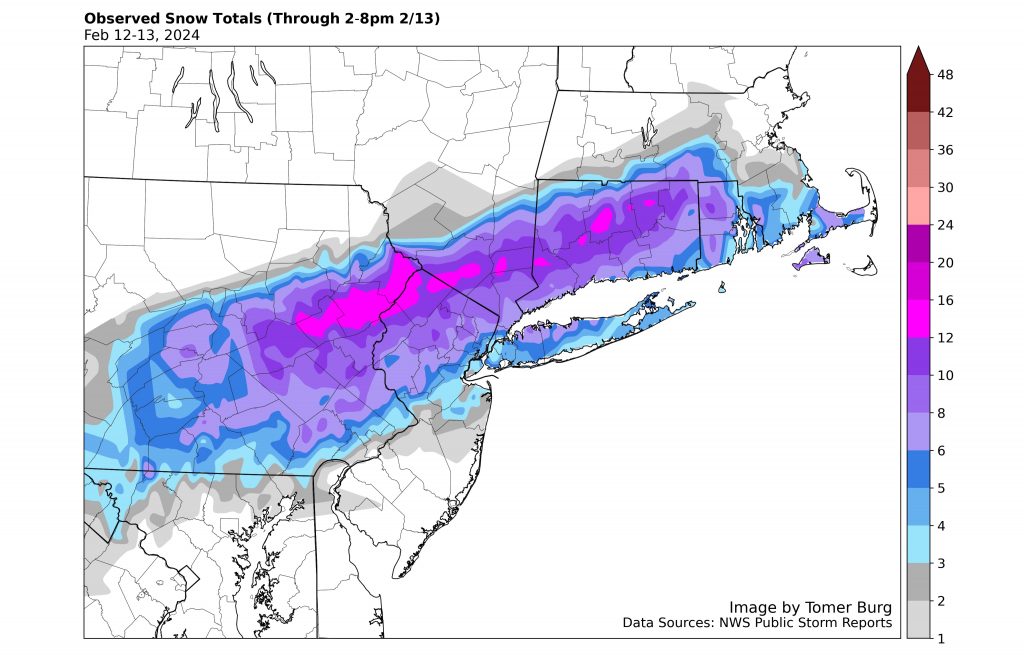
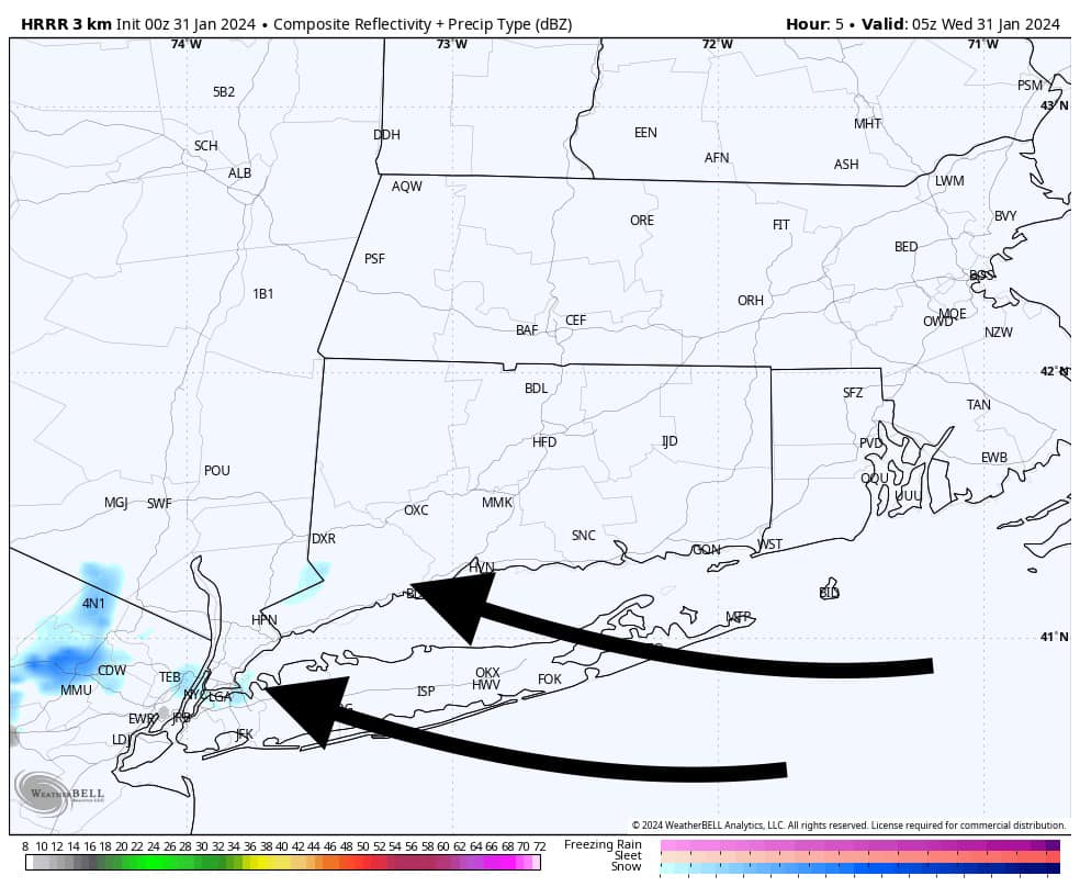
A few forecast concerns will be how close the rain/snow line comes to SE CT and RI, as well as where the heaviest bands of snow set up. While these are typical concerns for a CT snow event, every storm is slightly different. The last map I will attach is the precipitation types to help give an idea of how this storm will be structured. In general, would probably stat the bidding at a 3-6/4-8″ type event for most. More updates to come!