- Reach us by phone, fax or email.
- Phone: (203) 730-2899
- Fax: (203) 730--2839
- weatherlab@ctweather.com
Snow
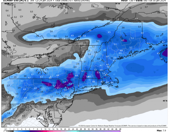
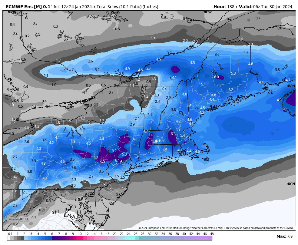
Models have trended colder and snowier for the late weekend forecast, with the Euro ensembles beginning to indicate a stronger signal for plowable snow across the region. With a slower track, more cold air is able to work into the storm, creating a recipe for snow across Southern New England. As with any nor’easter, the amount of snow will be very sensitive to minor changes in timing and track, but what once looked like a mainly rain event has quickly evolved into a snowier end of the weekend.
Pay close attention to this forecast as we head through the end of the week. Many of the details should become clearer by Friday afternoon.

January 24, 2024
Models have trended colder and snowier for the late weekend forecast, with the Euro ensembles beginning to indicate a stronger signal for plowable snow across the […]
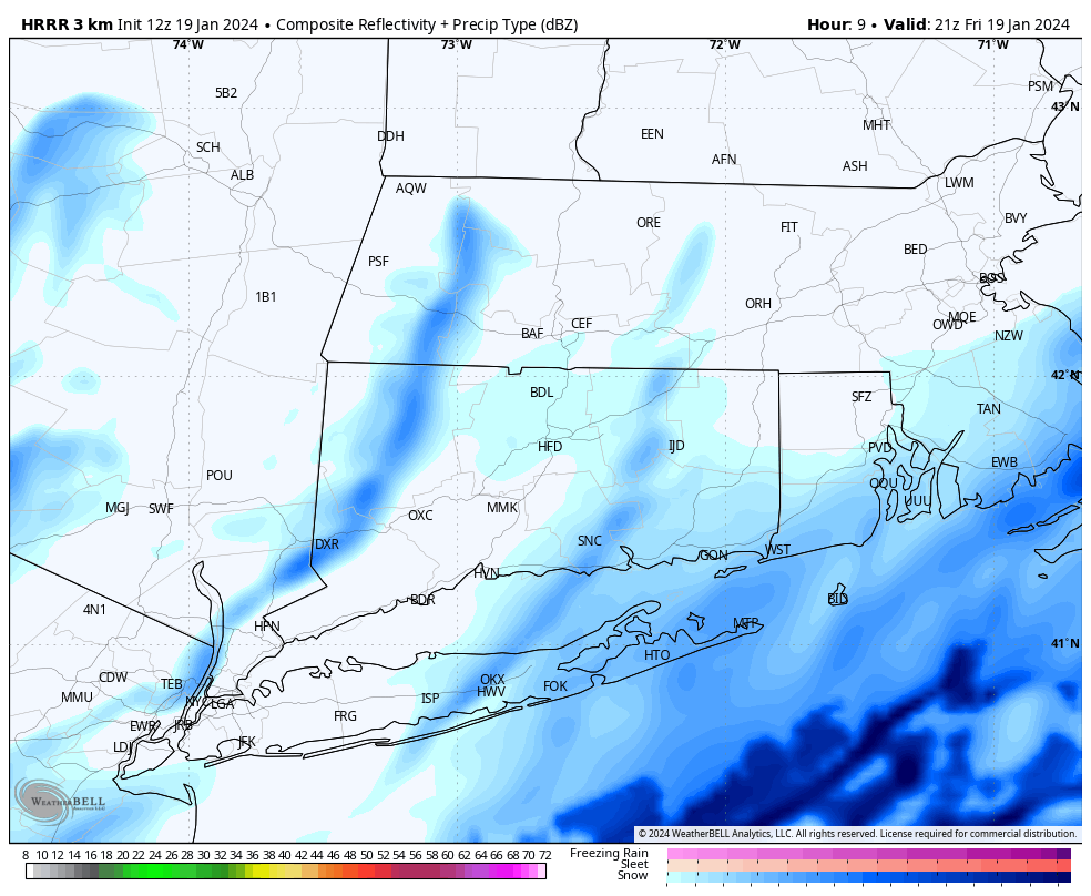
January 19, 2024
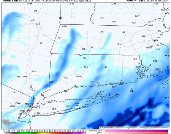
Good morning! Forecast is generally on track for Friday, with light snow falling through much of the day. Expect the steadiest snow to fall late this […]
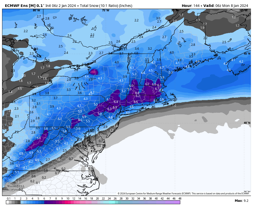
January 2, 2024
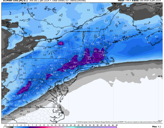
The largest snowstorm we’ve seen in a couple of years (not saying much but still) is possible Saturday night into Sunday. While we’re still a ways […]
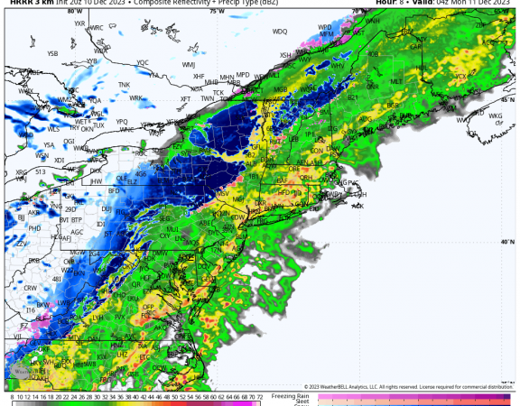
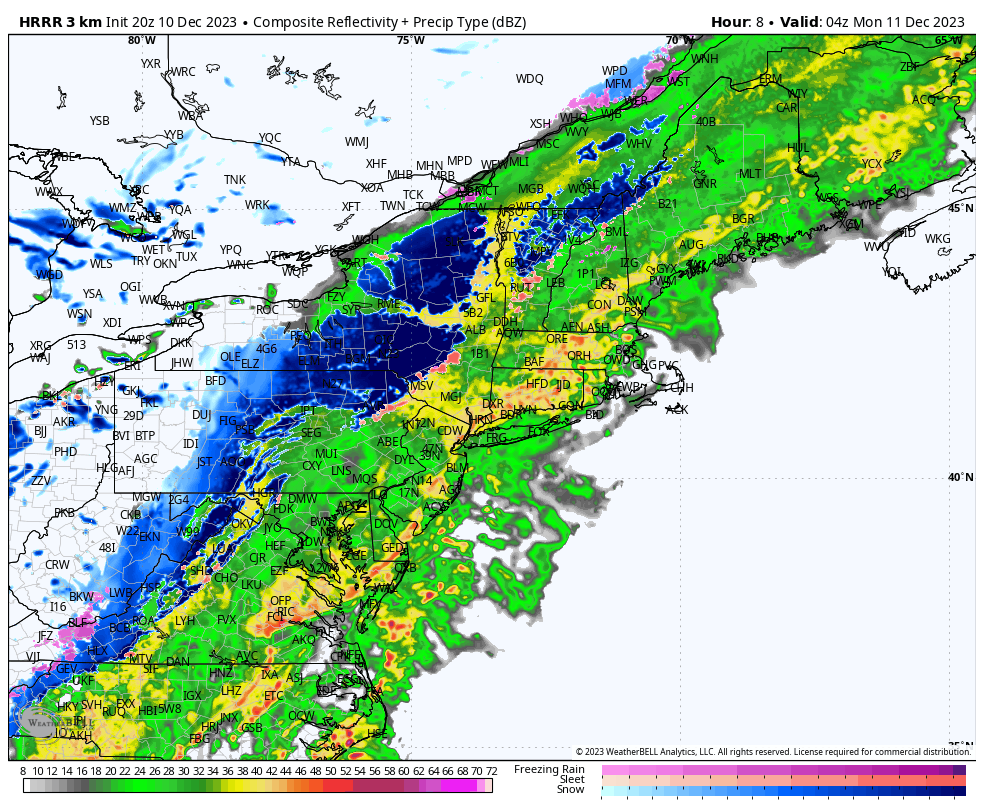
December 10, 2023
We have just briefed our clients and local Emergency Managers on the storm system impacting the region tonight through Monday. As of now, no changes to […]