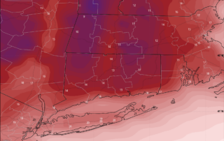
Paul Slaski

Forecast is on track for a big ticket “Southeaster” to impact the area tonight and tomorrow. This storm has already produced widespread rain and wind impacts in the Southeast and the Carolinas today, and will come chugging up the coast tonight. Expecting 2.0 to 4.0 inches of rain, with locally higher amounts possible and wind gusts to 50mph inland and 60mph at the shoreline. The period of worst weather will be from about 4AM to 1PM tomorrow.

One forecast uncertainty remains the Western extent of the wind field. Any more Eastern trend, and Western CT folks could dodge the worst of it. I’m not overly confident on that Eastern trend happening however, and would fully prepare in all areas for the 45mph to 60mph gusts, which are bad news when combined with the rain. Scattered to numerous outages appear likely.

Please be extra careful when venturing out tomorrow. The worst weather will be happening at the height of the morning commute. I have not heard much on school impacts and don’t want to speculate, but I believe delays/cancellations are possible. Personally, I’m worried about this one, and have made extra preparations around my house (stocking up on gas/water/propane) I don’t normally do.

December 18, 2023

STORM UPDATE: PREPARE FOR HIGH WINDS AND HEAVY RAIN

Forecast is on track for a big ticket “Southeaster” to impact the area tonight and tomorrow. This storm has already produced widespread rain and wind impacts […]
December 17, 2023

VIDEO: Multiple Hazard Storm Approaching – Sit In With Jack to Analyze Some Models

December 10, 2023

UPDATE: Latest Briefing on the Multi-Hazard Storm Set for Sunday Into Monday

We have just briefed our clients and local Emergency Managers on the storm system impacting the region tonight through Monday. As of now, no changes to […]
December 10, 2023

STORM UPDATE: Multiple Hazards Coming for the Forecast Region

1. WINDS: Based on current forecast, peak wind gusts 35 mph to 45 mph in the Hudson Valley, Western CT and Central CT; 45 mph to […]