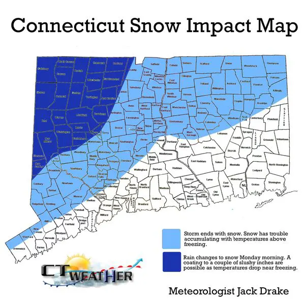
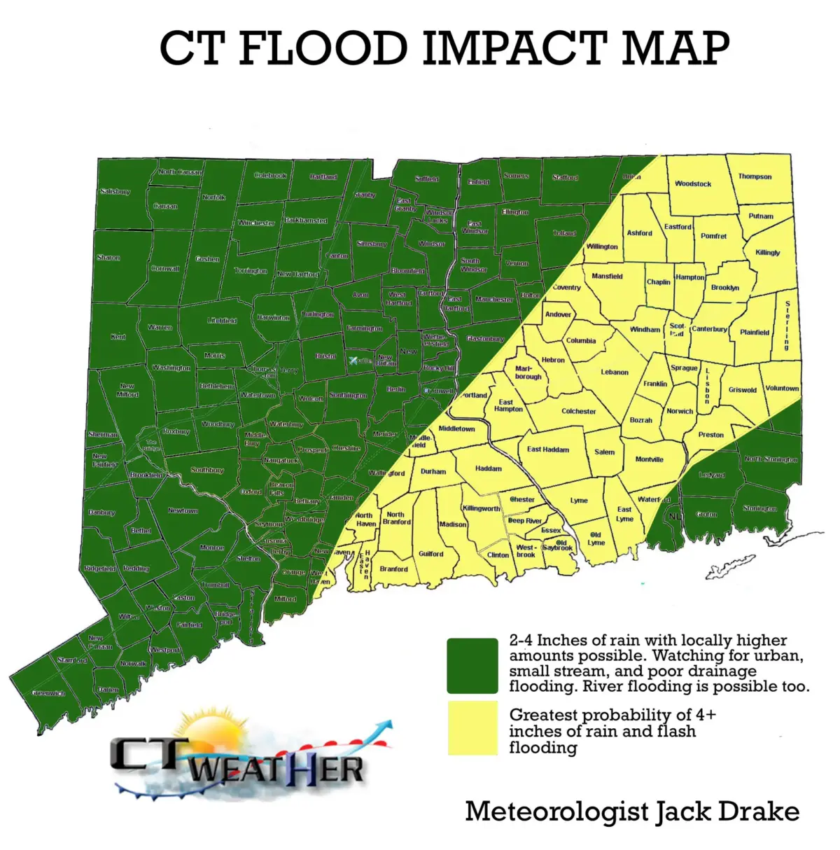
1. WINDS: Based on current forecast, peak wind gusts 35 mph to 45 mph in the Hudson Valley, Western CT and Central CT; 45 mph to 55 mph in Eastern CT, and 50 mph to 65 mph in coastal New London County and Rhode Island. 2. RAIN: Models continue to indicate a widespread 2.0 to 4.0 inches of rain through the event, with locally higher amounts possible. A FLOOD WATCH is in effect for the entire area. Several of the latest short range models have indicated a narrow band of 6.0 inches or more of rain. Prepare for the potential of river flooding as well as poor drainage flooding! 3. SNOW: Trends continue to support snow on the backside of this system, with temperatures approaching freezing by the Monday morning commute. Generally skeptical of these huge temp swings resulting in snow impacts, but growing concerned for higher elevations and especially the Litchfield Hills. See latest map below., 4. MARINE: For Long Island Sound, coastal flooding is possible up to a level of 1.0 to 2.0 feet, particularly in vulnerable areas. A Gale Warning will likely be needed due to the magnitude of wind and surf. TIMING: Overall, for the classic “timing” question, look for showers to break out as early as daybreak Sunday. Shower activity will get steadier as Sunday goes on, with full fledge heavy rain Sunday afternoon through late Sunday night. Cold air works in early Monday morning, with a changeover to snow by 5AM to 7AM Monday. This system finally pulls away by midday Monday, with gusty Northwest winds in its wake. It is possible this is actually the windiest part of the storm, especially for area West of the CT River. 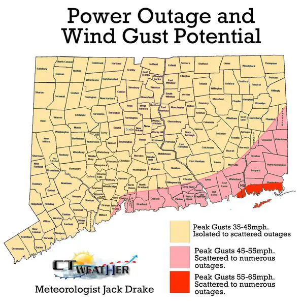


Would you like to work with or advertise with CTWeather? Reach us by phone or email. | Phone: (203) 730-2899 | E-Mail:weatherlab@ctweather.com
The Connecticut Weather Center strives to provide accurate weather information to the public and the many institutions. It is of the utmost importance that crisis information be made available to the public in time of need.
The countdown to Summer is on...
SUMMER 2026 is Coming!
0
0
0
0
Days
0
0
Hrs
0
0
Min
0
0
Sec
Copyright©2026 | CT Weather | All Rights Reserved | A Website Designed by Ridgefield CT Webdesign