

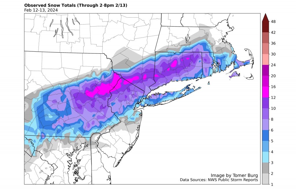
Here’s a look a COCORAHS snow totals for our winter storm. Notice the sharp gradient between Southern CT and Northern CT. The “two part” nature of the storm also added the totals in many Northern areas where temperatures stayed below freezing. Snow had a harder time accumulating with marginal temperatures along the I84 corridor and points south.
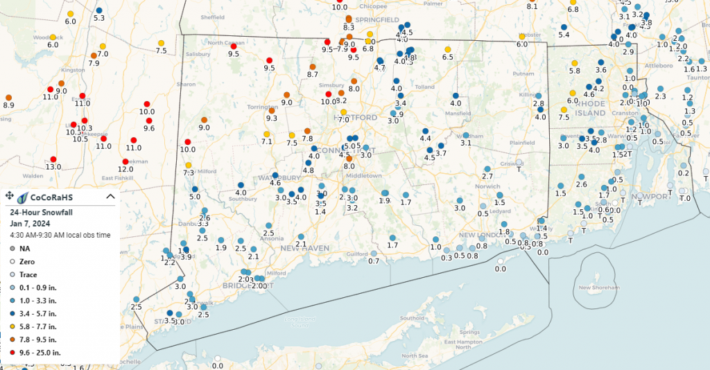
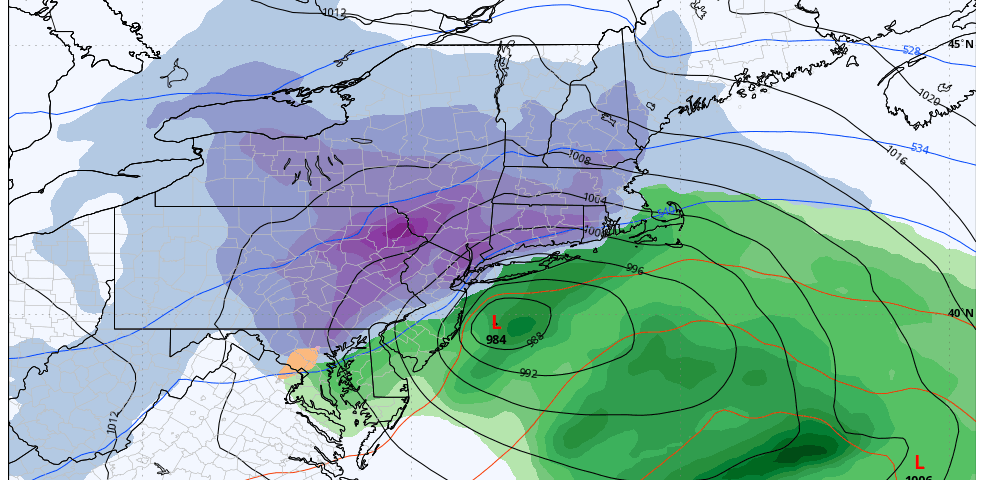
Overall, this was a challenging forecast with a very tight snowfall gradient from North to South. Within the 48 hours before the storm started, modeling trended closer to the area with the low pressure center of the storm, bringing in an extended period of mixing and a dry slot. While this was known and well advertised going into the storm, it adds more variability to the snowfall forecast. In the end, strong banding Saturday night allowed for ample accumulation in Northwest CT. With strong snow banding, though, also comes and area of subsidence. This sinking air and therefore lighter snow affected much of the I84 corridor, leading to lower than forecast values for Northern Fairfield, Northern New Haven, and Northern Middlesex Counties. While we were personally a bit disappointed in the underperformance around Greater Danbury, the forecast for much of the remainder of the state worked out well!
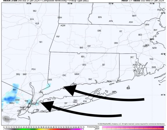
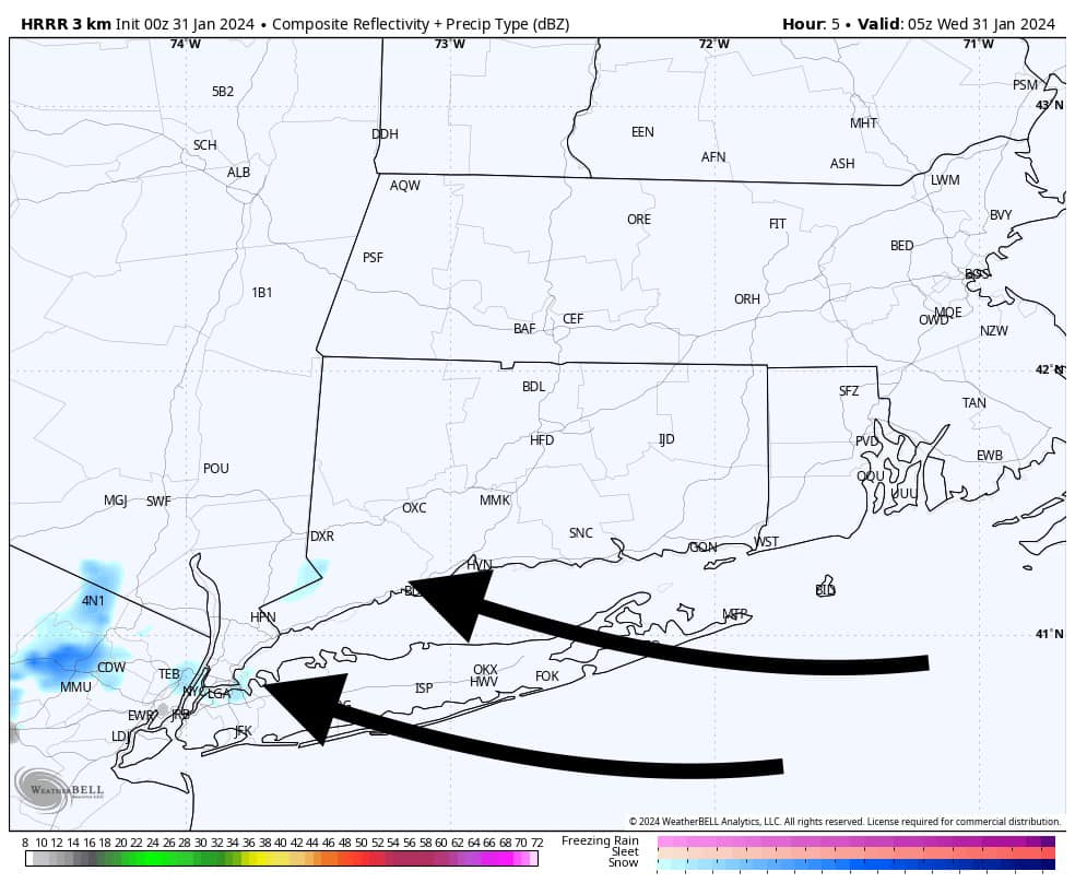
All attention now turns to a warmer storm system Tuesday night into Wednesday that looks to bring flood and wind impacts.