Mild Weather to Start the Work Week – No Snow In Sight
Highs have reached the middle 60s across CT as of 3:30PM Monday. Latest observations below: Mild temperatures appear likely to hang around with lots of 50s and 60s through the next several days away from the immediate shoreline. Sensors show Long Island Sound temperatures are still right around 40 [...]

Wind Advisory Issued Thursday Night into Friday
A WIND ADVISROY is in effect statewide from this this evening through Friday evening. Winds will slowly ramp up this as this evening progresses. It will start to feel gustier after 6PM and then winds will really ramp up between 10PM and 12AM. The peak of the winds will [...]
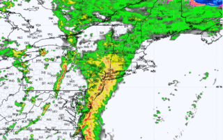
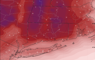
Heavy Rainfall Wednesday Evening: Thunder Possible
Drizzle and light showers are being reported over the area this morning. Expect breezy conditions with periods of drizzle and scattered showers to continue through the day today. Temperatures will be warm (middle 50s for most) but a strong cold front will impact the area this evening. HRRR [...]
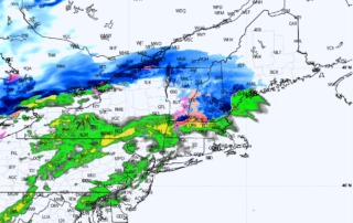
A Series of Low-Impact Systems Hit CT
Storm 1: Today's System Timing: Through the day on Thursday Details: Overcast skies with scattered showers across the region. General precipitation amounts of 0.10 to 0.25 inches. Precipitation: Scattered rain showers are expected to continue throughout the day, with highs climbing into the upper 40s to low 50s. There [...]
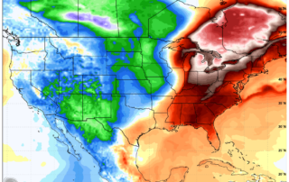
Temps Rise Though the End of February.. Will it Last Into March?
After a frigid stretch, there is confidence a more zonal, southwest flow will allow for an increase in temperatures through the weekend and into early next week. To be clear on expectations, this means highs closer to 50 degrees than 70 degrees, but if you are sick of snow [...]
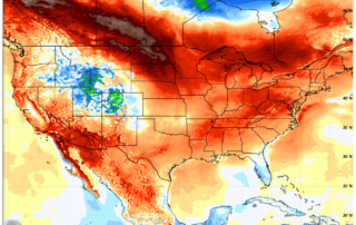
Light Snow Showers Thursday Night Across CT as Cold Weather Continues
As a larger storm system moves well to the south and east of the area, a trough will swing through this evening providing adequate lift for scattered snow showers across the region. Snow shower activity will impact the area between 5PM and 11PM. A light dusting to a coating [...]