Drizzle and light showers are being reported over the area this morning. Expect breezy conditions with periods of drizzle and scattered showers to continue through the day today. Temperatures will be warm (middle 50s for most) but a strong cold front will impact the area this evening.
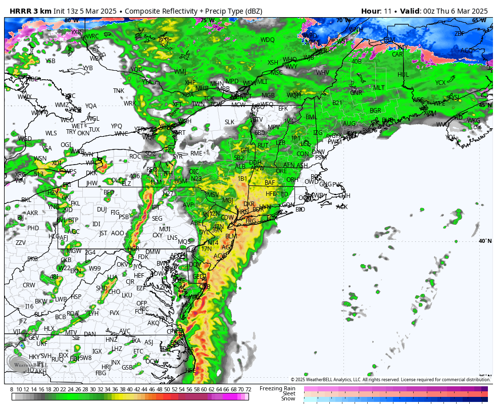
HRRR Future Radar 7PM
The bulk of the heavy rain moves into the area after 5PM. It will be pouring through Western CT by 7PM with embedded thunder and lightning still being shown on modeling. Heaviest weather lasts through about 12AM Thursday. While this is not an overly impactful storm, it will still carry hazards, especially at its peak this evening.
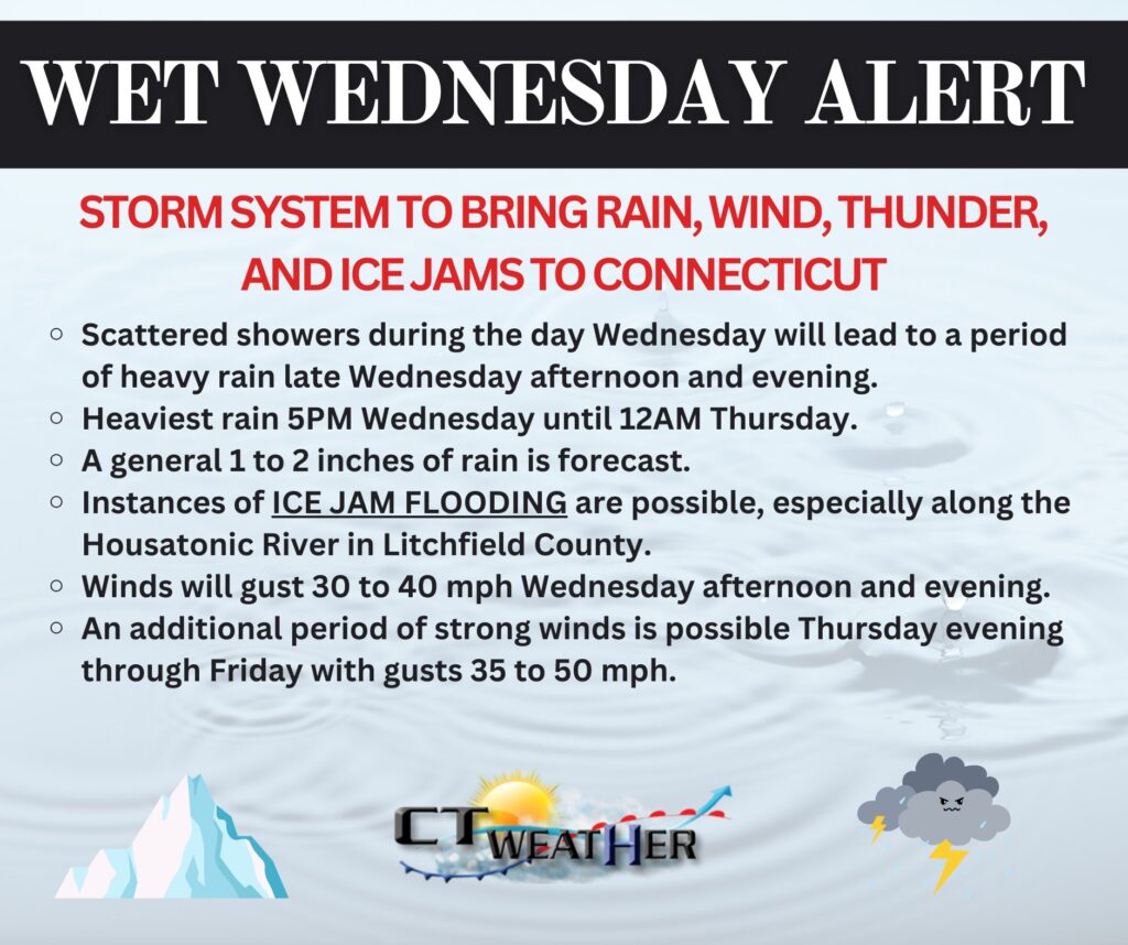
In addition to the heavy rain and thunder, there is the possibility for ice jams on rivers in the colder climate locations, namely the Housatonic River in Litchfield County. Also of note, a period of strong winds is likely after the storm as cold air rushes in. This looks to occur Thursday evening through Friday, with gusts 35 to 50 mph. Isolated to scattered power issues are expected!