A WINTER STORM WATCH is in effect from Saturday evening through Sunday morning. A storm system will track through the middle of the county, with low pressure eventually passing south of Long Island Saturday night. Right now, favoring a relatively conservative 3 to 6 inches in most locations, with 4 to 8 inches across the higher elevations of Northern CT. This is illustrated nicely by the latest GFS ensemble.
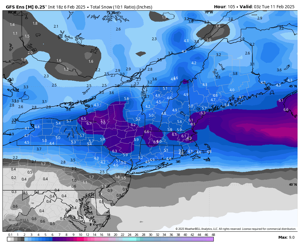
GFS Ensemble Snow
The storm track raises some concerns about potential mixture with sleet, especially in Southern CT and the Lower Hudson Valley. In addition to this, models have maintained a “dry layer” aloft during the storm, which may lead to less aggressive snowfall rates. The Dendritic Growth Zone (DGZ) is a region in the atmosphere where snowflakes form, typically between -10°C and -20°C. When there’s a dry layer within the DGZ, it means that the air in this zone lacks sufficient moisture for snowflake formation. The warm nose here is seen at the 700 mb layer.
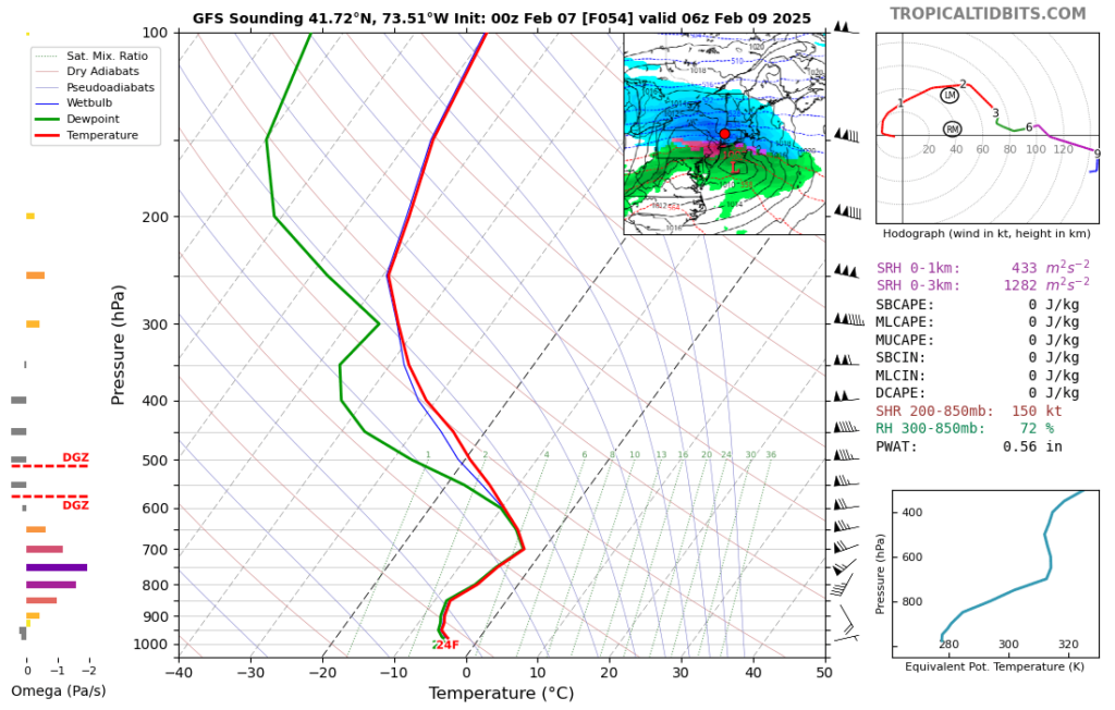
GFS model shows dry air in DGZ Layer as well as a notable warm nose.
These potential mitigating factors have me leaning towards the lower end of forecasts I have seen on broadcast news and the NWS, although there is certainly time for an adjustment to higher totals if warranted.