Last week, we had one of our first tastes of severe weather this season. Isolated afternoon thunderstorms developed over parts of Southern Connecticut, producing hail in a few spots.
This week, the increased heat and humidity combined with an incoming cold front may lead to more widespread thunderstorms, and a threat of more extensive severe weather. We already saw this coming into play yesterday with scattered thunderstorm action, including a few severe thunderstorm-warned storms!
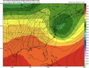
Friday 5/15
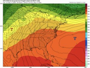
Sunday 5/17
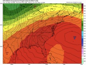
Tuesday 5/19
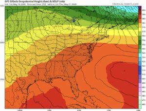
Thursday 5/21
500mb maps for the last week, which is great for showing us areas of high and low pressure. The blue “H” represents the high-pressure center, and the red colors represent its overall reach. This begins with last weekend and shows the predicted evolution through the remainder of this week.
Notice how the orange and red colors expand, and the blue “H” moves northward along the East Coast as the week progresses. This is a classic Southeast/Mid-Atlantic high-pressure dome. These high-pressure regimes can sometimes last for weeks, leading to long stretches of unbearable heat. Fortunately, this time around, this ridge looks to collapse very quickly. You can see this from the evolution of the setup by last week, as the ridge slowly retreats southward by Thursday.
This change will eventually bring us relief, but as they often do in weather, things will get worse before they get better.
When airmasses collide, especially when their characteristics are very different, we can almost always expect unsettled weather. In this case, the collapsing ridge will allow a cold front to drop down across the northeast today.
This cold front is meeting our 90+ degree temperatures, which will easily force updrafts up from the surface into tall thunderstorms. Yesterday, multiple severe thunderstorms were able to form, without much of a cold front to act as “forcing”. Today, the addition of this cold front into our environment should lead to more widespread and more powerful storms. The Storm Prediction Center has issued a slight risk of severe weather (level ⅖) for many areas, highlighting damaging wind as the most prevalent threat category in today’s storms, with small hail a possibility as well.
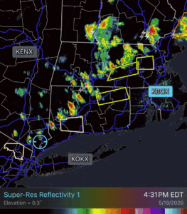
Yesterday’s radar as viewed from the Norton, MA radar site. Several special weather statements and severe thunderstorm warnings can be seen (beige and yellow, respectively).
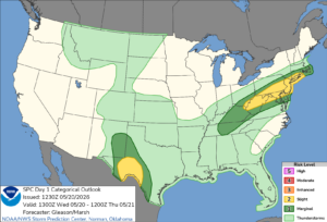
The Day 1 (Today’s) Categorical Outlook from the Storm Prediction Center.
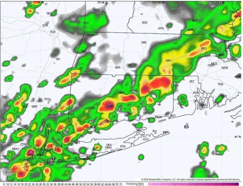
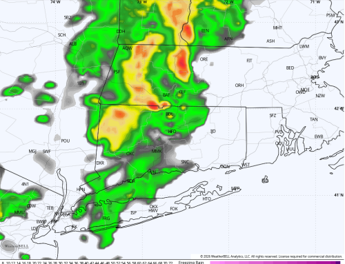
Here are some model predictions that really explode the storms by late this afternoon:
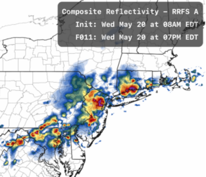
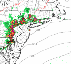
Nam 3km and RRFS models for 6pm today, May 20.
These aren’t the only models telling us that storms will be present this evening, but these two in particular are highlighting what today is capable of producing if the ingredients come together right (or wrong). As you can see from these models, storms are likely to be targeted in southern areas. The storm motion will primarily be towards the southeast, and the further north you are, the sooner you will be clear of the storms for today. Based on the expected west-east orientation of today’s storms and the slightly overlapping axis of storm motion (Southeastward), I’d also watch out for the risk of many areas being hit by more than a single storm today, and potentially several. We refer to this as “training” storms, or a train of storms that hit the same areas over and over. This can easily result in flash flooding, and I’m definitely on the lookout for that today as well. The flooding risk increases the further south you go today, and it only takes a short period of torrential rain to kick off.
Stay safe out there!