This January has brought colder-than-average temperatures to many parts of the United States, but snowfall has been surprisingly sparse, unless you live on the Gulf Coast. To understand why this has happened, we need to delve into some basic meteorology.
Cold Pattern for the East Coast but the energy is strung out and positively tilted – this does not create large Winter Storms
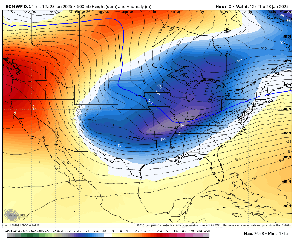
At the heart of the explanation for this weather pattern is the 500 millibar (mb) level in the atmosphere, which meteorologists often analyze to predict weather. The 500 mb level is roughly halfway up the atmosphere and is crucial for understanding large-scale weather patterns. This January, the energy at this level has been stretched out, creating elongated troughs and ridges. These stretched-out patterns mean that the energy is not concentrated enough to produce significant storms and therefore significant snowfall.

Basic 500 Mb Pattern
In simpler terms, think of the atmosphere as a river. When the river flows smoothly, it can carry a lot of water (or in this case, snow). But when the river is spread out and meandering, it loses its strength and can’t carry as much. This is what’s happening with the 500 mb energy – it’s too spread out to create the strong storms needed for heavy snowfall.
Another factor is the lack of “phasing” in the weather patterns. Phasing occurs when different streams of atmospheric energy from come together to create a more powerful storm. This January, the patterns have not been favorable for phasing, meaning the northern and southern energy streams are staying separate and weak. Without this combination, the storms that do form are less intense and produce less snow.
Additionally, some of the atmospheric energy has been stuck in a “cutoff” low near Baja California. A cutoff low is a pocket of cold air that gets separated from the main jet stream and lingers in one area. This cutoff low has been difficult for weather models to predict accurately, making it challenging to forecast how and when this energy will move and impact subsequent winter storm threats. This is what has partially been responsible for the “model mayhem” with the last few storm threats.
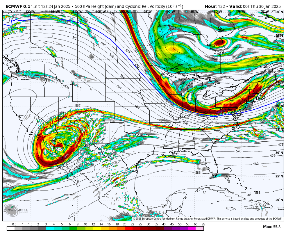
Another example of a cutoff piece of energy over the Baja Peninsula next week, while a shot of cold air enters the Northeast.
Thanks for reading! If you are sick of the cold, we do have a shot at upper 30s or perhaps even low 40s next week! Stay tuned.