If you’ve been feeling the chill lately, get ready—winter is making its presence known across the region. Dry conditions will dominate through midweek, but temperatures will remain well below normal. Highs Wednesday and Thursday will only reach the upper 30s to lower 40s, about 10 degrees colder than what we typically expect for early December.
On Wednesday, high pressure over the Ohio Valley will slowly drift east, leaving our area sandwiched between that system and a departing coastal low. Winds will ease by midday as the pressure gradient relaxes. Thursday brings similar weather, though a cold front will slide through during the afternoon. It won’t bring precipitation, just some extra clouds.
Late Week and Weekend: A Glancing Blow and Bitter Cold
Friday looks downright cold as a strong high-pressure system (around 1030 mb) moves overhead. Expect highs in the upper 20s inland and mid-30s near the coast. Friday night into Saturday, a southern-stream low passing to our south could brush the region. While models differ on the exact track, there’s a chance for light snow late Friday night into early Saturday morning, followed by a rain/snow mix for interior southeastern Connecticut and mainly rain for eastern Long Island and coastal Connecticut by late morning.
Another cold front arrives Sunday night, ushering in an even colder air mass for early next week.
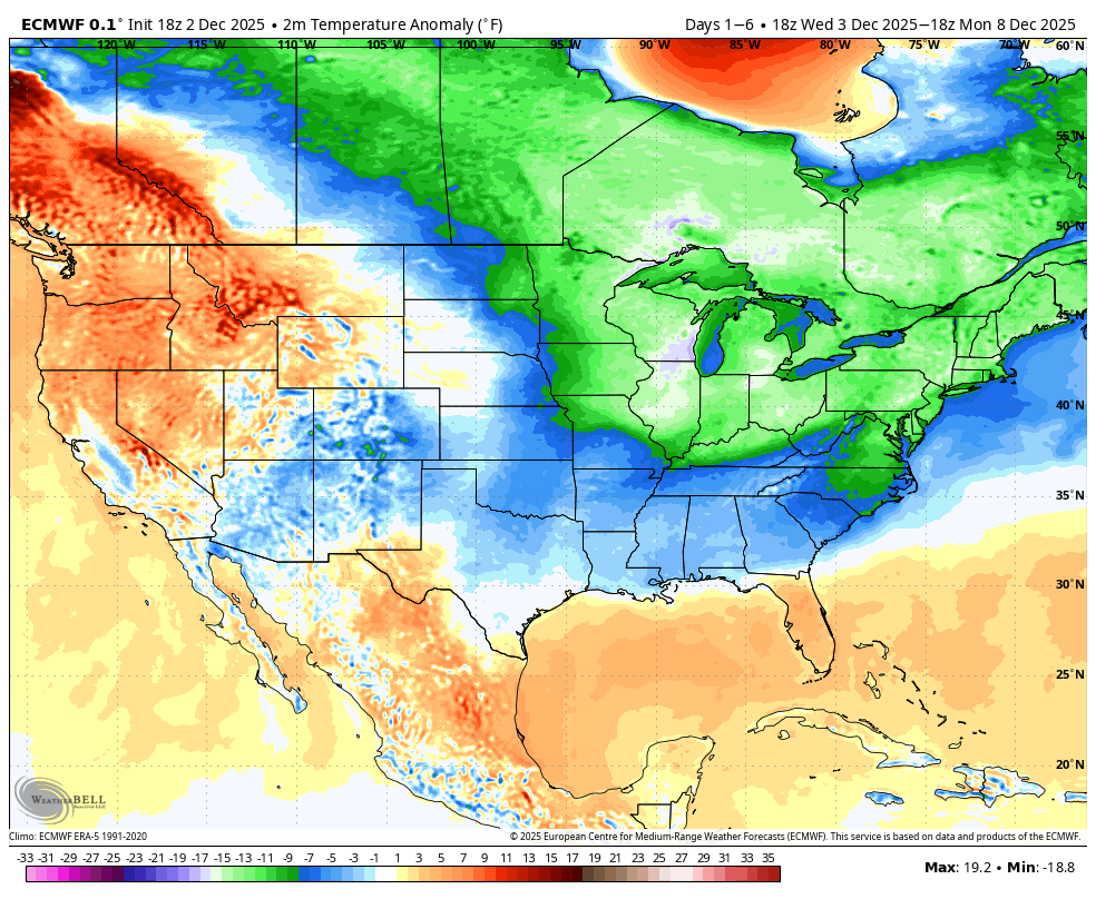
Looking Ahead: 6–10 Day Outlook
If you’re hoping for a quick warm-up, don’t hold your breath. The extended outlook through mid-December keeps the theme of below-normal temperatures going strong. Ensemble guidance suggests continued troughing over the eastern U.S., favoring Arctic air intrusions. Highs will likely remain in the 20s and 30s for much of the period, with overnight lows in the teens for inland areas. This pattern could also set the stage for additional storm chances as southern-stream energy interacts with cold air in place—something to watch as we head deeper into December.


