A large winter storm will move into the area this weekend. This will be yet another system with a dual low-pressure evolution, with a primary low tracking through Pennsylvania and a secondary low offshore. The strength and placement of these lows respective to each other will ultimately dictate how long the cold lingers during the storm. In general, this is a snow to ice to rain event in CT, but the question remains of just how long the icy part of the storm lasts.
The answer may be for quite awhile, especially across the higher elevations of the interior. Models are coming into good alignment with 1/4 inch or more of ice accretion across portions of Northern CT. With this amount of ice, concerns start to grow regarding tree and powerline issues, especially if ice totals get close to 1/2 inch. This icing would take place late Saturday night into Sunday morning.
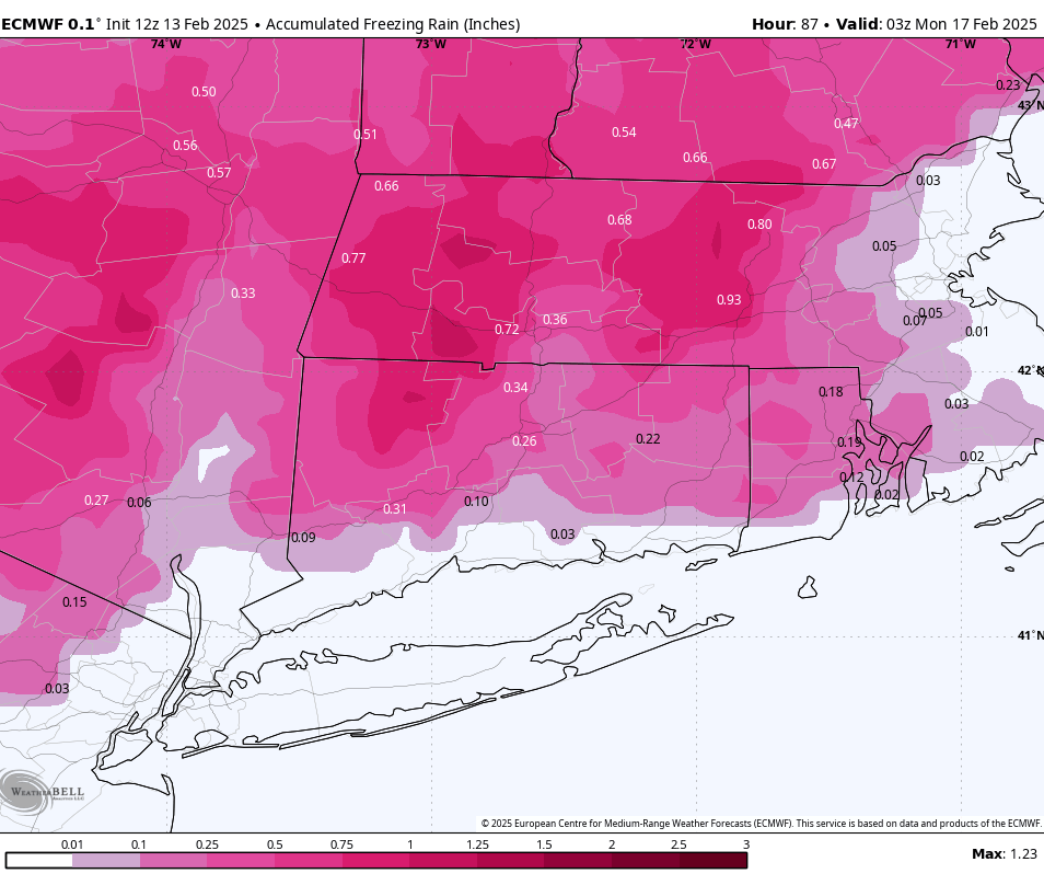
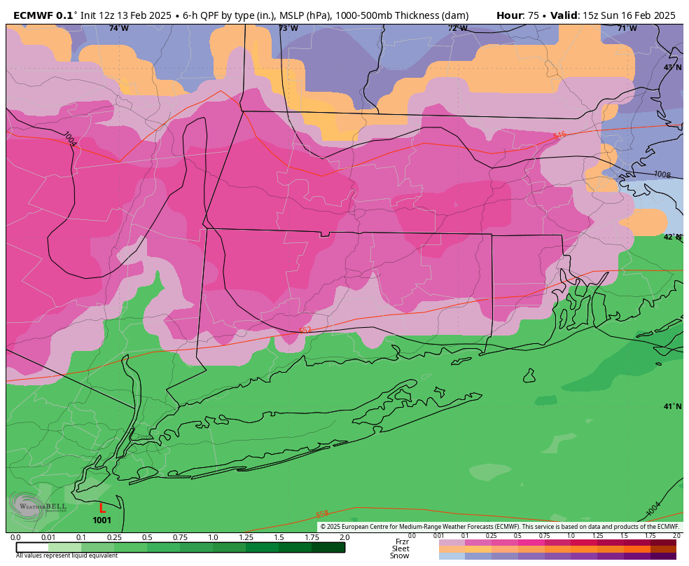
European model freezing rain totals. A general rule of thumb is to cut these modeled totals in half to reflect a truer outcome. Half of this is still a LOT though!
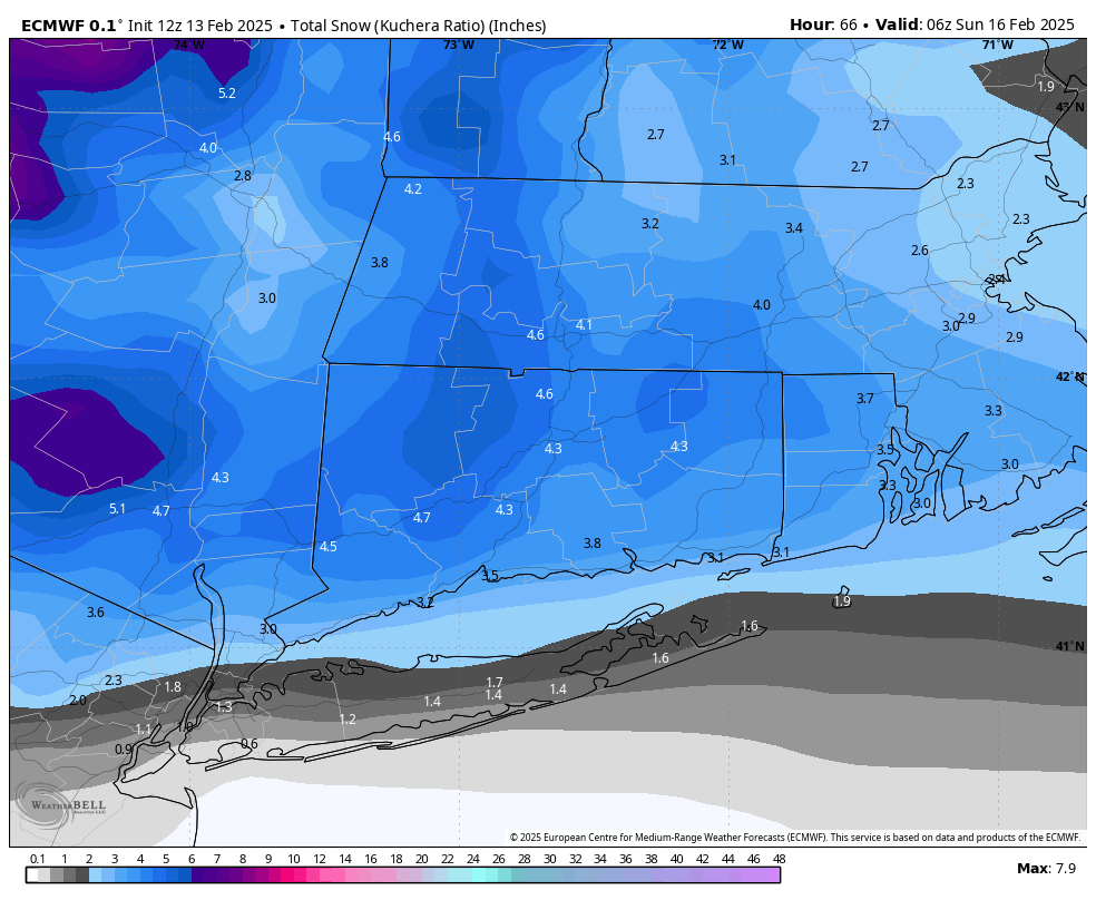
With the ice forecast less certain and prone to fluctuations based on shifts in the data, I am confident all of CT sees snow on the front side of the storm during Saturday afternoon and evening. There is good consensus we see a general 2 to 5 inches of snow through CT, prior to any change to ice or rain.
As for overall storm timing, as there is a lot going on, expect snow to break out Saturday afternoon between 1PM and 4PM. Steady snow should continue until about 12AM or 1AM Sunday, before the ice sets in. Ice across the interior and plain rain at the shoreline continue through early Sunday afternoon before the storm ends. Gust winds and much colder air come in Sunday night and Monday.
European Model – 10AM Sunday