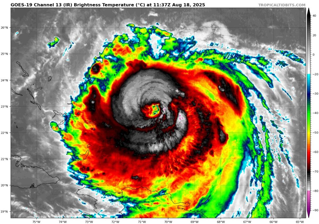
Hurricane Erin has grown in size and strength overnight. Hurricane hunter aircraft flying into the storm found that hurricane-force winds now stretch out 70 miles from the center, and tropical-storm-force winds reach as far as 200 miles. This is considerably larger than the storm was only 48 hours ago. The eye of the storm is also now about 30 miles wide, and there are signs of swirling mini-vortices inside it — a sign of a powerful system. Satellite this morning passes the eye test, and Erin looks the part of a major Category 4 storm!
There’s also evidence of concentric eyewalls, which means Erin may still be going through a structural change that can temporarily slow down wind speed but often leads to a larger and more powerful overall storm. Erin’s current wind speed is around 115 knots (130 mph), making it a Category 4 hurricane, and there is still room for strengthening in the next 24 hours before a gradual weakening trend.
📍 Where Is Erin Headed?
Erin is moving west-northwest at about 13 mph, but it’s expected to turn north later today and Tuesday. Forecasts show the storm passing between Bermuda and the U.S. East Coast, staying well offshore. By Wednesday and Thursday, Erin should be midway between Bermuda and the East Coast, then speeding off to the northeast later in the week.
The latest forecast has shifted slightly west, but Erin is still expected to stay well southeast of New England. There is very high confidence in a turn away from New England.
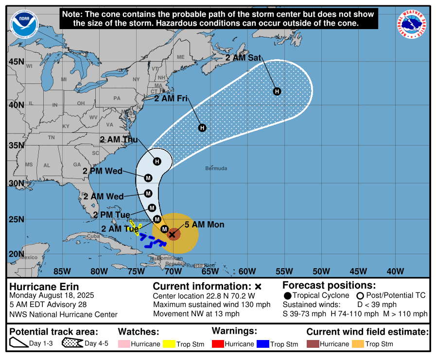
Latest track from the NHC
🌊 What to Expect Along the Coast
Even though Erin will stay offshore, its growing size means rough ocean conditions are likely across much of the western Atlantic. The storm’s outer bands are already bringing rain and wind to the southeast Bahamas and Turks and Caicos, and more tropical storm conditions are expected in the central Bahamas through Tuesday.
For New England, especially Rhode Island and Massachusetts South Coast beaches, expect dangerous surf and strong rip currents starting Wednesday night through Friday. Breaking waves could reach 6 to 12 feet, especially during high tide.
⚠️ Key Points to Know
- Erin will not be making a direct impact on New England, but we will still likely see a breeze and rough surf conditions.
- Some Coastal Flooding is possible into Long Island Sound Wednesday through Friday
- Big surf and dangerous rip currents are likely up and down the East Coast.


