We have a WIND ALERT as we head into the middle of the week. The latest data this morning is showing an aggressive setup for a high wind event starting tomorrow evening as a cold front moves through the region, and and lasting through Thursday morning. For a few hours late Wednesday evening into the overnight—gusts could reach 50 to 60 mph as colder, drier air pushes in behind the front.
Why So Windy?
When we talk about momentum transfer in a wind event, we’re describing how strong winds aloft (higher in the atmosphere) get “mixed down” to the surface. Normally, winds at 1,000–5,000 feet above ground can be much stronger than what we feel at the surface.
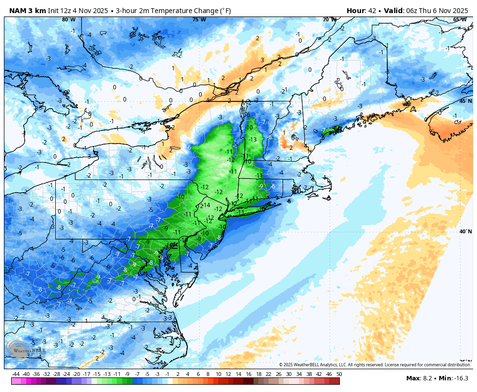
Temperatures Drop Quickly per the NAM Model: 10 to 15 degrees in just a few hours.
During cold air advection—when colder, denser air moves in behind a front—the atmosphere becomes more turbulent. This turbulence acts like a mixing spoon, pulling that faster-moving air from above down to ground level. The result? Surface gusts that can match or come close to those stronger winds aloft.
Timing
- Start: Around 8 PM Wednesday
- Peak: 11PM to 3AM Wednesday Night
- End: By 6 AM Thursday
Impacts
- Scattered tree damage is likely, even with foliage past peak.
- Power outages could occur due to downed limbs and lines.
- Driving may be hazardous, particularly for high-profile vehicles at night.
What You Can Do
- Secure outdoor items like trash bins, patio furniture, and decorations.
- Charge devices in case of power interruptions.
- Stay tuned to updated forecasts and the potential for HIGH WIND WARNINGS as the event approaches.
We will provide updates as the storm gets closer!
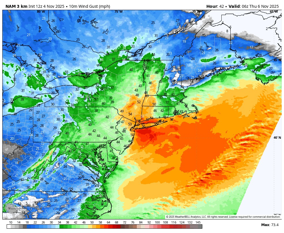
Future Wind Gusts – 1AM Thursday on the NAM Model


