It has been an eventful start to December in the Weather Department, with seasonably cold temperatures and a few light snow events, especially across the interior. Clouds will increase for Saturday afternoon as yet another clipper system approaches the area and moves over the Great Lakes. This will be weaker and shorter-lived than our last system, but will still likely produce a period of light snow across much of CT away from the immediate shoreline. Light snow will start after 10PM, and continue for a few hours through the early morning. 12AM Sunday is shown on the latest HRRR below. Only a dusting of snow is expected across much of the urban corridor, with a coating to an inch possible in the higher elevation of Litchfield County where orographic enhancement is more likely.
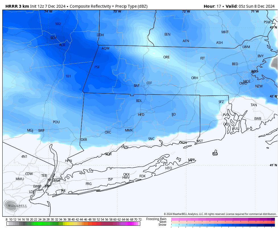
Light snow across Northern CT 12AM Sunday per HRRR
After this system, temperatures will rebound to the 40s on Sunday and Monday. The next storm system approaches for Monday. While the most likely solution for this storm will be plan rain for everyone, an ENE flow as the system approaches may result in a wintery mix for areas just to the North of CT. The rain/mix line is worth watching in this scenario, but as it currently sits, I would put my money on 40-45 degree rain. Euro below valid Monday evening around 10PM.
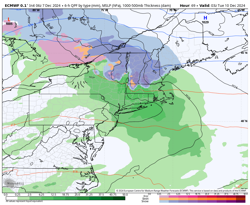
European model shows all rain for the Monday system, with mix and snow in ski county where cold air damming is possible.
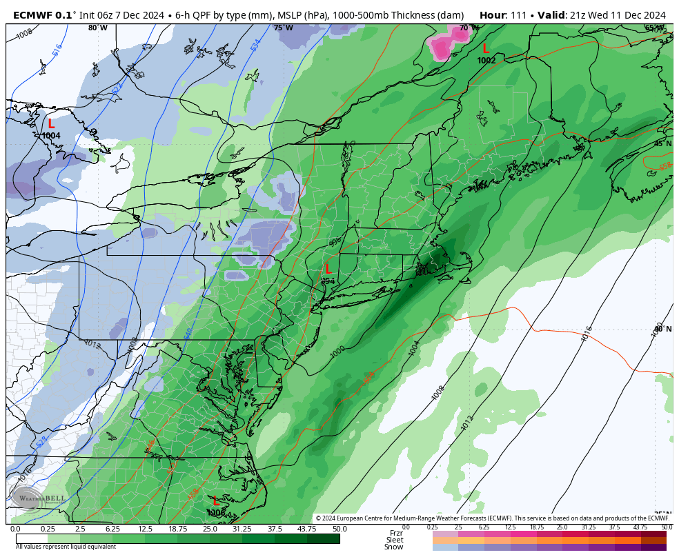
The rain from the Monday system will clear out for Tuesday morning, but clouds will quickly increase again Tuesday afternoon with highs running above average – near 50 degrees! A stronger low pressure system will form and move close to the area Wednesday. This is a classic “inland cutter” track that brings Grinch Storms (rain and southerly wind) in December as opposed to snow. This is the European model valid Wednesday afternoon. With this being a stronger low pressure system, we do have to watch for the possibility of 30 to 40 mph winds as the low approaches, and then again behind the storm as it pulls away.
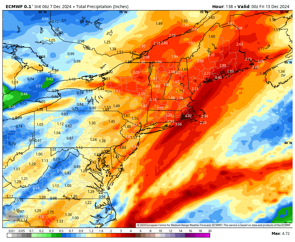
Overall, this active pattern is great news for the rainfall deficit, with around 1.5 to 3.0 inches of total rain likely through Wednesday. I will drop the latest total precipitation estimate below. Have the umbrellas handy.
Thanks for reading!