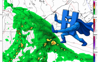
High Pressure Trying Its Best to Save Us From the Rain
Unfortunately, a classic weekend washout is on the way. Feels straight out of this spring's playbook. Luckily however, some will avoid the rain until Saturday night, and some may not see it until Sunday. The difference of having rain during the whole day on Saturday and staying completely dry [...]
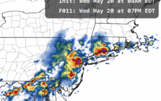
More Severe Weather Possible Today
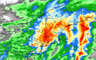
Last week, we had one of our first tastes of severe weather this season. Isolated afternoon thunderstorms developed over parts of Southern Connecticut, producing hail in a few spots. This week, the increased heat and humidity combined with an incoming cold front may lead to more widespread thunderstorms, [...]
Heat Peaks Today Before a Dramatic Late-Week Cooldown Arrives
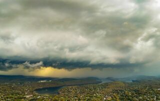
It is yet another hot start out there! A Heat Advisory remains in effect for Hartford, Tolland, and Windham counties through this evening. While the heat will be the main story early in the day, attention will quickly turn to the potential for thunderstorms later this afternoon and evening. [...]
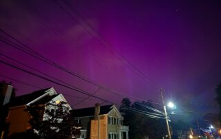
Two years ago: The biggest geomagnetic storm in 20 years
Two years ago: The biggest geomagnetic storm in 20 years Aurora is not something people usually associate with Connecticut, or at least they didn’t until this event. On May 10, 2024, the sun blasted us with a gargantuan solar storm, or a giant cloud of plasma and magnetic fields. [...]
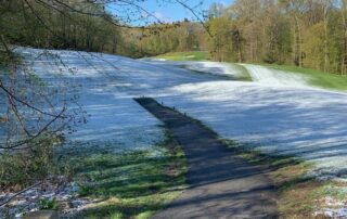
It’s Been a Cold Start to May. That Doesn’t Mean You Should be Complaining
It's Been a Cold Start to May. That Doesn't Mean You Should be Complaining It's fair to complain about how cold it's felt to start off the month of May. Still, we’re often having days that struggle to get out of the 50s. But I’m sorry to tell you, [...]
Connecticut Weather Blog: Clearing Skies Today, Midweek Rain Ahead
A cold front swept through the region overnight, leaving behind a few lingering showers across southeastern Connecticut and Rhode Island early this morning. Those final showers will taper off shortly after sunrise, setting the stage for a gradual return to quieter weather conditions. 🌬️ Today: Clearing and Comfortable Behind [...]