The next two weeks look active and wintery across the region as we head into a favorable pattern for winter storms. These will likely not be all snow events, as lows will track close to the area, but it will be very active with snow, sleet, freezing rain and rain – usually in that order.
Wednesday will bring colder air, with highs struggling to reach 30°F under partly to mostly cloudy skies. An impactful weather system is expected to arrive Thursday morning, with snow likely starting between 6 AM and 10 AM. Snow accumulation is anticipated to be between 1-4 inches, followed by a transition to sleet and freezing rain in the afternoon, forming a solid ice layer. Most of the precipitation will end before temperatures rise above freezing, especially in interior regions, so any change to rain is unlikely to wash away the snow and ice. Widespread school disruptions are expected.
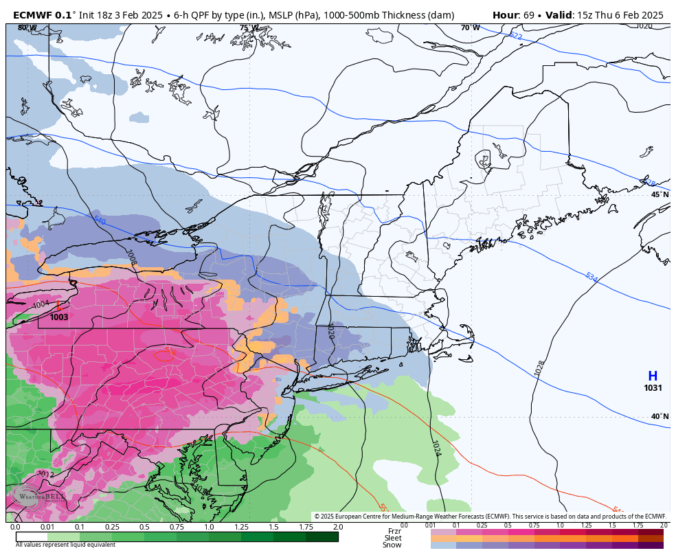
European model showing snow breaking out Thursday morning. 10AM shown.
Another similar system is forecasted for Saturday night into Sunday, potentially bringing colder temperatures and more snow. This system is likely to include a mix of snow, sleet, and freezing rain, with some models indicating 0.25 to 0.50 inches of freezing rain in certain areas. Close monitoring is required, as significant impacts are possible. The active weather pattern will continue into next week, with additional chances for winter storms.

European model showing freezing rain late Saturday night – 1AM shown