As we head into the heart of hurricane season, the European weather model is showing something rather unusual — the potential development of two tropical systems early next week. While long-range forecasts always come with a healthy dose of uncertainty, this particular setup is worth watching closely. Not only is the timing and proximity of these systems intriguing, but it also raises the possibility of a rare meteorological phenomenon: the Fujiwara Effect.
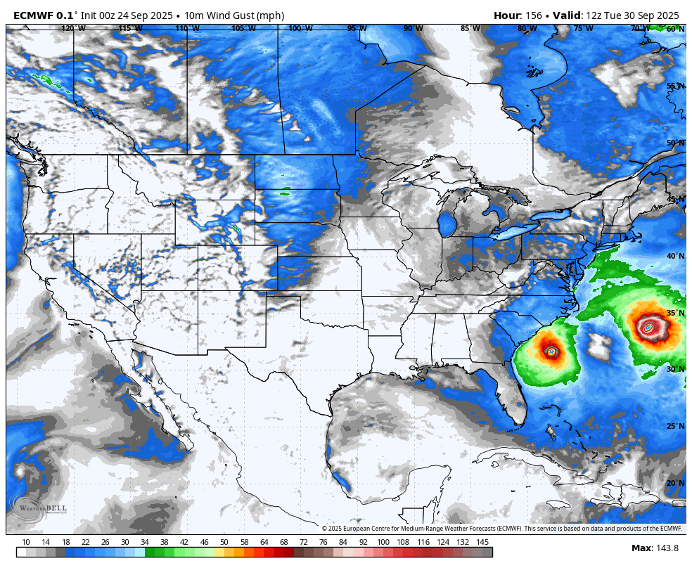
00Z European Model Shows Twin Hurricanes
What Is the Fujiwara Effect?
Named after Japanese meteorologist Sakuhei Fujiwara, who first described it in the 1920s, the Fujiwara Effect occurs when two cyclonic systems — such as tropical storms or hurricanes — come within about 900 miles (1,450 km) of each other. Instead of colliding, the storms begin to interact gravitationally and rotate around a common center. Think of it like a slow-motion dance in the sky, with each storm influencing the other’s path.
This interaction can lead to several outcomes:
- Mutual orbiting: The storms circle each other, sometimes for days.
- Merger/Consumption: In rare cases, the two systems can combine into a single, larger storm. Usually this involves a larger, dominant storm consuming the smaller storm.
- Deflection: One storm may be flung off in a new direction, while the other continues on its original path or shifts slightly.
Why This Matters Now
The European model has been fairly consistent in showing development of two tropical waves we’ve been tracking. While it’s still early — and models can change significantly within a 7-day window — the possibility of two hurricanes forming close to one another is not something we see often. If they do get close enough, the Fujiwara Effect could come into play, potentially altering their tracks in unpredictable ways.
This kind of interaction adds a layer of complexity to forecasting. Not only do we have to consider the strength and movement of each individual storm, but also how they might influence each other. That’s why it’s important to stress uncertainty at this stage — both in terms of track and intensity.
What to Watch For
- Model consistency: Are other models beginning to agree with the European solution?
- Storm development: Do both waves show signs of strengthening into named storms or hurricanes?
- Proximity: Will the storms get close enough to interact?
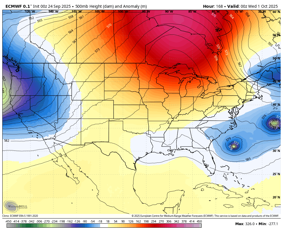
If this scenario does play out, it could be a fascinating — and potentially impactful. Thankfully a large ridge over Central Canada has blocked the storm(s) away in recent runs – this pattern is generally not conducive for New England hurricanes.
Stay with CT Weather for updates!