A quiet but somewhat unsettled start to May is underway across Connecticut. Today will feature mostly sunny skies with a breezy feel and seasonably cool temperatures, topping out in the low to mid 60s. As colder air moves in aloft later this afternoon and evening, a bit of instability could spark a few scattered showers, though many locations stay dry. Any showers that do develop will be brief and spotty, with better chances holding off until after midnight—mainly across interior parts of the state as clouds gradually increase overnight.
The cooler pattern sticks around for the weekend. Saturday will bring more clouds overall, with highs struggling through the 50s. With that cold air still in place above us, expect scattered showers to develop, especially during the afternoon and evening. While not a washout, a few briefly heavier downpours are possible.
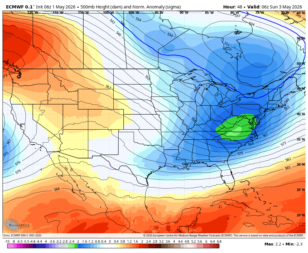
European Model Highlights a Generally Cool Pattern This Weekend
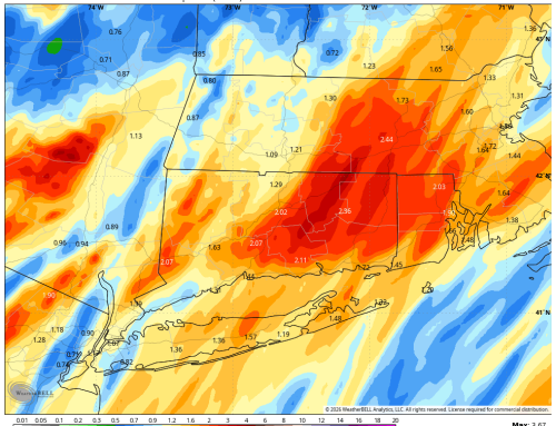
Attention then turns to Saturday night into Sunday, when a coastal storm passes to our south and east. The latest trends suggest the steadiest, more organized rainfall will stay offshore, but Connecticut could still see periods of light rain or showers—especially overnight Saturday into early Sunday. Rainfall amounts look fairly light overall, generally a tenth of an inch or less for most of the state. By Sunday afternoon, conditions should gradually improve, though some clouds may linger and it will remain on the cool side.

Note storm system slides SE Saturday night and Sunday. This could still clip SE areas with some rain.
Looking ahead, the start of next week brings a noticeable shift. Monday looks dry, breezy, and milder as high pressure builds in. Temperatures then climb well above normal by Tuesday and Wednesday, with highs reaching the mid to upper 70s. However, this warmup comes with increasing humidity and a return to unsettled weather. A system approaching from the Great Lakes will bring rising chances for showers by midweek, with the best opportunity for more widespread rain arriving sometime Wednesday night into Thursday.
Overall, expect a cool and occasionally unsettled weekend across Connecticut, followed by a brief stretch of warm, dry weather before more active conditions return in the middle to latter part of next week.