A clipper system is expected to approach the region late Saturday and impact the area through Sunday morning. While there is still some uncertainty regarding the exact track and snowfall amounts, the most likely scenario points to a light, area-wide snow event, generally in the 1 to 3-inch range.
The highest likelihood for 3-inch totals will be along the shoreline, where moisture may be slightly enhanced. Conversely, Hartford County could see some dry air lingering and funneling into the valley, potentially keeping totals closer to 1 inch. However, confidence is not high enough to exclude Hartford from the general 1 to 3-inch range at this time.
It’s worth noting that the European model and its ensemble suite continue to suggest slightly higher amounts along the shoreline (2 to 4 inches). Future updates may reflect a slight increase for coastal areas, but for now, maintaining a uniform 1 to 3-inch forecast avoids unnecessary complexity.
This will be a cold system, with temperatures in the 20s during the snowfall. Snow will stick easily, and mixing with ice or rain is unlikely. Expect the snow to be light and fluffy in nature.
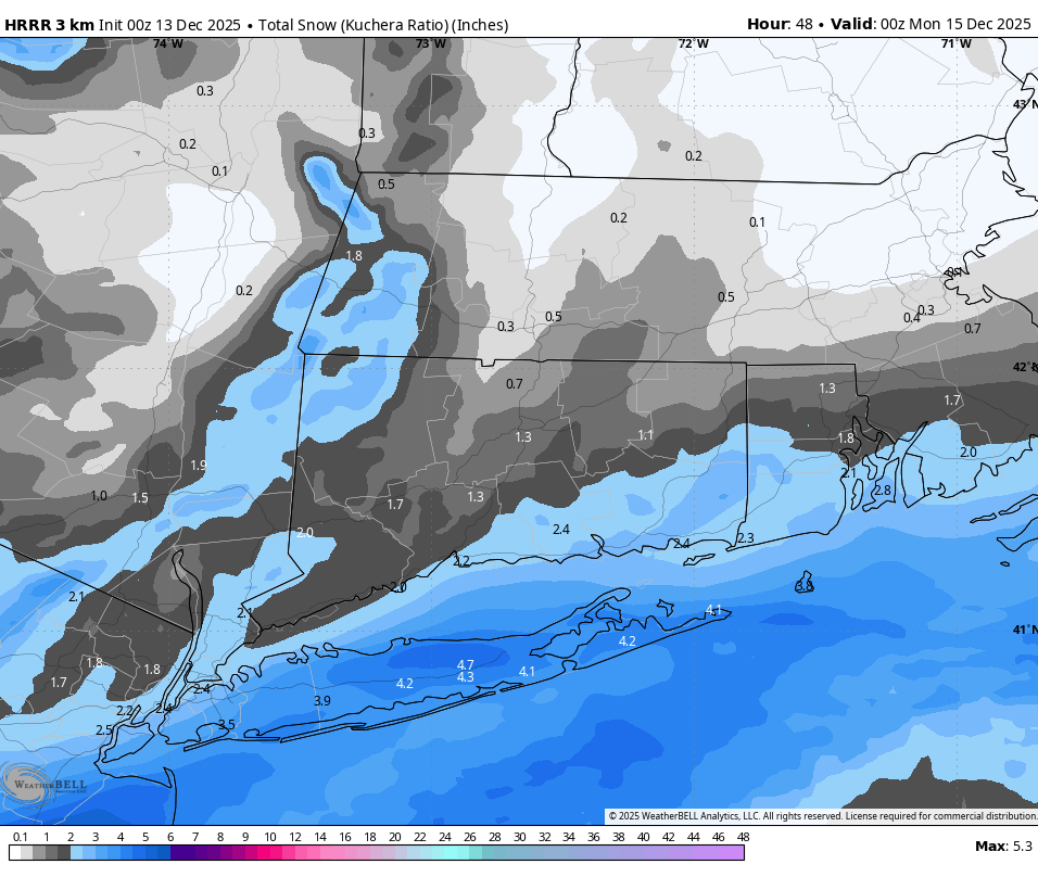
HRRR snow totals through Sunday