A significant winter storm is set to impact the region from Sunday into Monday, and confidence continues to grow that this will be a high‑impact event. This system has all the hallmarks of a classic Miller B nor’easter, where an inland low transfers its energy to a rapidly developing coastal storm—often a favorable setup for heavy snowfall in southern New England.
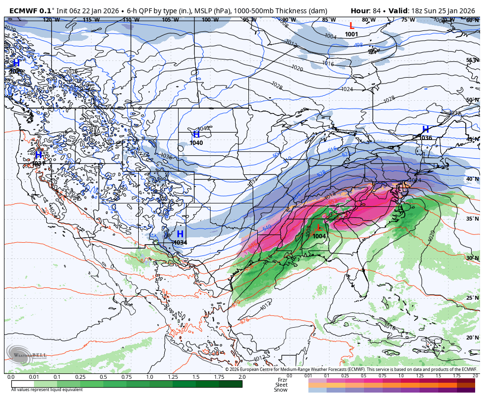
European model valid 1PM Sunday – Large Storm!
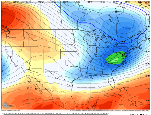
Arctic Air Already in Place
One key ingredient is already locked in: a deep supply of Arctic air anchored over the Northeast. This ensures that the region starts the storm well below freezing, which increases the likelihood that precipitation begins — and largely remains — as snow.
The presence of such cold air also means the snow will have a higher “fluff factor”, boosting totals compared to a typical wet, heavy snowstorm.
Storm Setup: Moisture-Rich System With Gulf and Pacific Connections
The parent storm tracks across the country this weekend, tapping into an impressive plume of moisture originating from both:
- The Gulf of America, and
- The Pacific, through an active subtropical jet.
As the primary low transfers to the coast Sunday night, the developing nor’easter will rapidly intensify offshore, pulling Atlantic moisture into the already-cold airmass—an ideal setup for widespread heavy snowfall.
Snowfall Expectations
Most ensemble guidance continues to cluster around 6–12 inches for the region. Given the expected light, fluffy nature of the snow, 8–14 inches appears to be a reasonable forecast for much of the area at this time. Higher amounts remain on the table if the coastal low tracks just inside the “sweet spot” near the benchmark.
This storm is likely to strengthen quickly, and snowfall rates Sunday night could reach 1–2 inches per hour during the peak.
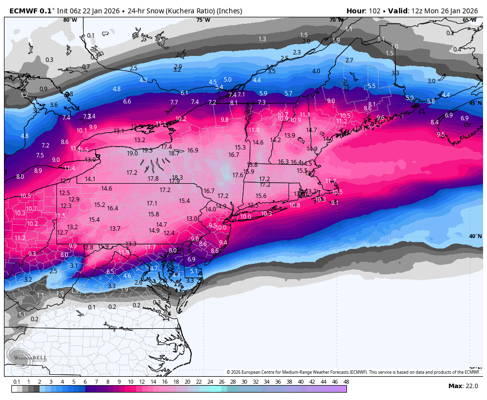
European Model Total Snowfall
Mixing Concerns: Low Confidence
The latest European model introduces the possibility of some sleet or freezing rain mixing in Sunday night. However, given:
- The depth of the Arctic air mass,
- The strength of the cold high to our north, and
- The expected low track,
confidence in significant mixing remains low.
Even if a brief period of mixing were to occur, most areas would still see 6+ inches of snow before any changeover.
What to Watch Heading Into the Weekend
Here are the key features still being monitored:
- Track of the coastal low — a shift east or west will influence totals.
- Timing of coastal transfer — earlier transfer generally favors higher snow totals inland.
- Warm air intrusion aloft — will determine whether mixing reaches the surface.
Updated model trends through Friday and Saturday will provide sharper clarity.
Bottom Line
A major winter storm is increasingly likely Sunday into Monday, with:
- Widespread 8–14 inches of snow
- Locally higher amounts possible
- A brief period of mixing possible (30-40% chance)
- High-impact travel disruptions from Sunday afternoon through Monday morning with school closures for Monday appearing likely.
More refinements will follow as higher-resolution guidance becomes available.