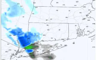
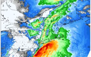
Light Snow Event 12-7-23
What is this? A sneaky snow event? Snow will approach from the west during the day today. Some of the latest short range models have a bit more activity making it into the Western CT this afternoon. Keeping an eye on this as temperatures will only be in the [...]
When Will Winter Arrive?
Despite meteorological winter starting on December 1st, our true "snow season" here in Connecticut is normally January, February and March. In many recent years, it seems there has been a flood of warmer weather right around the holidays. To close out 2023, which has been by all standards an [...]
Storm System to Approach Sunday Evening: 11-26-23
Increasing and lowering clouds with temperatures a hair warmer for your Sunday. Expect highs in the mid 40s. Rain moves in during the evening, with a start time right between 6:00PM to 9:00PM, earliest towards the Hudson Valley and latest in Eastern CT and Rhode Island. Expect rain heavy [...]
Temperatures Drop Black Friday Afternoon – Bundle Up
A cold front moves through midday Friday, with temperatures dropping and the wind picking up for the afternoon. Here are modeled “feels like” temperatures for 6PM. Expect air temps to quickly tumble through the 30s with NW wind gusts to 25mph. This will make it feel like the low [...]
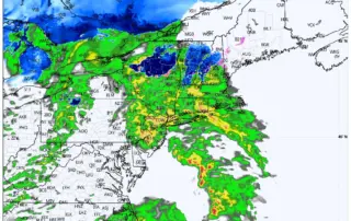
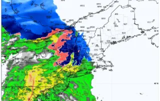
Heavy Weather On The Way Tuesday Night Into Wednesday:
Current radar trends indicate light rain and mixed precipitation moving into the area over the next few hours, with steadier precipitation working in after 5PM. Any mix should quickly turn to rain along the I84 corridor, with winter precipitation hanging on longer in the highest elevations of Litchfield [...]
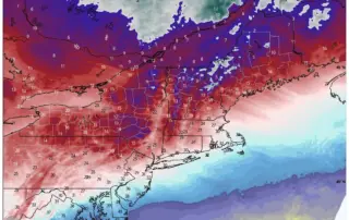
Latest on the Storm System Coming in Tuesday Evening Through Wednesday Morning
Our storm system is on track for Tuesday evening. Rain should begin between 4PM and 6PM in the Hudson Valley and Western CT, and 6PM to 8PM in Central CT and Eastern CT/RI. Still expecting a mostly rain event for the forecast area, with some mixing at the [...]
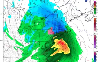
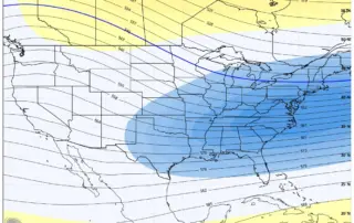
Storm Update: What’s Coming The Wednesday Before Thanksgiving?
Timing details are coming into better focus for our Tuesday evening thru Wednesday midday storm. Thinking rain/wind is primary threat in CT. Watching the colder GFS solution (see photo), but feel rapid dig of Northern vort is a bit exaggerated. This aggressive vort dig is crucial in helping [...]