- Reach us by phone, fax or email.
- Phone: (203) 730-2899
- Fax: (203) 730--2839
- weatherlab@ctweather.com
Forecast Blog
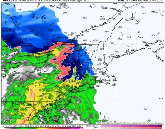
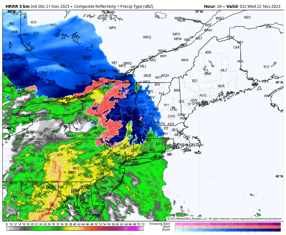
Current radar trends indicate light rain and mixed precipitation moving into the area over the next few hours, with steadier precipitation working in after 5PM. Any mix should quickly turn to rain along the I84 corridor, with winter precipitation hanging on longer in the highest elevations of Litchfield County. The shoreline areas should remain plain rain throughout, as expected. Should note there is a Coastal Flood Advisory up along the coast for minor coastal flooding in Fairfield, New Haven, and Middlesex County.
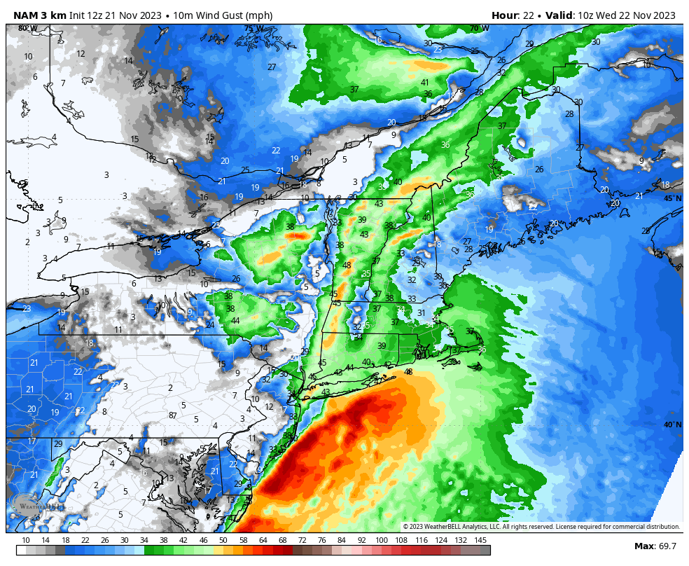
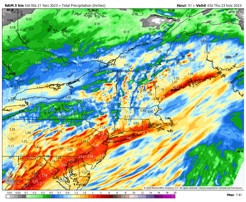
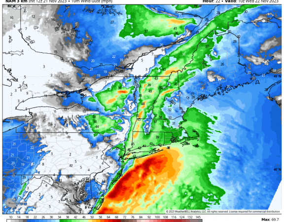
Rain will be heavy at times Tuesday night, with rainfall rates and winds peaking by the early Wednesday morning commute (3AM to 8AM). Increasing the wind gust forecast to 35-45mph during this interval inland, and 40-50mph at the coast. This amount of wind could potentially cause some isolated tree or power issues, even with foliage down.
Weather improves by mid morning Wednesday with clearing by midday. This will set the stage for a nice Thanksgiving day.

