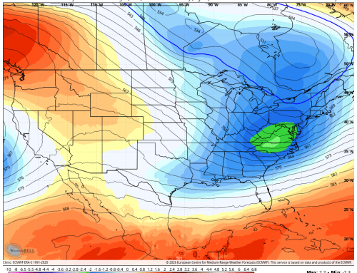
Morning satellite imagery shows clear skies across the region, setting the stage for a beautiful and unseasonably warm day. A strong ridge of high pressure is pushing warmer air into the area, and this trend continues through midweek.
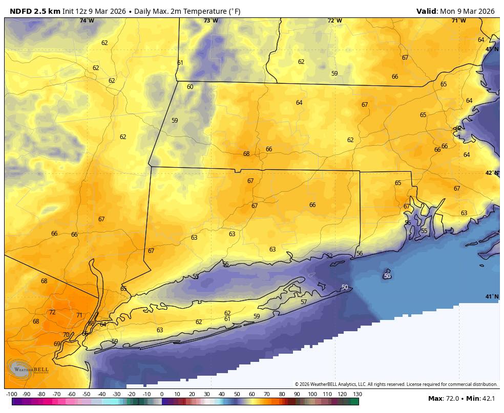
Highs in the 60s Monday bump up to near 70 Tuesday
Warm Through Wednesday
Expect temperatures to run 15–20° above average inland, where the warmest readings occur. Coastal areas will be cooler in the afternoons and evenings as winds turn onshore, pulling in chillier air from the ocean, which is still in the upper 40s to near 50°F. This marine influence will also promote low clouds and fog along the coast tonight through Wednesday morning.
Midweek Front Brings Rain, Then Colder Air
A frontal system approaches on Wednesday, but most of the day stays dry thanks to lingering high pressure. Rain chances rise Wednesday night as gusty southerly winds increase ahead of the cold front. The front crosses early Thursday, flipping winds to the northwest and ushering in a colder, drier air mass.
Some rain may briefly mix with wet snow Thursday morning, but no accumulation or travel impacts are expected. Temperatures tumble through the 40s and into the 30s by Thursday evening. With below‑freezing temperatures Thursday night, some black ice is possible.
Looking Ahead
The extended period looks seasonably cool with highs in the 30s and 40s into early next week. A chance of rain or snow showers on Sunday is on the table, though details remain uncertain.