After a stretch of dry and sunny days across Connecticut, the region is finally on track to receive some much-needed rainfall—though not as much as we might hope. The dry spell has not only made lawns crispy and rivers low, but it’s also contributed to an elevated brush fire risk, with one active fire still smoldering in Steep Rock Preserve in Litchfield County.
The Steep Rock Preserve Fire located in Washington, CT, which has been burning stubbornly due to persistent dry conditions, remains contained to one main area thanks to light winds. However, the lack of moisture has made it difficult for crews to fully extinguish the blaze. The hope now lies in the forecast: rain is expected to arrive late tonight, potentially offering some relief.

Washington CT Fire at Steep Rock Preserve – James Cooper Photo
Today’s Forecast
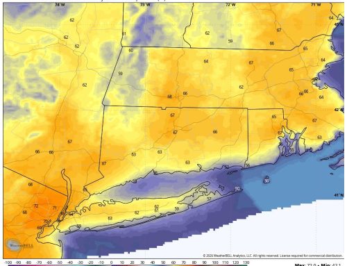
Morning satellite imagery showed areas of fog, especially along river valleys, which are expected to burn off by mid-morning. Temperatures will climb into the upper 70s to low 80s under abundant sunshine. A few clouds will drift in toward evening, setting the stage for tonight’s weather shift.
Scattered showers and possibly a thunderstorm are expected after midnight, with most models predicting less than 0.25 inches of rainfall. While this won’t be a drought-buster, it could be just enough to help suppress the fire activity at Steep Rock. Western Connecticut and the adjacent Hudson stands the best chance of seeing slightly higher rainfall totals in the 0.25 to 0.35 inch range.
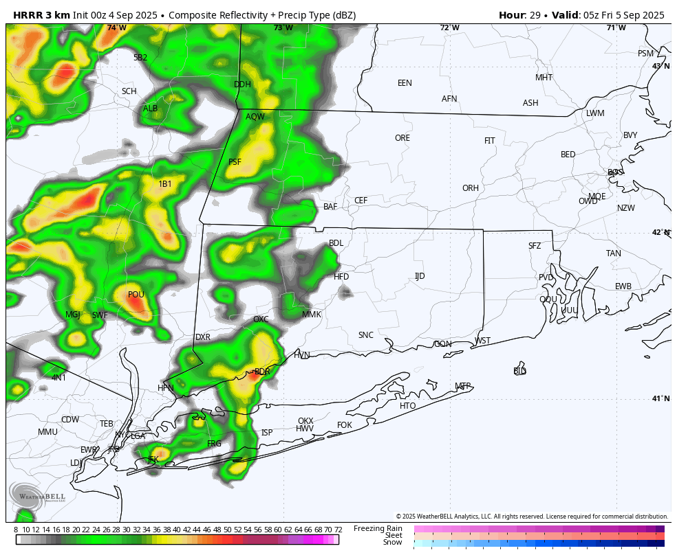
Future Radar 1AM Friday Morning – HRRR model
Looking Ahead
- Friday: Showers will taper off early, giving way to mostly sunny skies and warmer temperatures in the mid-80s. A persistent southwest flow will keep things feeling summery.
- Saturday: Another warm and sunny start, but a cold front will bring more widespread showers and storms by late afternoon into the evening. The Hudson Valley and Western CT could see stronger storms, so it’s worth keeping an eye on the severe weather potential.
- Sunday and Beyond: Cooler, quieter weather returns with decreasing clouds and seasonable temperatures. Expect generally sunny skies through midweek.