- Reach us by phone, fax or email.
- Phone: (203) 730-2899
- Fax: (203) 730--2839
- weatherlab@ctweather.com
CT Weather
What is this? A sneaky snow event?
Snow will approach from the west during the day today. Some of the latest short range models have a bit more activity making it into the Western CT this afternoon. Keeping an eye on this as temperatures will only be in the mid-30s and we will have decreasing sun angle by midafternoon. A quick coating and locally slick travel could occur in some areas that see steadier snow rates. Areas that are most likely to be impacted include Northern Westchester, Northern Fairfield, Northern New Haven, and all of Litchfield Counties. Timing is 12PM to 5PM. Keep an eye to the sky and the forecast this afternoon!
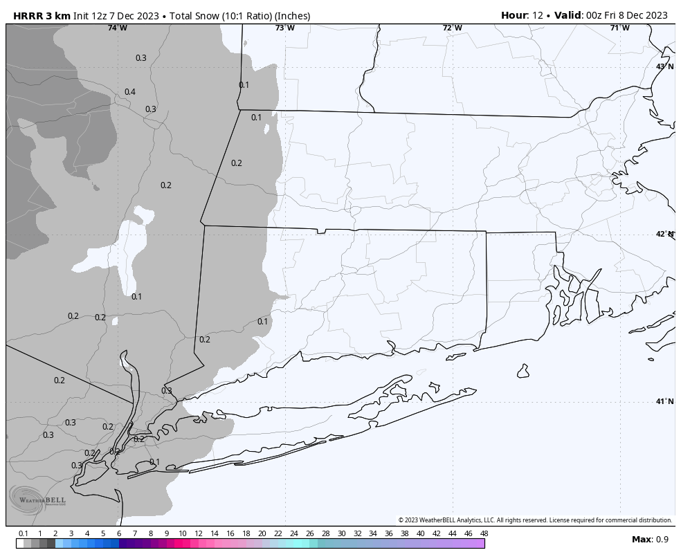
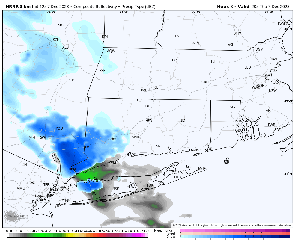
December 7, 2023
What is this? A sneaky snow event? Snow will approach from the west during the day today. Some of the latest short range models have a […]
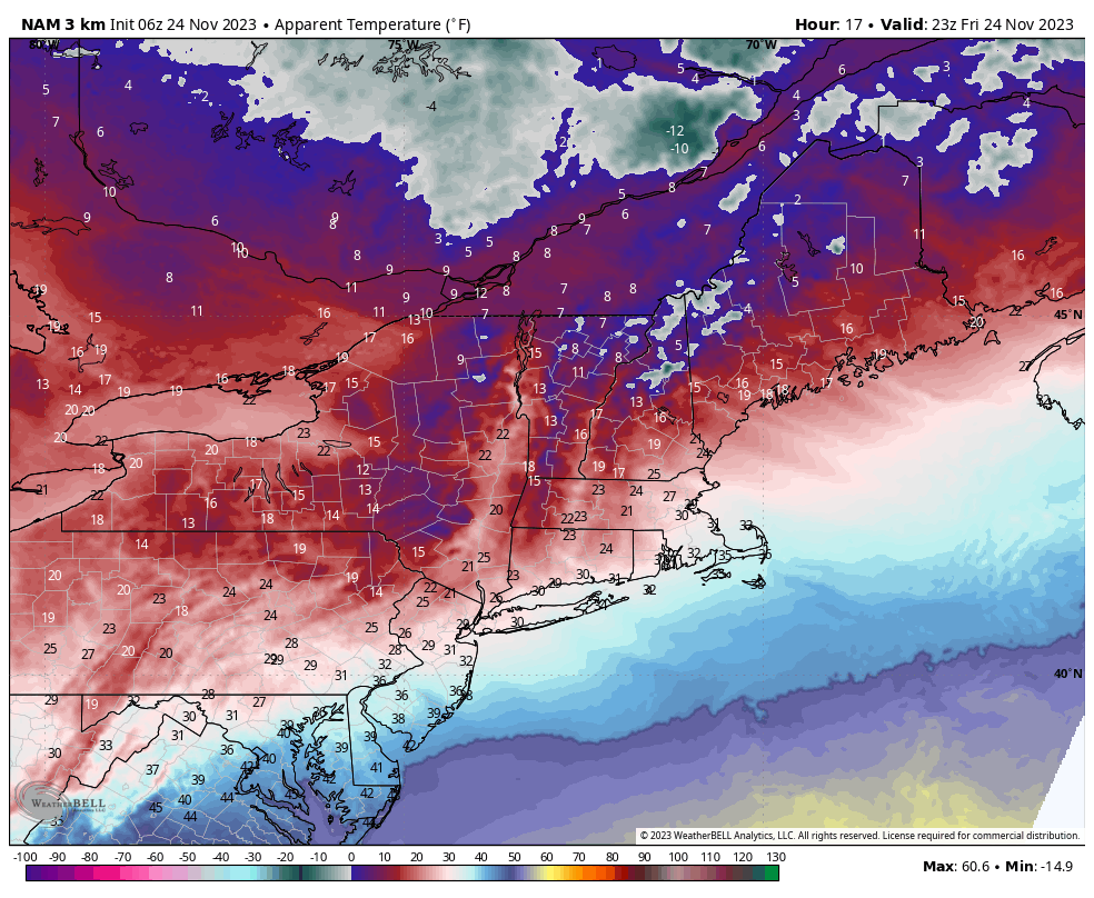
November 24, 2023

A cold front moves through midday Friday, with temperatures dropping and the wind picking up for the afternoon. Here are modeled “feels like” temperatures for 6PM. […]
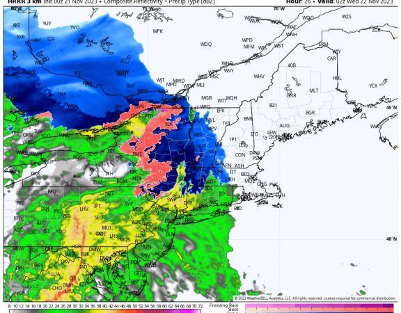
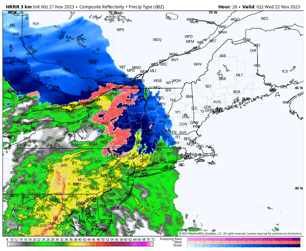
November 21, 2023
Current radar trends indicate light rain and mixed precipitation moving into the area over the next few hours, with steadier precipitation working in after 5PM. Any […]
November 21, 2023
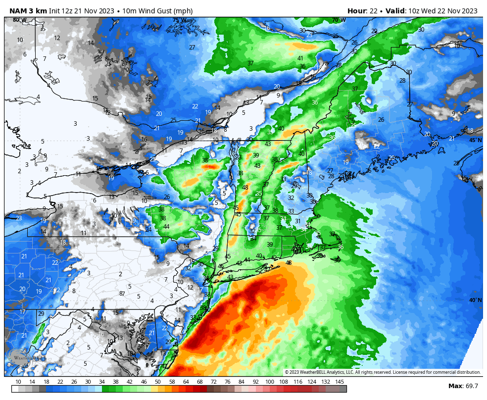
Our storm system is on track for Tuesday evening. Rain should begin between 4PM and 6PM in the Hudson Valley and Western CT, and 6PM to […]