- Reach us by phone, fax or email.
- Phone: (203) 730-2899
- Fax: (203) 730--2839
- weatherlab@ctweather.com
Blog
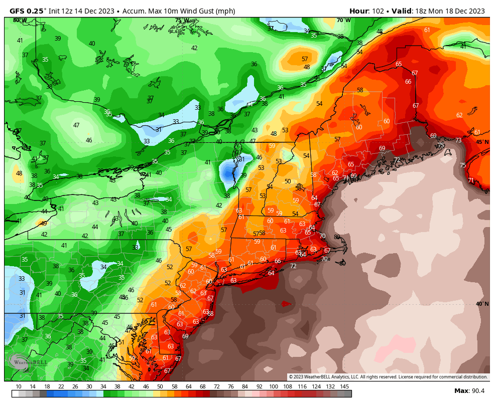
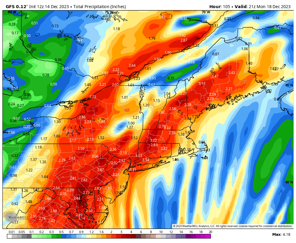
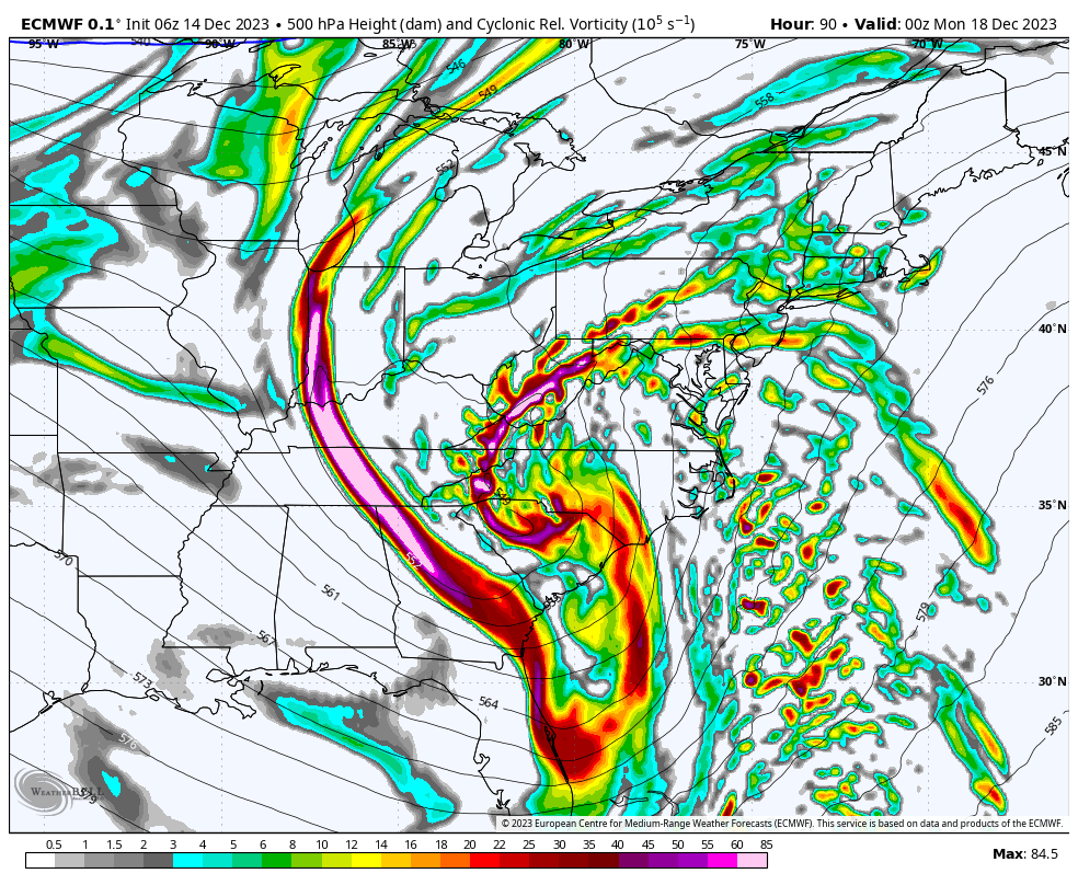
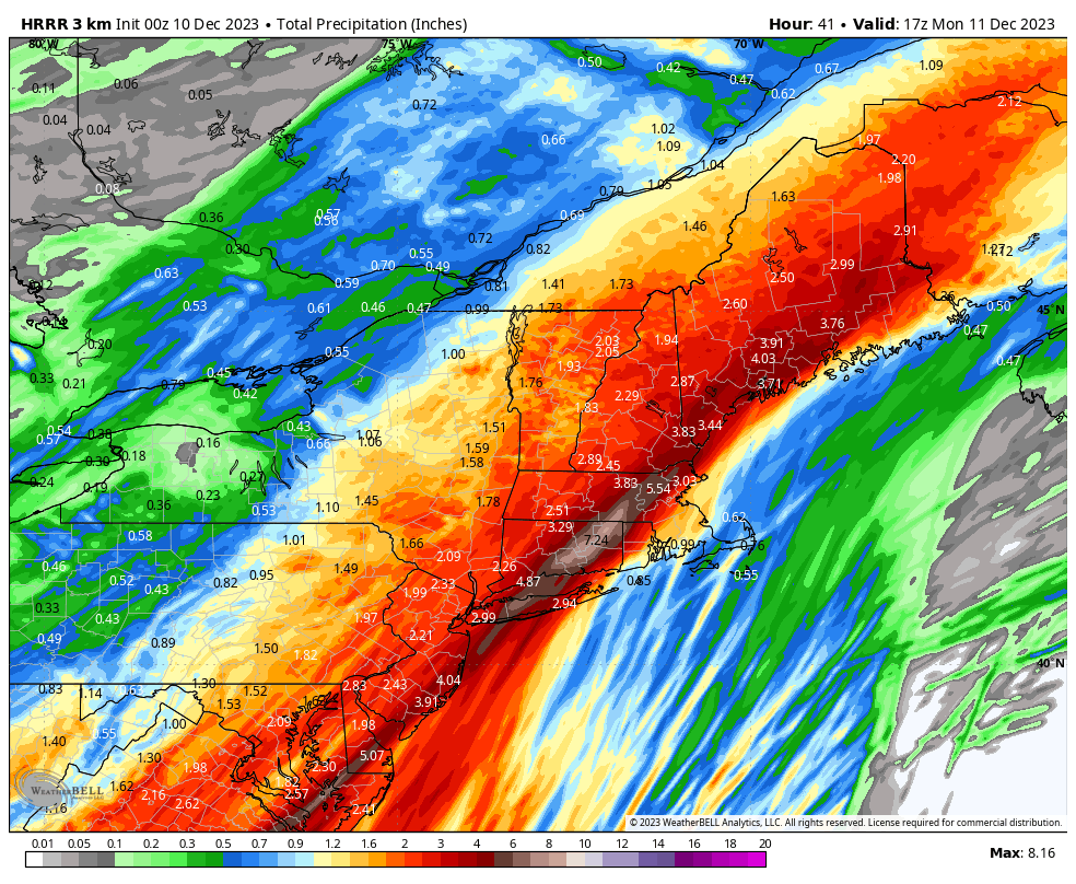
It feels like déjà vu! Another large storm is on the way late Sunday into Monday – and it will not be snow. Despite another rain event, this is an interesting setup from a meteorological perspective, with a trough dipping down well into the Gulf of Mexico, interacting with tropical energy to form the storm. There is good model alignment with a surface low rapidly strengthening and tracking out of the Central Gulf of Mexico, and up the Eastern seaboard this weekend.
As could be expected with the origin of the storm, this system will have a robust tropical moisture feed. With the shear size of the system, a tight pressure gradient could lead to a period of strong winds Sunday night and Monday morning. With some time to go in the forecast process, exact details will need to be ironed out, but I think this system could end up being windier than last week, as well as another significant amount of rain. Look out for another round of wind and rain impact maps!
