On cool autumn mornings around Connecticut, it’s common to see fog rising off lakes and ponds. This effect—sometimes called “lake smoke” or “frost smoke”—happens when cold overnight air moves over warmer water. The temperature difference causes moisture from the lake to evaporate and condense into fog just above the surface. This is also the same phenomena that causes “sea smoke” out over Long Island Sound.
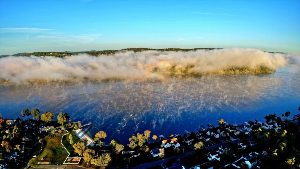
Amazing image of the morning ‘lake smoke’ rising out of Candlewood Shores in Brookfield, CT
In the photo of Candlewood Lake, you can actually see this in action. The warm water releases vapor into the cooler air, creating a thin layer of fog that looks like smoke drifting off the lake. These fog layers are usually shallow and tend to disappear quickly once the sun warms the land and air.
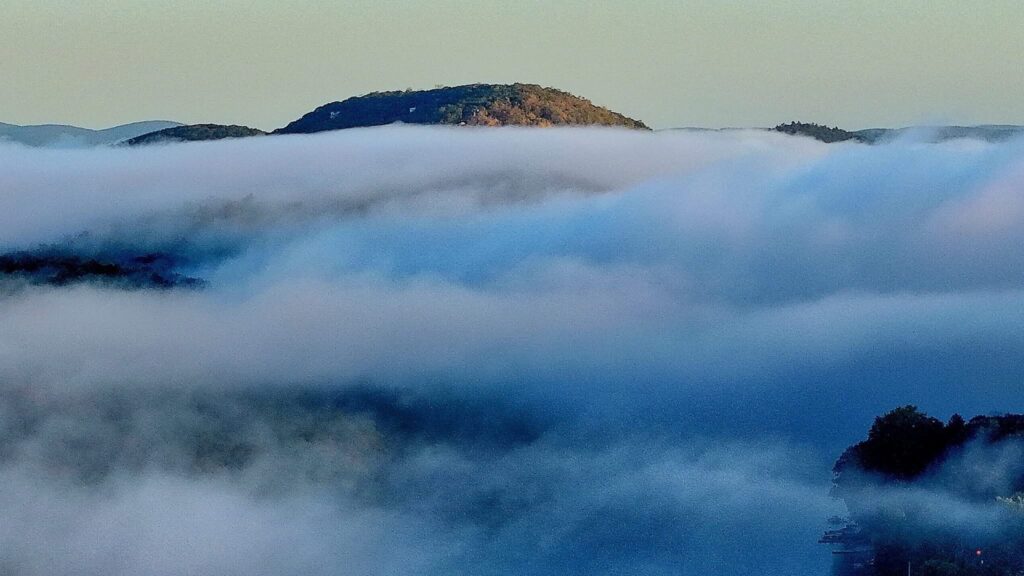
It is easy to see how shallow the cloud (fog) layer is here, with Candlewood Mountain rising above
It’s a simple but cool reminder of how temperature and moisture interact, and a great lesson to kids on some common weather “stuff” we see here in Connecticut —plus it makes for some great early morning views.
Thanks to our friend Adam Dean for the beautiful photos!