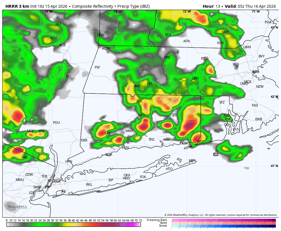
After a generally quiet but hot day, the threat for showers and thunderstorms increases late tonight, as a subtle change in the upper‑air pattern moves across the region.
Between roughly 9 PM and 3 AM, a shortwave passing north of the area may provide enough lift to interact with a lingering thermal trough across Connecticut. Instability will be limited, but there should be just enough instability and forcing to support scattered showers and a few thunderstorms, especially overnight. Activity is expected to be isolated to scattered, not widespread, though a few storms could briefly produce heavy rain and gusty winds.
The Storm Prediction Center (SPC) has placed all of Connecticut in a Level 1 risk, also known as a Marginal Risk, for severe weather tonight. A Level 1 risk means isolated severe thunderstorms are possible, but coverage and intensity should remain limited. Not everyone will see a storm, and most locations will stay below severe criteria. However, a stronger storm or two could briefly produce damaging wind gusts, small hail, and frequent lightning.
Understanding the SPC Severe Weather Scale
The SPC categorizes severe thunderstorm risk using a five‑tier scale:
- Level 1 – Marginal: Isolated severe storms possible
- Level 2 – Slight: Scattered severe storms possible
- Level 3 – Enhanced: Numerous severe storms possible
- Level 4 – Moderate: Widespread severe storms likely
- Level 5 – High: Significant and widespread severe weather expected
Tonight’s Level 1 designation reflects a conditional setup, where storms may struggle to organize but one or two stronger cells could briefly reach severe levels.
Any overnight activity should diminish toward daybreak. Attention then turns to late Thursday night, when a cold front crossing the region may bring another round of showers and thunderstorms.