Stormy Friday Ahead: Heavy Rain, Strong Winds, and Rapid Temperature Drop
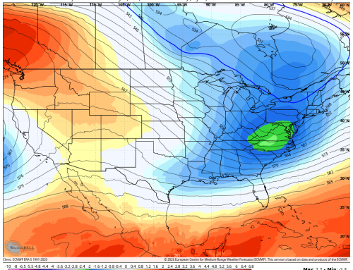
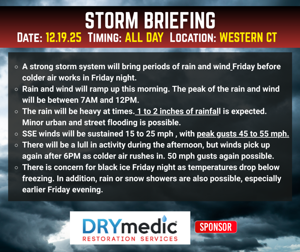
Radar is lighting up this morning as a strong storm system moves into the region. Expect periods of heavy rain through the morning commute, which could lead to urban and poor drainage flooding in some spots. If you’re heading out early, allow extra travel time and watch for ponding on roads.
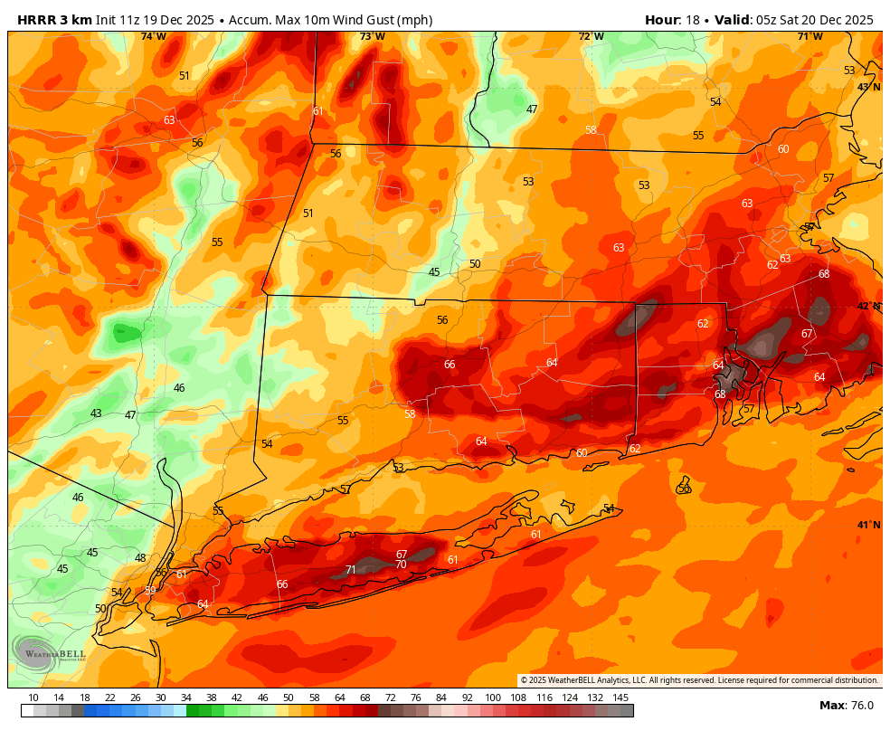
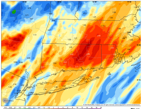
Winds are on the rise, and by mid to late morning, we’re looking at gusts of 45–55 mph. These strong winds, combined with saturated ground, could lead to scattered power outages across the area. The worst of the rain and wind will occur between 8 AM and 1 PM, with rainfall totals generally in the 1–2 inch range.
Cold Front Brings a Dramatic Change
Later this afternoon, a powerful cold front sweeps through, bringing a sharp temperature drop and another surge of strong winds. Expect gusts of 40–50 mph from the northwest between 5 PM and midnight, which means another round of scattered outages is possible.
As temperatures drop below freezing between 10 PM and 1 AM, watch for black ice on untreated surfaces. While the wind will help dry some areas, any lingering moisture will freeze solid overnight.
Looking Ahead
The weekend looks much calmer, with seasonable temperatures and dry conditions—a welcome break after today’s wild weather. However, keep an eye on late Monday night into Tuesday, when a quick-moving clipper system could bring light snow accumulations, mainly across interior areas. Right now, a coating to an inch seems most likely.