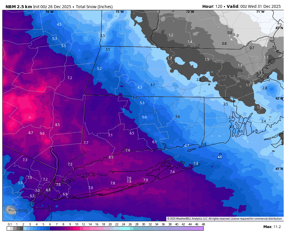
A significant winter storm is set to impact the region Friday night into Saturday morning, prompting the National Weather Service to issue a Winter Storm Warning for Fairfield, New Haven, Litchfield, and Westchester Counties. A Winter Weather Advisory remains in effect for Hartford and Middlesex Counties. Low pressure will track from the Great Lakes to just south of the area during this time, bringing a period of moderate to locally heavy snowfall. The most intense conditions are expected between 5 PM Friday and 4 AM Saturday, with snowfall rates potentially exceeding one inch per hour Friday evening, especially across western portions of the forecast area. Snow will begin around 5 PM Friday and quickly increase in intensity.
Current projections call for 5 to 9 inches of snow across the Hudson Valley and western Connecticut, 4 to 7 inches across central Connecticut, and 2 to 5 inches in eastern Connecticut and Rhode Island. This storm setup creates a narrow band of warning-level snow from the Hudson Valley into parts of Connecticut. Dry air will limit totals east of Connecticut, while warm air aloft may cause sleet or mixing issues west of the Hudson Valley. Connecticut finds itself in the “Goldilocks Zone,” perfectly positioned to maximize snowfall. If any trends or shifts occur overnight, updates will be provided. I would not at all be surprised to see Winter Storm Warnings expanded into parts of Central CT including Harford County.
Residents should prepare for hazardous travel conditions Friday night and early Saturday. Avoid unnecessary travel, keep emergency supplies on hand, and charge devices in case of power outages. Stay tuned for further updates as the storm approaches.
National Model Blend – Snow Totals


