Skip to content
Unsettled July Stretch: Humidity and Storms
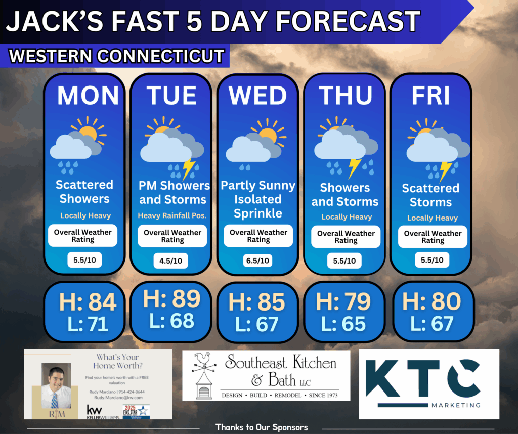
Monday (July 7) – Hot, Humid & Breezy
- Highs: Upper 80s to low 90s (cooler by the shoreline)
- Feels Like: Low to mid 90s due to high humidity.
- Conditions: Mostly sunny and breezy with SW winds.
- Heat Advisory: In effect due to elevated heat index values.
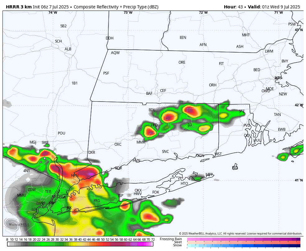
- Afternoon/Evening: Isolated to scattered showers and thunderstorms possible, especially in the Hudson Valley and Western CT. Not expected to be severe, but heavy downpours are possible due to high moisture content.
Monday Night
- Lows: Upper 60s to low 70s.
- Conditions: Mild and muggy. A cold front slowly moves in, bringing a chance of overnight showers, especially across SE MA and the Cape/Islands.
Tuesday (July 8) – Unsettled & Tropical
- Highs: Upper 80s to low 90s.
- Feels Like: 95–100°F in some areas.
- Conditions:
- Morning: Possible rain from interaction with remnants of Tropical Storm Chantal.
- Afternoon: Widespread showers and scattered thunderstorms likely.
- Risks:
- Flash Flooding: Marginal risk due to tropical moisture (PWATs up to 2.1″).
- Severe Storms: Marginal risk in western/central CT and the Hudson Valley. Main threat: damaging winds.
- Atmosphere: Very moist, slow-moving storms due to weak steering wind
Wednesday to Friday – Continued Unsettled
- Pattern: Persistent tropical moisture feed from the Bermuda High.
- Conditions: Daily chances for showers and thunderstorms, especially in the afternoon.
- PWATs: 200–250% above normal = potential for heavy rainfall.
- Thursday: A weak low may enhance rainfall. Some models hint at 1″+ totals.
- Temperatures: Trending cooler by Thursday and Friday with onshore flow.
- Highs may be 5–10°F below normal by late week.
Share This Article, Choose Your Platform!
Page load link


