The forecast remains on track for our upcoming winter storm. Expect light snow to break out across Western CT between about 2PM and 3PM Saturday. Light snow rates will likely take awhile to stick to treated surfaces, so not expecting roads to go downhill until snow rates increase and the sun goes down around 5PM or 6PM Saturday evening for much of the state. A general 1-3 inches of snow is expected at the shoreline, with 2-5 inches across the interior.
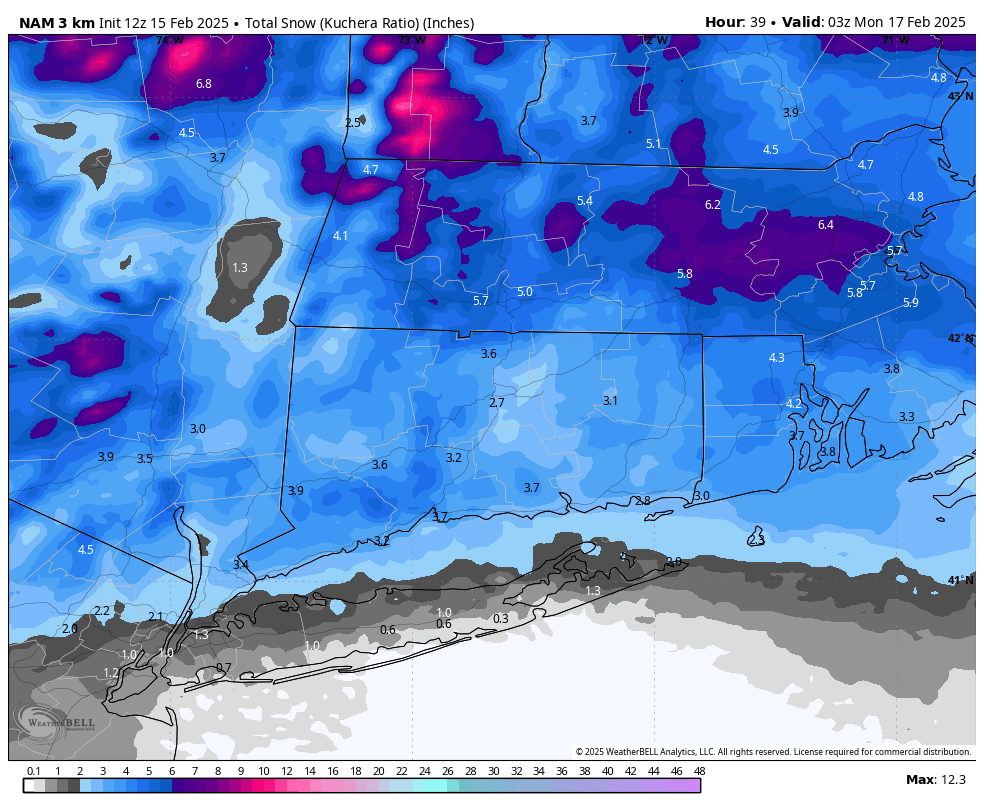
Latest 12Z 3K NAM Snow Totals
Snow changes to sleet and freezing rain between 11PM Saturday and 1AM Sunday. A quick change to plain rain is likely thereafter along the shoreline, but freezing rain will linger across the interior into daybreak Sunday. There is potential for 0.10 to 0.25 inches of ice in the hills along the I84 corridor by 9AM. Some of the highest hills of Fairfield and New Haven County could see localized higher amounts – think New Fairfield, Sherman and Wolcott.
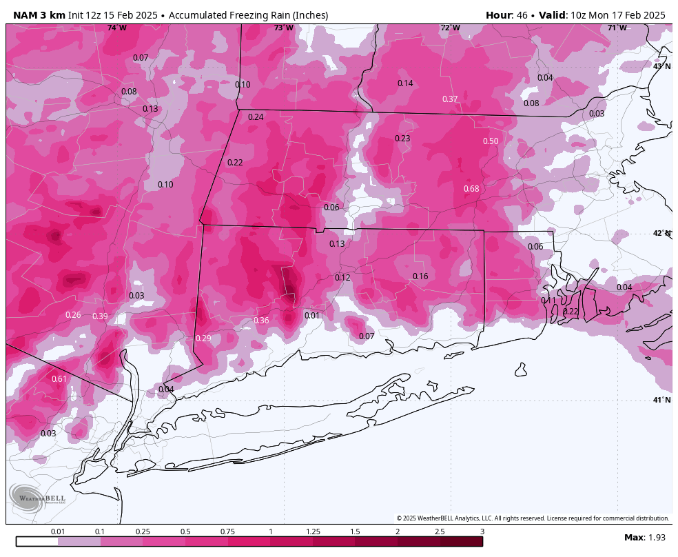
Latest 12Z 3K NAM. This is likely overdone, but notice how it highlights the hills with significant icing!
The ice may hang on even longer across portions of Litchfield County, Hartford County, and Tolland, where short range guidance lingers ice thru much of Sunday. The NWS is only calling for 0.10 to 0.20 inches of ice accretion in Litchfield County, but I am concerned values will be closer to 0.25 to 0.50 inches, especially in the higher hills. There is only a Winter Weather Advisory in effect, but PLEASE I would keep an eye on the forecast. Ice totals of 0.50” will start to break trees, causing scattered to numerous outages. Snow and ice totals below.
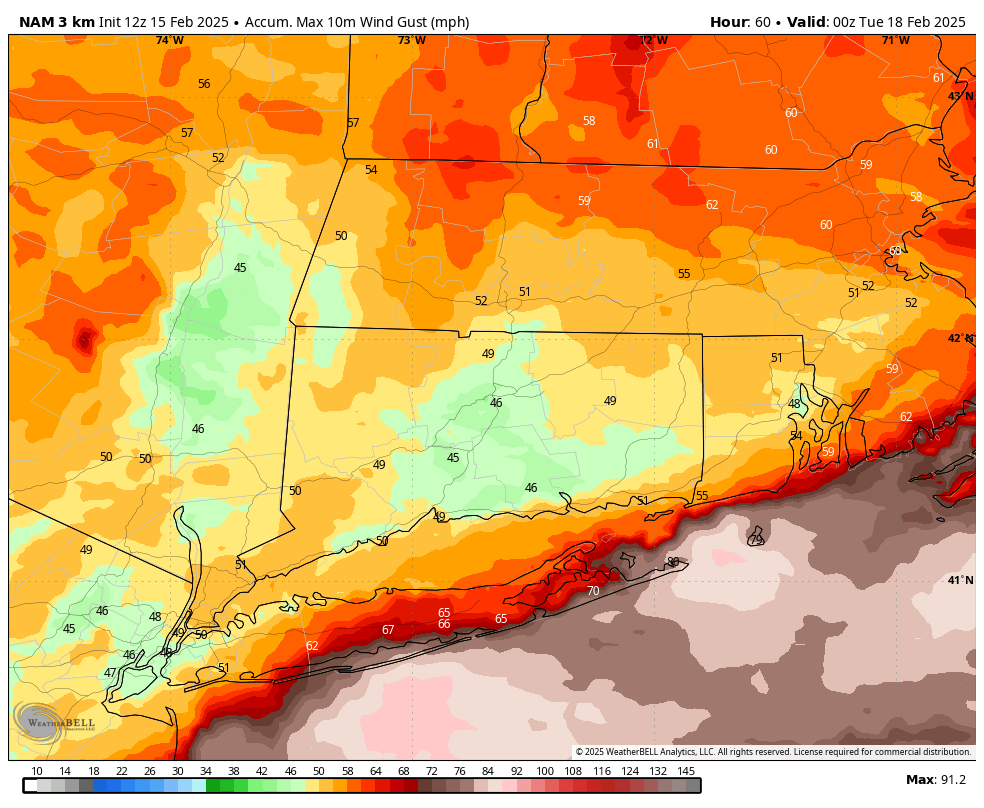
Latest 12Z 3k NAM Wind Gusts through Monday afternoon.
Any rain will come to and end by Sunday evening, with winds picking up Sunday night into Monday. A HIGH WIND WATCH has been issued for all of CT, with gusts 50 to 55 mph possible. Scattered power outages are expected!