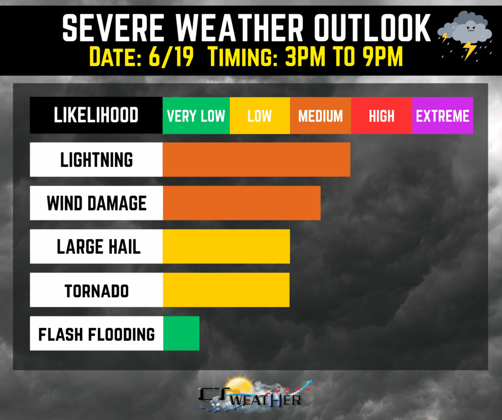
Models tonight continue to indicate sufficient instability (~2000j/kg) to go along with sufficient wind shear on Thursday, pointing to the potential for strong to severe storms to work in. Given the environment, damaging wind gusts are the primary concern, with a lower risk for hail and even the potential for isolated tornadoes as the SPC has placed the much of the area in a 2% tornado risk. Most models now show storms developing mid to late afternoon along a pre-frontal trough, so decided to keep the timing window for storms 3PM to 9PM. Storms are expected to weaken as they move east into Connecticut and Rhode Island after sunset.