Temperatures will drop to near or below freezing Monday night. With some residual moisture, it is possible there is patchy black ice or refreeze, especially in areas that saw more than an inch of rainfall where runoff may be more common.
High pressure builds in for Tuesday and Wednesday with pleasant conditions returning. Temps rebound nicely – expecting highs to approach or exceed 60 degrees across the interior both days.
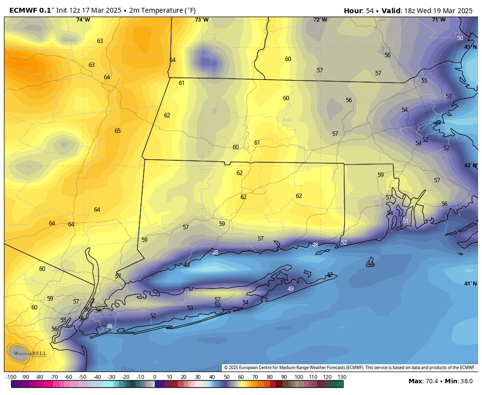
Highs on Wednesday – European Model
The one caveat to even higher temperatures on Wednesday will be a wind direction out of the east and southeast. This wind direction can spell doom for really warm temperatures in the early spring as cool air will be funneled in from Long Island Sound.
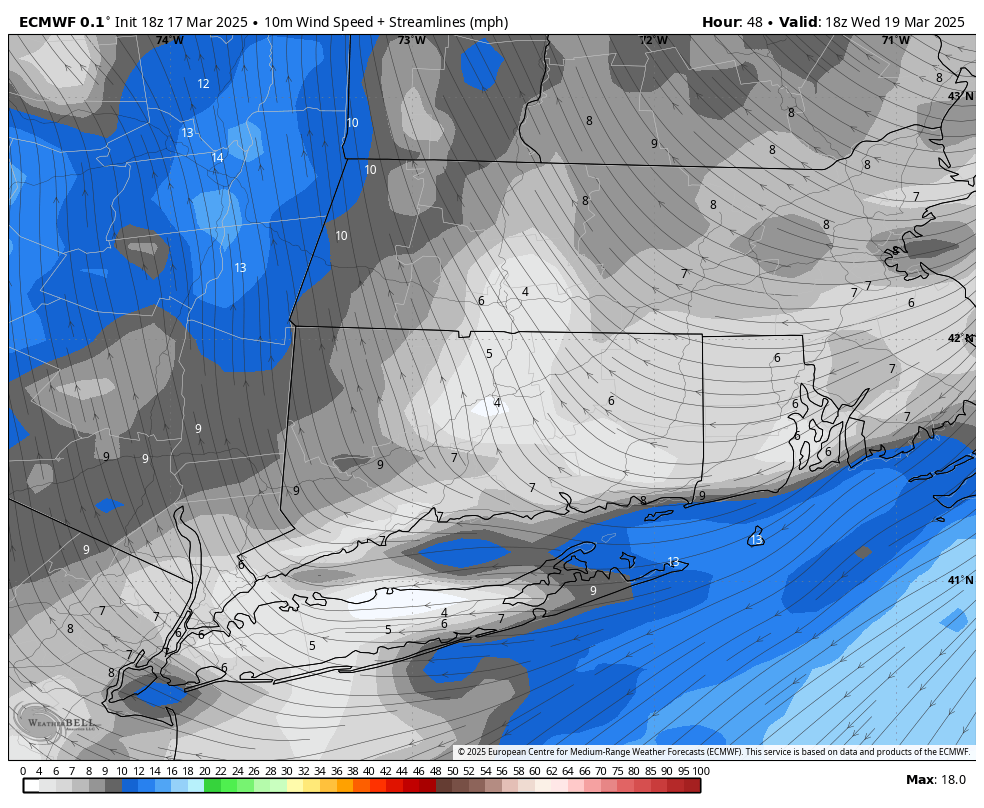
Winds Wednesday midday – note SE flow