While Tuesday will feature mostly sunny skies, a change in the weather pattern midweek will bring an increase in clouds and a chance of showers. A low pressure system has developed off the Virginia coastline, and will slowly meander near the Mid Atlantic coastline over the next 36 hours. This could spin in showers to CT, especially Wednesday afternoon and Wednesday night.
Wednesday: Cloudy, Damp, and Cool
Wednesday brings a continued chance for showers, though the forecast remains a bit uncertain. The latest high-resolution models show mixed signals—some are relatively dry, while others, like the HRRR, suggest more widespread shower activity. The key factor here is the lingering surface ridge, which could suppress shower development in some areas.
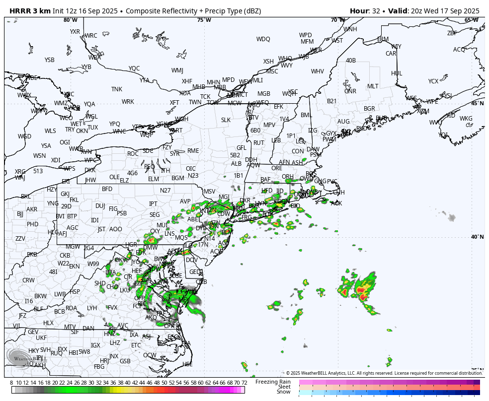
HRRR Future Radar shows showers Wednesday Night
To stay aligned with the most consistent guidance, we’re leaning on the National Blend of Models (NBM), which keeps the highest rain chances across the southern half of the region, especially near the coast. With limited instability in the atmosphere, thunderstorms are not expected.
Showers may linger into Wednesday night and early Thursday morning, but conditions should trend drier by Thursday afternoon as the system moves eastward. Rolling with ‘mostly sunny’ for the forecast on Thursday.
Rainfall & Temperatures
Any showers that do develop are expected to produce light to moderate rainfall. M0dels generally cap rainfall at about 0.25 to 0.50 inches. There is a slight chance of higher amounts if downpours are able to move further inland Wednesday night.
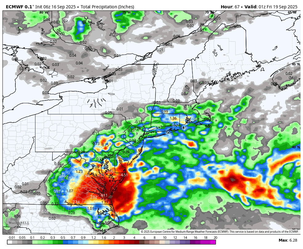
Total Rainfall – European Model
Temperatures will be noticeably cooler on Wednesday due to cloud cover and an easterly flow. Highs will struggle to reach the lower 70s. By Thursday and Friday, expect a rebound into the upper 70s to low 80s as clouds begin to clear.
Weekend Outlook
A cold front will likely move through completely dry on Friday night or early Saturday morning. This will lead to great weekend weather, with temperatures falling to the lower 70s for highs.


