A significant winter storm is forecast to impact the region from Saturday night through Sunday morning, bringing hazardous travel conditions. Snow is expected to begin around 8 PM, rapidly intensifying with snowfall rates of 1 to 2 inches per hour between 9 PM and 12 PM.
HRRR Snow Rates at 10PM – 1.0 to 2.0 Inches per Hour!
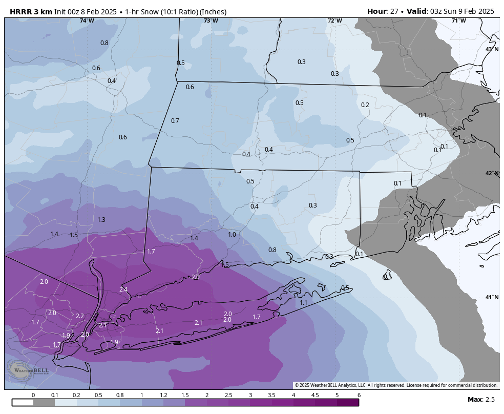
Concerned with the trends on short range guidance to introduce a period of prolonged sleet and freezing rain with temps steady in the upper 20s from about 1AM to 6AM. While I want an all snow solution personally, can’t ignore the data and my gut forecasting that we see mix and ice well inland into CT, similar to what the HRRR shows below.

This would be ugly for the Sunday morning commute and for snow removal – as many would be clearing a heavy 3-6 inches of snow and ice.

3K NAM total snow accumulations in the 3 to 6 inch range
Again, hoping I can increase my snow totals and cut out the ice tomorrow morning, but just going by what I see. Would highly recommend snow removal and salt by midday Sunday, as everything will freeze up solid Sunday night!