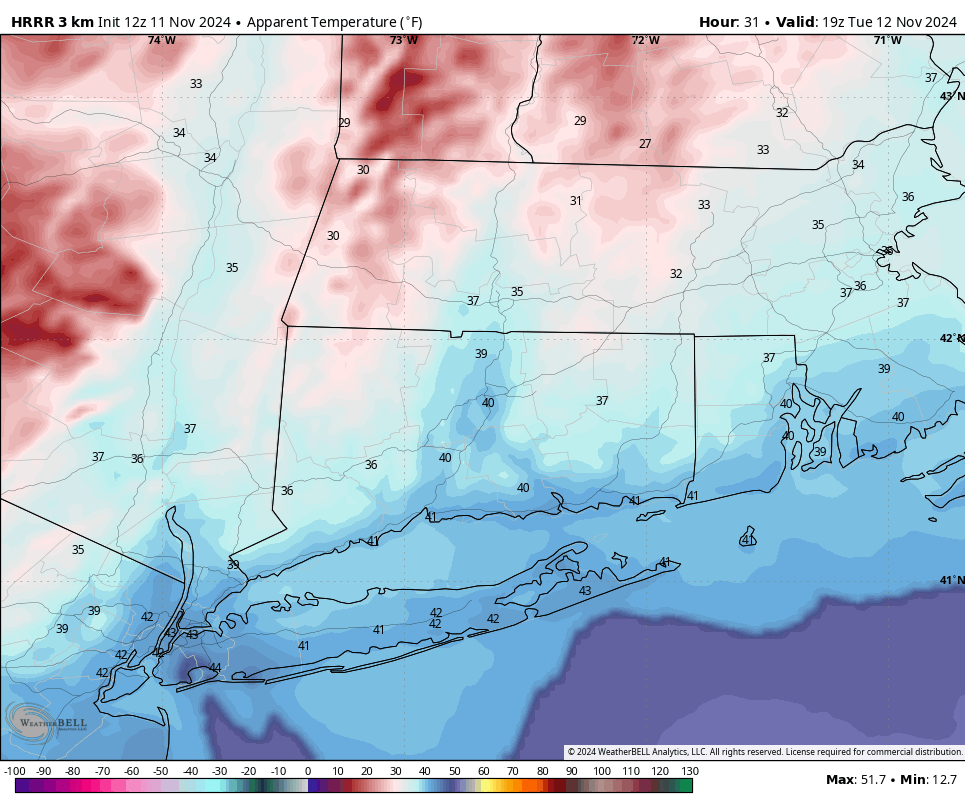
After a mild Monday, cooler air will begin to invade the Northeast tonight. Winds shift out of the Northwest early Tuesday morning and pick up considerably during the day. Winds could gust 30 to 40 mph by midday Tuesday, with temperatures struggling to reach 50 degrees across the interior. Here’s a look at the HRRR wind gusts below. This model typically does a good job with wind gusts out of the NW in cold-air advection scenarios, which is exactly what we have tomorrow.
With the wind factored in, Tuesday will be downright chilly across the area, with ‘feels-like’ temperatures in the 30s for many through the afternoon. Please bundle up if headed out to school or work. Tuesday night will be very cold as well, with temperatures dipping down into the 20s for most.
The wind is also bad news for the fire danger. Despite rain last night accumulating to 0.15 to 0.40 inches in most areas across the state, local fire officials and Emergency Managers I talked to this morning remain concerned with the brush fire danger this week. We will monitor for any Red Flag Warnings as they arise.