Issued: Tuesday, September 9, 2025
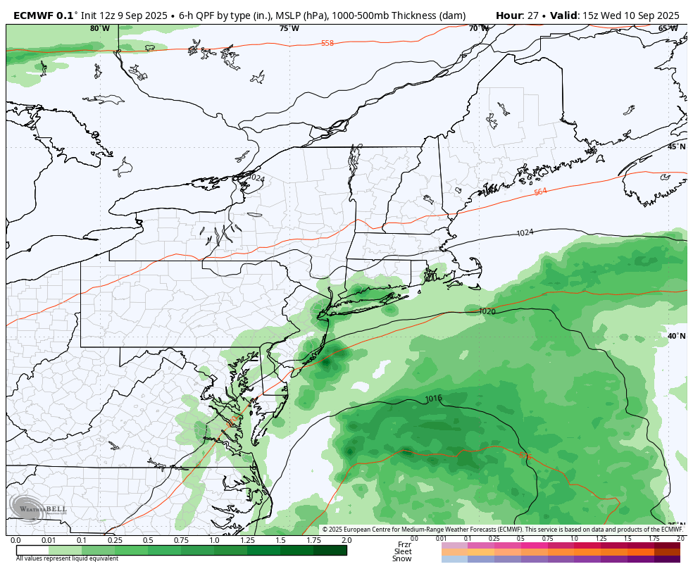
A developing offshore low pressure system, visible on current satellite imagery, is expected to serve as the focal point for a wave of low pressure that will track southeast of the region. Forecast guidance remains inconsistent regarding the inland extent of associated precipitation, with some high-resolution models suggesting showers could reach parts of Connecticut and the Lower Hudson Valley as early as late this afternoon.
Despite these signals on modeling, low-level dry air remains entrenched across the area, which should limit precipitation potential in the near term. As a result, the forecast remains dry through this evening, though trends will be monitored closely.
European model brings rain showers Wednesday morning
Short-Term Outlook: Tonight Through Thursday Night
The wave of low pressure will continue to move offshore tonight through Wednesday night. While widespread impactful weather is not anticipated, several convective-allowing models (CAMs) indicate that showers may extend westward into the Lower Hudson Valley and western Connecticut, particularly late tonight into Wednesday. Enhanced moisture and instability could support isolated convective activity, though confidence remains low.
In addition to the rain potential, expect gusty northeast to east winds across the region, generally 15–20 mph, with gusts up to 25 mph through Wednesday.
By Thursday, a weak cold front will approach from the northwest, bringing a return to more typical early September conditions. High temperatures on Thursday are expected to reach the upper 70s to low 80s, with dry weather prevailing as high pressure builds in behind the front.
Extended Forecast: Friday Through Tuesday
No major changes are expected in the extended period. High pressure will dominate through Saturday, ensuring dry and pleasant conditions across Connecticut and the Lower Hudson Valley. By Sunday night, a weak cold front may bring a slight chance of showers, but daytime Sunday looks dry and seasonable.
Temperatures will remain comfortable, with highs in the 70s each day, making for an ideal stretch of early fall weather.


