The second half of this week is bringing an unusual three-day severe weather stretch to our area.
The National Weather Service Storm Prediction Center has highlighted the potential for severe weather with a level 1/5 marginal risk today in some areas, and level 2/5 slight risks for tomorrow and Friday in many spots. Each day has slightly different threats and probabilities of those threats, but each day is certainly worth watching out for.
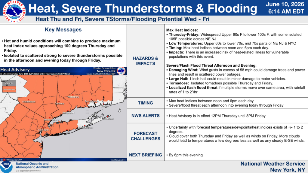
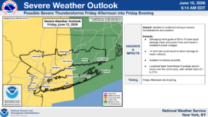
A briefing issued this morning by our local National Weather Service Office, OKX – New York (Long Island).
This briefing page gives a good idea of all the factors coming together this week that could lead to dangerous weather. The first thing highlighted is the heat risk, which by itself can be very dangerous. But more importantly, this heat will carry a deep, powerful surge of moisture, pushing dewpoints into the 70s. Together, these factors will allow for an extremely energetic and unstable atmosphere to set up over the next couple days.
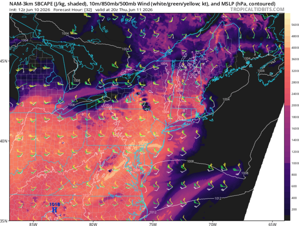
NAM model CAPE (Convective Available Potential Energy) for tomorrow afternoon.
CAPE is a way we can illustrate this energy and instability in the atmosphere. CAPE is effectively storm “fuel”. The NAM model does overdo CAPE sometimes, but values in the 2000-3000 J/Kg range are something we don’t see a ton of around here. Think of the more energetic, lightning heavy thunderstorms you see every once in a while. Having this kind of energy in place will allow storms to rapidly explode in the afternoon and evening hours over the next couple days, and even possibly late tonight.
Today’s storms don’t look too threatening, with a slight chance for damaging winds. Tomorrow, this threat increases, as well as the small threat of isolated tornadoes. Yes, tornadoes. They are unlikely but cannot be ruled out. Friday, a sharp cold front will sweep through, upping the potential even further for damaging wind.
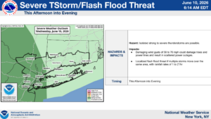
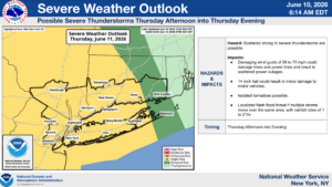
The Storm Outlooks for today, tomorrow, and Friday.
It’s highly unusual for us to be included in severe threats for three days in a row here. This doesn’t mean you’re guaranteed to be hit with a strong thunderstorm each day, or even any at all over the course of the week. What’s likely is that strong storms will be present somewhere, and where they track, we’ll likely see downed trees and power outages. This is nothing to be too worried about, just be prepared to get inside quickly to avoid lightning and the possibility of trees coming down.


