We are continuing to track our twin systems in the Atlantic. The Eastern system (Humberto) is now a Category 5 Hurricane, but this storm will eventually curve out to sea. The Western system, Tropical Depression 9 (TD9), which may soon be named Imelda, remains somewhat disorganized tonight, but signs point to strengthening in the coming days. While the system is still broad and lacking a tight center as can be noted on satellite below, but warm waters and relatively light (favorable) wind shear could help it intensify quickly once a central core forms.
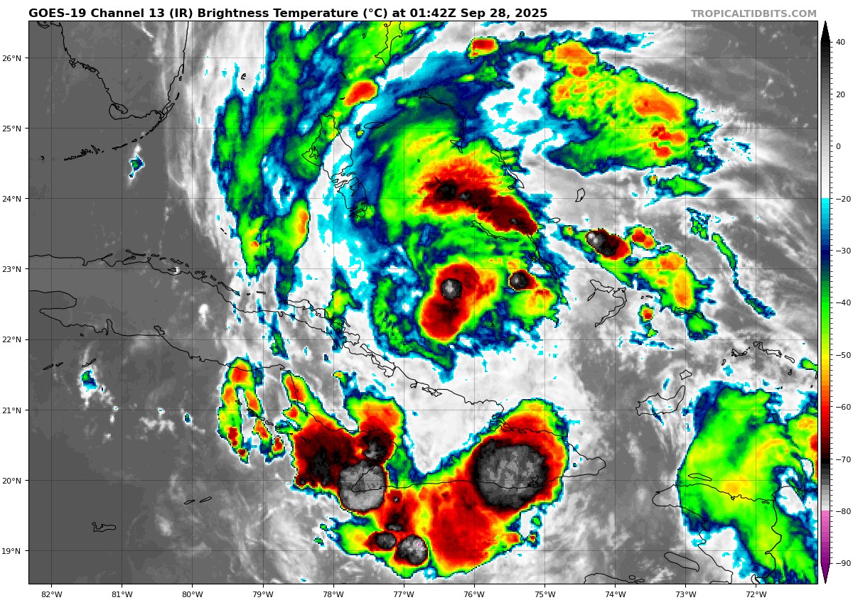
Evening Satellite – TD9 showing some convection near the center of the storm north of Cuba, but overall a disorganized structure
Forecasts now suggest it could reach hurricane strength by Tuesday, as it makes its closest pass to the United States.
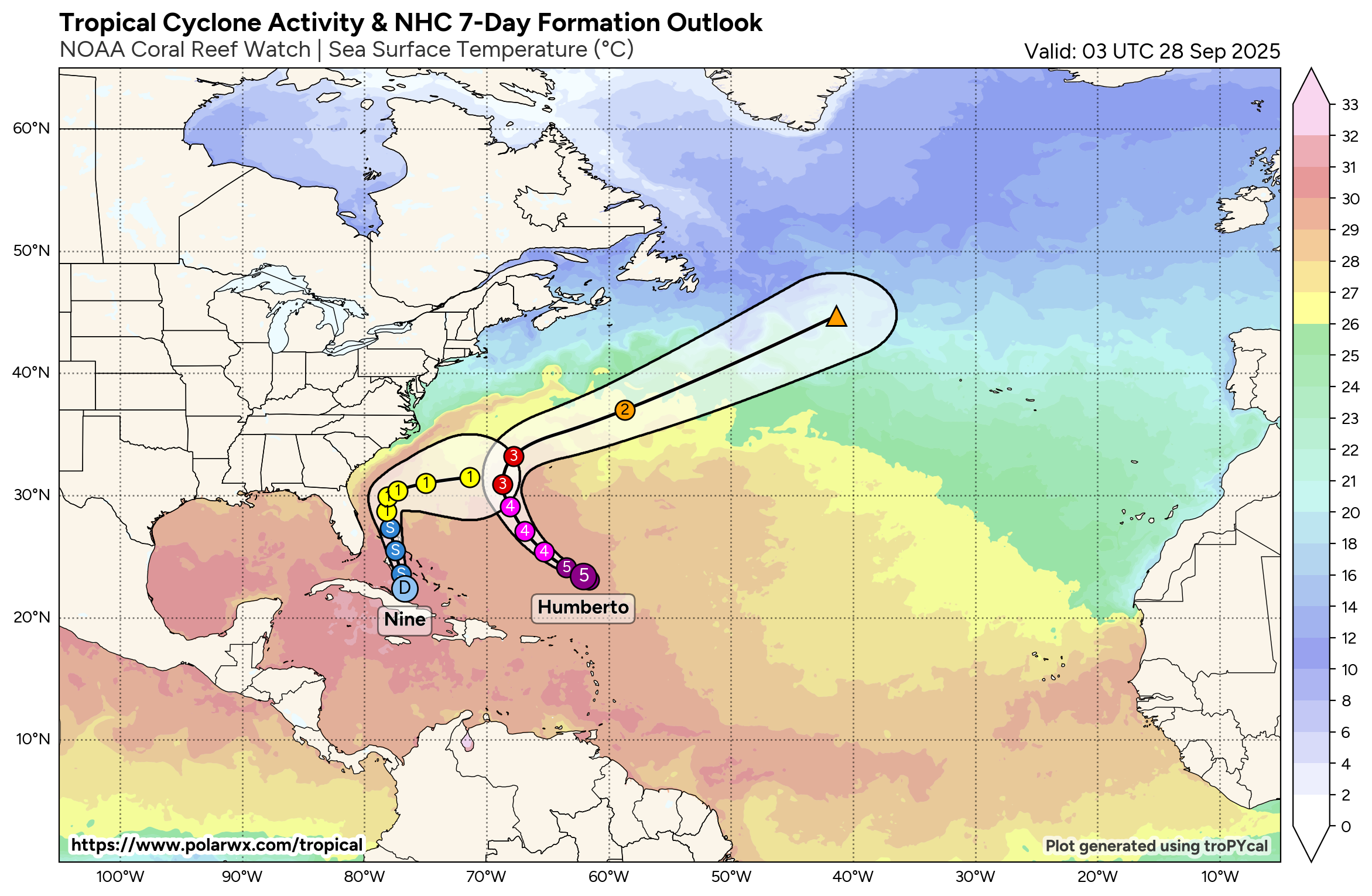
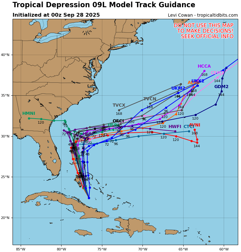
Latest NHC tracks for TD9 and Humberto. Note the forecast has trended to an earlier, sharper right hook.
Latest Trends: A Sharp Turn
Recent model guidance shows growing confidence in a sharp right turn of Imelda by Tuesday. This shift is likely influenced by Hurricane Humberto, now a powerful Category 4 storm, which may tug Imelda eastward just enough to avoid a direct landfall in the Carolinas. While this would be welcome news for coastal residents, the forecast track is still uncertain, and even an offshore path could bring significant impacts.
What to Expect
- Bahamas & Eastern Cuba: Heavy rain and tropical storm conditions through Sunday night. Flash flooding and mudslides are possible.
- Florida & Southeast U.S. Coast: Tropical storm conditions could begin Monday. Even if the center stays offshore, expect strong winds, heavy rain, and possible storm surge.
- Carolinas: A direct hit is less likely, but coastal areas should still prepare for potential flooding and wind impacts.
Why the Track Matters
The storm’s slower-than-expected movement has shifted forecast models eastward. Faster-moving tracks bring the system closer to the Carolinas, while slower ones may curve it out to sea. Either way, the wind field is expected to expand, meaning impacts could be felt far from the center.
Bottom Line
Imelda may not make landfall, but it’s no reason to let your guard down. If you have interests on the coastline from Florida to the Carolinas should stay alert, monitor updates, and have their hurricane plans ready.