Severe Weather Threat This Afternoon: What to Expect
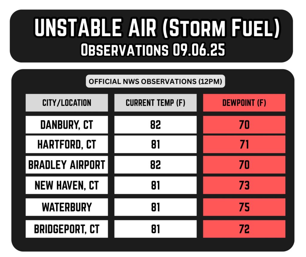
We’re off to a hazy start across Connecticut today, with wildfire smoke lingering high in the atmosphere. As the day progresses, warm and humid conditions will build—setting the stage for what could be the most robust severe weather setup of the year.
A cold front approaching from the west will interact with this unstable air mass, triggering strong to severe thunderstorms between 3PM and 9PM, though some models suggest storms may hold off until after 5PM or 6PM, especially near the shoreline locations.
Hazards to Watch For
- Damaging winds are the primary concern, with gusts potentially exceeding 60 mph.
- Localized flooding is possible due to heavy downpours, especially in SW CT and the Hudson Valley.
- Hail may accompany stronger cells.
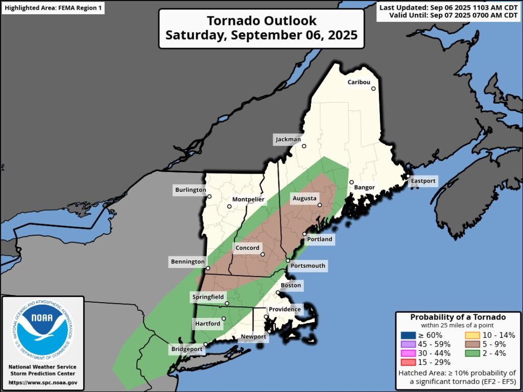
- Isolated tornadoes cannot be ruled out, especially where wind shear is enhanced.
The Storm Prediction Center has placed western and northern Connecticut under a Level 2 (out of 5) risk for severe weather as well as a 2% to 4% tornado risk.
While not everyone will experience severe conditions, impacts can vary significantly even within the same town, so it’s important to stay alert.
Timing & Coverage
- Storms may begin as early as 1PM in western areas, moving eastward through the afternoon
- NAM model guidance suggests activity around 4PM, with peak intensity likely between 3PM and 7PM
- Lingering showers may continue into the early hours of Sunday morning
Stay Prepared
- Have multiple ways to receive weather alerts.
- Secure outdoor items and plan for indoor alternatives if you have afternoon or evening plans.
- Monitor radar and forecasts throughout the day.
This is a dynamic setup with scattered but potentially intense storms, so even if skies look calm early on, conditions can change rapidly.


