Tonight, Tropical Storm Erin has gotten more organized and powerful. A NOAA aircraft flew into the storm and found that its center is now more tightly wrapped in thunderstorms. The strongest winds are on the east side, and the storm is starting to line up better from top to bottom — a sign it’s becoming more intense. The plane measured winds of 69 knots (about 80 mph) high up in the storm, which means winds near the surface are around 60 knots (about 70 mph) — just below hurricane strength. This was as of the 11PM NHC Advisory – but I would not be surprised if Erin was a hurricane by Friday morning or midday.
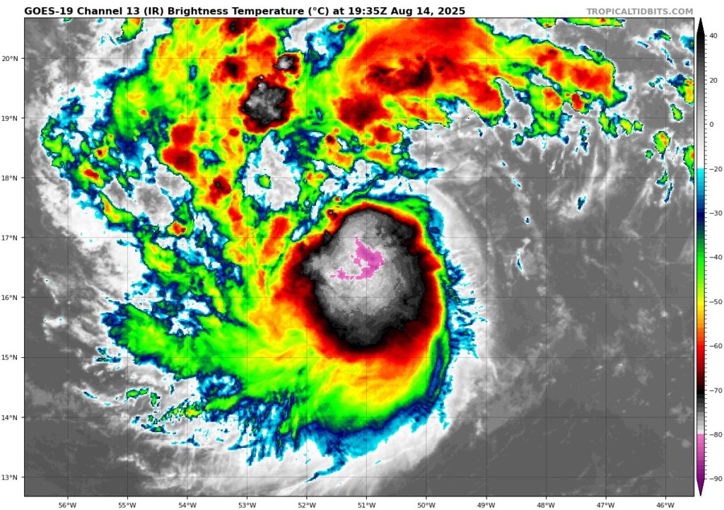
A look at Erin Friday evening – note the intense storms (pinks) around the center
Erin is moving west-northwest at about 15 mph, guided by a large area of high pressure over the Atlantic. Over the next few days, a dip in the jet stream near Bermuda will create a path for Erin to turn northwest and then north. As discussed in previous updates, forecast models continue to show Erin passing between Bermuda and the U.S. East Coast.
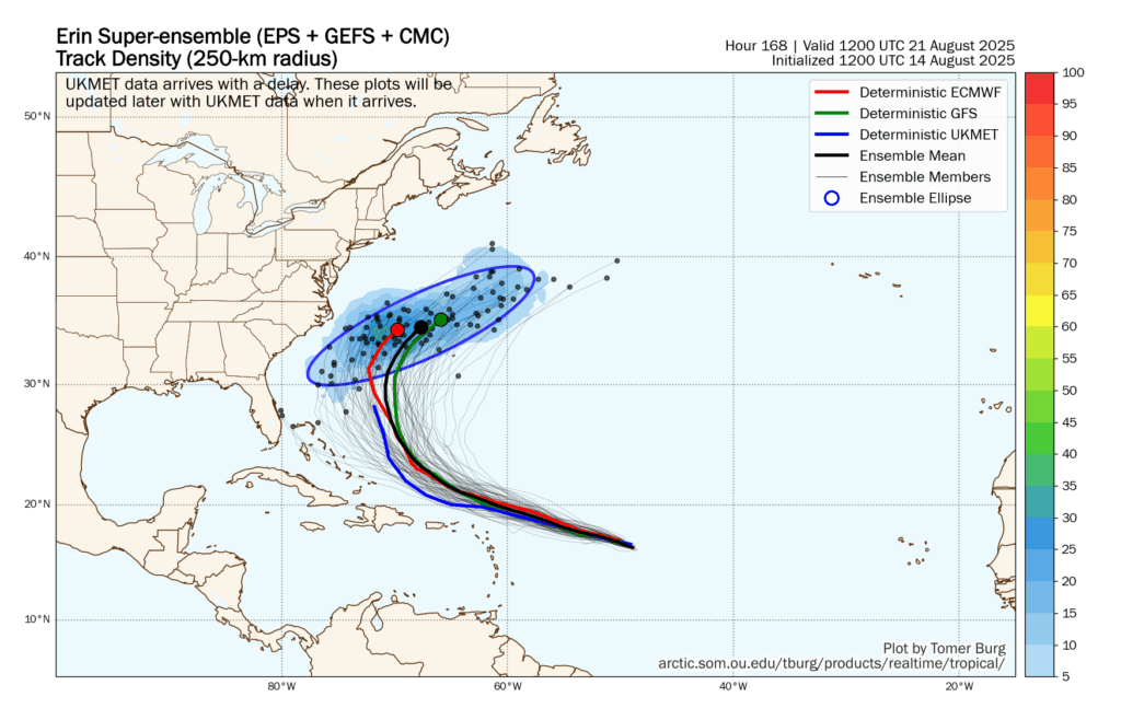
Model blend showing potential storm centers for Erin
Right now, conditions around Erin are perfect for strengthening. The ocean water is warm (around 82°F / 28°C), and the air is moist — both help fuel the storm. There’s now a 40% chance Erin could get 30 mph stronger in just 24 hours.
The latest forecast from the NHC says Erin will become a Category 4 hurricane with winds up to 130 mph in the next few days. After that, it might weaken a bit due to wind shear and changes inside the storm, but its wind field could grow larger. This is typical of a system taking that classic “recurve” track.
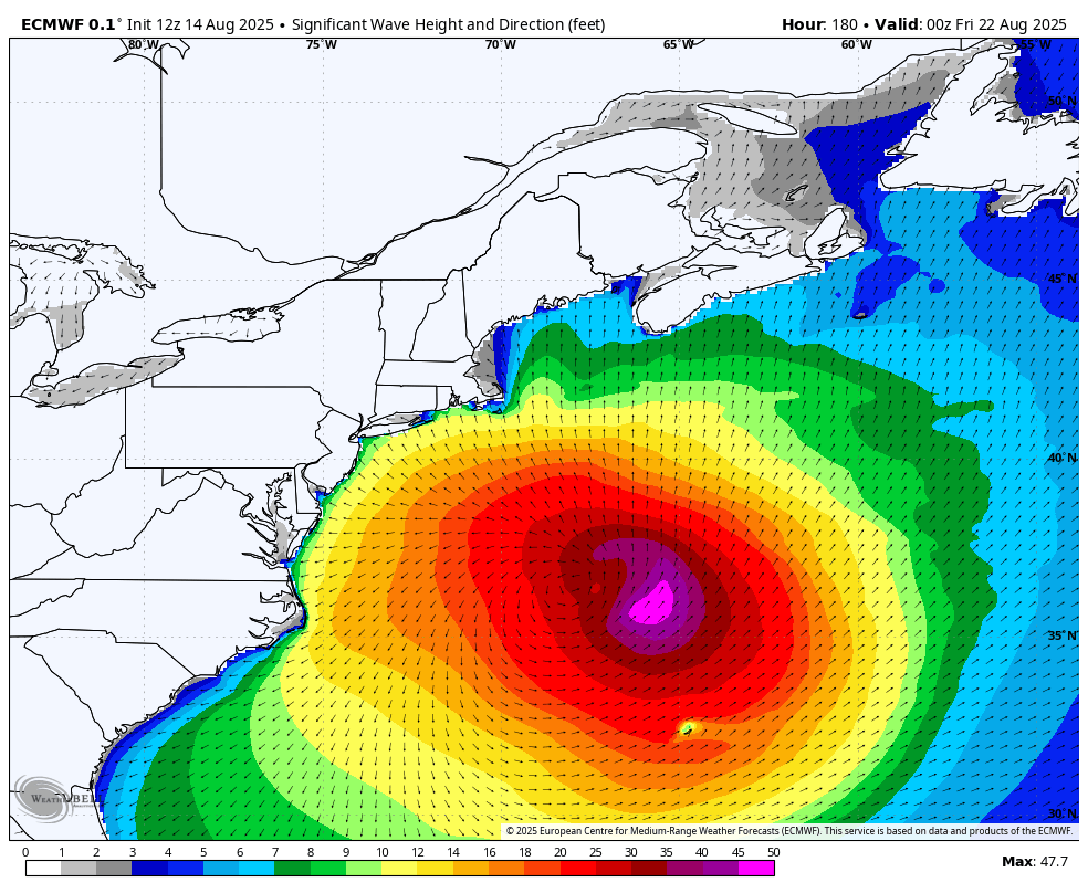
Big Surf possible on the East Coast by next Thursday
Regardless of exact track, Erin will likely produce big surf and a rip current risk to many beaches. I still like 6 to 10 foot breakers for a good chunk of LI, RI, and E MA.
Thanks for reading and stay tuned for additional updates.


