Connecticut is facing a high-impact weather day on Friday, with a combination of dangerous heat and the potential for severe thunderstorms by late afternoon and evening.
Extreme Heat First
Before storms arrive, the state will endure a brief but intense surge of heat and humidity. Highs will climb into the low to mid-90s, and with dew points in the low to mid-70s, heat index values will reach 100–105°F. An Excessive Heat Warning is in effect for parts of southwestern Connecticut, with Heat Advisories elsewhere. This will be a one-day event, but the heat will be oppressive—residents should take precautions to stay cool and hydrated. We have briefed our local OEMs here at CT Weather!
Storm Threat Builds in the Afternoon
By late Friday, a cold front will approach from the north, interacting with a hot, moist, and increasingly unstable atmosphere. A robust midlevel trough will swing across Quebec and northern New England, enhancing midlevel westerly winds (30–40 kt) over the Northeast. This setup will provide around 30 kt of effective shear, enough to support organized storm clusters, small line segments, and possibly isolated supercells.
Forecast models show MLCAPE values approaching 2500 J/kg, indicating strong instability. As storms develop along the front, they’ll tap into this energy and could produce damaging wind gusts, especially in areas where storms organize into broken lines. There’s also a low-end risk for localized flash flooding, given high moisture levels (PWATs over 2 inches) and the potential for heavy rainfall in a short period.
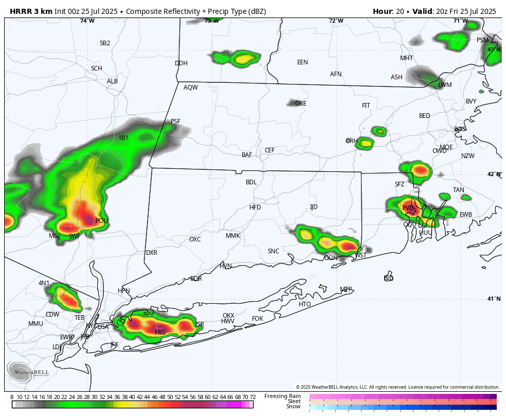
Future Radar 4PM Friday Afternoon – HRRR Model
What to Watch For
- Timing: Storms are most likely between 3 PM and 9 PM Friday.
- Main Threats: Damaging wind gusts, isolated flash flooding, and possibly frequent lightning.
- Confidence: Moderate confidence in scattered severe storms, especially in interior and southwestern Connecticut.
Relief Arrives Saturday
The cold front will clear the region by midnight, bringing in cooler and drier air for Saturday. Highs will still reach the mid to upper 80s, but with much lower humidity, it will feel significantly more comfortable.