As we head into the new week, Connecticut is in for a stretch of humid, unsettled weather with a few rounds of showers and storms, followed by a potential heat wave midweek.
Tonight: Low Clouds and Patchy Fog
A weak cold front is slowly approaching from the west, but most of the state will stay dry this evening. Some low clouds and patchy fog or drizzle may develop overnight, especially along the shoreline, thanks to persistent onshore flow and saturated air near the surface.
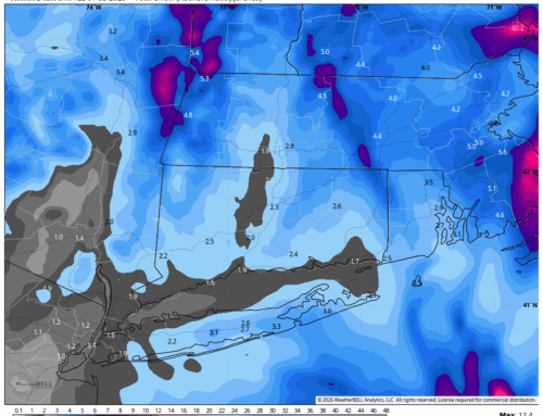
Monday: Humid with Scattered Storms
Monday starts off with clouds and possible fog, but conditions will gradually improve by late morning. As the cold front moves closer, scattered showers and thunderstorms are expected to develop in the afternoon and evening. While the severe threat is low, heavy downpours are possible—especially in western Connecticut, where localized flooding could occur. Most of the state will see highs in the 80s, with tropical-like humidity making it feel even warmer.
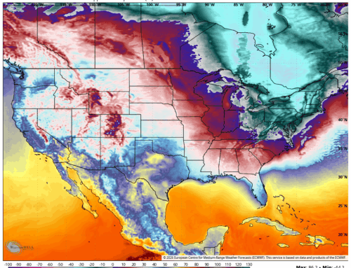
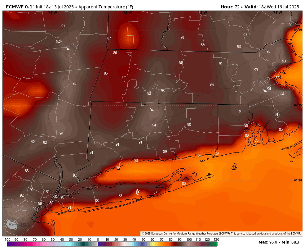
Midweek: Heat and Humidity Build
From Tuesday through Friday, the story shifts to heat and humidity. A stalled front offshore and a strong Bermuda high will pump in warm, moist air from the south. Heat index values are expected to reach the mid to upper 90s, especially Wednesday through Friday, potentially meeting Heat Advisory criteria. Each afternoon will also bring a chance for pop-up thunderstorms, some of which could produce heavy rain.
Looking Ahead: Relief by the Weekend?
A cold front may arrive late in the week, bringing a break from the heat and a return to more comfortable conditions by the weekend. However, timing and details are still uncertain, so stay tuned for updates.
Bottom Line: Keep the umbrella handy and stay hydrated—a muggy, stormy, and hot week is ahead for Connecticut. Be weather-aware, especially during the afternoon hours when storms are most likely.