It feels like we flipped a switch the today – going from BIG heat to cooler than average temps! After a stretch of cooler, overcast days under the influence of high pressure over New England, Connecticut is on the verge of a noticeable weather shift ONCE AGAIN heading into the weekend. While Thursday night and Friday will remain relatively quiet, changes begin to take shape Friday night as a warm front approaches from the south.
Friday: A Calm Before the Change
Friday will bring mostly cloudy skies across the state, with seasonable temperatures ranging from the low to mid-70s. Winds will gradually shift to the southeast, and while most of Connecticut will stay dry, a stray afternoon shower is possible, particularly in the western and northern parts of the state. Overnight, temperatures will remain steady or rise slightly as the warm front nears, bringing increasing humidity, a chance of showers or isolated thunderstorms, and patchy fog along the shoreline.
Saturday: Warmer, More Humid, and Stormy
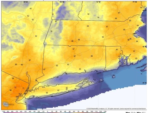
Saturday marks a turning point in the forecast. The warm front is expected to lift north through Connecticut during the morning, ushering in a surge of warmer and more humid air. Highs could reach the low 80s in inland areas, with upper 70s more likely along the southeastern coast.
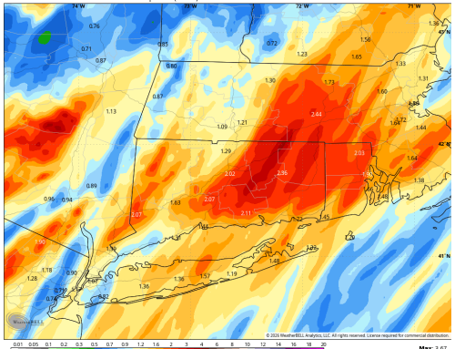
As the front passes, a wave of low pressure and an upper-level disturbance will enhance instability, setting the stage for scattered to numerous showers and thunderstorms Saturday afternoon into the evening. Some storms may produce brief heavy downpours and isolated severe weather, especially in northern and western Connecticut. The Storm Prediction Center has outlined a marginal risk for damaging winds in these areas, and the Weather Prediction Center has highlighted a marginal risk for excessive rainfall.
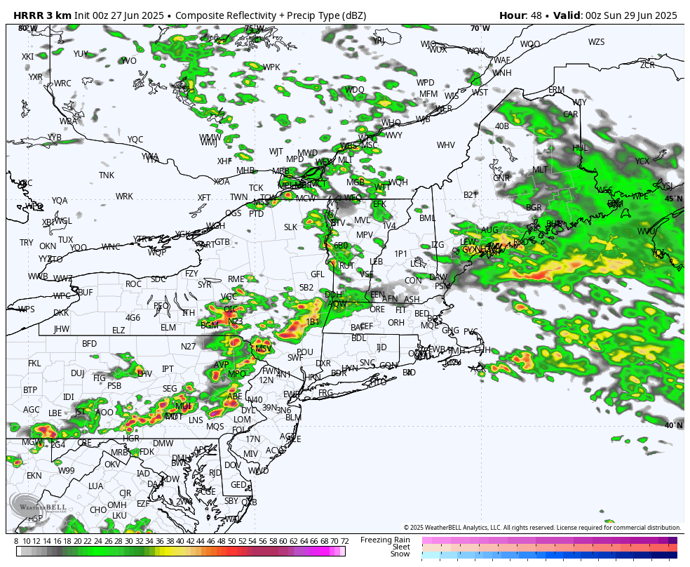
HRRR Model showing storms working in Saturday Evening – 8pm Sat Future Radar
Sunday into Early Next Week: A Brief Break, Then More Rain
By Saturday night, the front will begin to drift back south and stall over the region, bringing a return to more stable conditions. Sunday into early Monday looks mostly dry under weak high pressure, though a stray shower remains possible. Temperatures will remain near or slightly above seasonal norms.
However, the break will be short-lived. By Monday, the stalled front will surge north again in response to a Canadian low-pressure system, placing Connecticut in a warm and humid air mass through Tuesday. This will bring another round of unsettled weather, with showers and thunderstorms likely before a cold front sweeps through Tuesday night.
Midweek Outlook: Drying Out Again
Following Tuesday night’s cold front, high pressure is expected to return for the middle of next week, bringing drier and more comfortable conditions. Temperatures are forecast to remain near or slightly above average through this period.